TopoQuest Logo
Do you find TopoQuest useful?
Help keep TopoQuest running and adding new maps/features by donating!
Bitcoin:  19c7KJd3qBynnjoSw5npx9KScwjBe4ifkT
Litecoin:  LXs6TkuXGGXo1vDsWCkWVdjQX94eUKd6ui
Home View Maps Find Maps Find Places Resources & Links


Veseli, Minnesota Topographic Map

USGS Map Title: Veseli, MN
USGS Map MRC: 44093E4
DRG (GeoTIFF) Download: o44093e4.tif


Neighboring USGS Topographic Map Quads:


  Jordan East, MN  
44093F5
 

  Prior Lake, MN  
44093F4
 

  Orchard Lake, MN  
44093F3
 

  New Prague, MN  
44093E5
 

  Veseli, MN  
44093E4
 

  New Market, MN  
44093E3
 

  Montgomery, MN  
44093D5
 

  Lonsdale, MN  
44093D4
 

  Little Chicago, MN  
44093D3


Map MRC Location:

N45°
W94°
N45°
W93°
H8 H7 H6 H5 H4 H3 H2 H1
G8 G7 G6 G5 G4 G3 G2 G1
F8 F7 F6 F5 F4 F3 F2 F1
E8 E7 E6 E5 E4 E3 E2 E1
D8 D7 D6 D5 D4 D3 D2 D1
C8 C7 C6 C5 C4 C3 C2 C1
B8 B7 B6 B5 B4 B3 B2 B1
A8 A7 A6 A5 A4 A3 A2 A1
N44°
W94°
N44°
W93°

Veseli, MN USGS 1:24K Topographic Map Preview:
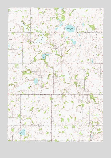
Veseli, MN USGS Topographic Map
Click on map above to begin viewing in our Map Viewer.

This topographic map contains these locations and features:
Feature Name Type Latitude Longitude GNIS ID View Map
Bob's Bluebird OrchardLocaleN44.5700°W93.4589°2651172View Map
Bradshaw LakeSwampN44.5961°W93.4544°640419View Map
Cedar LakePopulated PlaceN44.5872°W93.4402°654637View Map
Cedarlake Post Office (historical)Post OfficeN44.5872°W93.4400°2094055View Map
Dvorak Wildlife PondReservoirN44.5633°W93.4619°1776382View Map
Dvorak Wildlife Pond DamDamN44.5633°W93.4619°1776381View Map
Hatch LakeLakeN44.5083°W93.4804°644718View Map
Lennon LakeLakeN44.6055°W93.4190°646597View Map
Nash LakeLakeN44.5798°W93.4524°648425View Map
Plum Creek Post Office (historical)Post OfficeN44.5597°W93.4083°2093239View Map
Porter CreekStreamN44.6250°W93.4847°639171View Map
Saint Johns CemeteryCemeteryN44.5158°W93.4677°650668View Map
Saint Johns CemeteryCemeteryN44.5394°W93.3824°650670View Map
Saint Patrick State Wildlife Management AreaParkN44.5889°W93.4980°639175View Map
Scott County Waterfowl Production AreaParkN44.5474°W93.4489°2776745View Map
Smith FieldAirportN44.6218°W93.4001°2770215View Map
Sweetland OrchardLocaleN44.5700°W93.4586°2663768View Map
Thomas Dairy FarmLocaleN44.6169°W93.3869°2664398View Map
Thompson's Hillcrest OrchardLocaleN44.5853°W93.3939°2663769View Map
Township of Cedar LakeCivilN44.5872°W93.4609°663767View Map
Township of WheatlandCivilN44.5022°W93.4668°665977View Map
VeseliPopulated PlaceN44.5150°W93.4599°653643View Map

Note: Coordinates in the location and feature list above are referenced to NAD83 datum.


Copyright (C) 2008-2025 Ryan Niemi / Sunset Dynamics ... All Rights Reserved