TopoQuest Logo
Do you find TopoQuest useful?
Help keep TopoQuest running and adding new maps/features by donating!
Bitcoin:  19c7KJd3qBynnjoSw5npx9KScwjBe4ifkT
Litecoin:  LXs6TkuXGGXo1vDsWCkWVdjQX94eUKd6ui
Home View Maps Find Maps Find Places Resources & Links


Montgomery, Minnesota Topographic Map

USGS Map Title: Montgomery, MN
USGS Map MRC: 44093D5
DRG (GeoTIFF) Download: o44093d5.tif


Neighboring USGS Topographic Map Quads:


  Union Hill, MN  
44093E6
 

  New Prague, MN  
44093E5
 

  Veseli, MN  
44093E4
 

  Le Center, MN  
44093D6
 

  Montgomery, MN  
44093D5
 

  Lonsdale, MN  
44093D4
 

  Cordova, MN  
44093C6
 

  Kilkenny, MN  
44093C5
 

  Shieldsville, MN  
44093C4


Map MRC Location:

N45°
W94°
N45°
W93°
H8 H7 H6 H5 H4 H3 H2 H1
G8 G7 G6 G5 G4 G3 G2 G1
F8 F7 F6 F5 F4 F3 F2 F1
E8 E7 E6 E5 E4 E3 E2 E1
D8 D7 D6 D5 D4 D3 D2 D1
C8 C7 C6 C5 C4 C3 C2 C1
B8 B7 B6 B5 B4 B3 B2 B1
A8 A7 A6 A5 A4 A3 A2 A1
N44°
W94°
N44°
W93°

Montgomery, MN USGS 1:24K Topographic Map Preview:
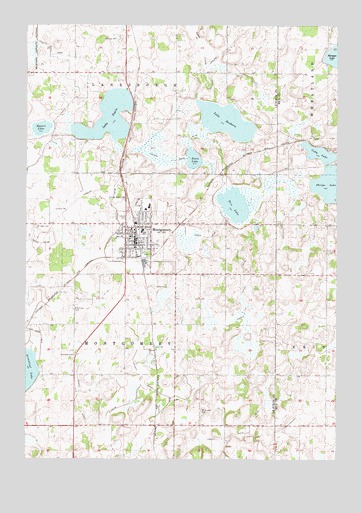
Montgomery, MN USGS Topographic Map
Click on map above to begin viewing in our Map Viewer.

This topographic map contains these locations and features:
Feature Name Type Latitude Longitude GNIS ID View Map
Arts and Heritage CenterBuildingN44.4403°W93.5806°2063429View Map
Bohemian CemeteryCemeteryN44.4180°W93.6061°640337View Map
Calvary CemeteryCemeteryN44.4444°W93.5842°640760View Map
City of MontgomeryCivilN44.4445°W93.5802°2395381View Map
County Ditch Number EighteenCanalN44.4255°W93.5372°641742View Map
County Ditch Number FortyCanalN44.3936°W93.5705°642068View Map
County Ditch Number FortyfiveCanalN44.4391°W93.5541°642106View Map
County Ditch Number FortyfourCanalN44.4941°W93.6163°642099View Map
County Ditch Number FortysixCanalN44.3869°W93.5958°642114View Map
County Ditch Number SixtythreeCanalN44.3819°W93.5430°642243View Map
County Ditch Number ThirtyCanalN44.4611°W93.5652°641938View Map
County Ditch Number TwentytwoCanalN44.4469°W93.5894°641822View Map
Dietz LakeLakeN44.4613°W93.5572°642815View Map
Eggert LakeLakeN44.4702°W93.6192°643199View Map
Holy Redeemer Catholic ChurchChurchN44.4386°W93.5831°2063439View Map
KCHK-FM (New Prague)TowerN44.4614°W93.5858°663309View Map
Lake PepinLakeN44.4733°W93.5922°649272View Map
Lake SanbornLakeN44.4724°W93.5447°651133View Map
Memorial ParkParkN44.4342°W93.5764°2063440View Map
Metogga LakeLakeN44.4912°W93.5008°647786View Map
MontgomeryLocaleN44.4386°W93.5803°2063433View Map
MontgomeryPopulated PlaceN44.4389°W93.5813°648047View Map
Montgomery - Lonsdale Middle SchoolSchoolN44.4405°W93.5793°2433192View Map
Montgomery - Lonsdale Secondary SchoolSchoolN44.4408°W93.5786°2433373View Map
Montgomery Area Emergency Medical ServicesBuildingN44.4381°W93.5830°2721316View Map
Montgomery Elementary - Middle SchoolSchoolN44.4404°W93.5793°2063436View Map
Montgomery Fire DepartmentBuildingN44.4380°W93.5831°2666324View Map
Montgomery Golf ClubLocaleN44.4508°W93.5736°2063425View Map
Montgomery Medical ClinicHospitalN44.4375°W93.5808°2063434View Map
Montgomery OrchardsLocaleN44.3831°W93.5853°2651202View Map
Montgomery Police DepartmentBuildingN44.4419°W93.5842°2063430View Map
Montgomery Post OfficePost OfficeN44.4365°W93.5800°2063432View Map
Montgomery Public LibraryBuildingN44.4381°W93.5828°2063431View Map
Montgomery Wayside ParkParkN44.4050°W93.6053°2063588View Map
Most Holy Redeemer Catholic SchoolSchoolN44.4391°W93.5836°2063435View Map
Northside ParkParkN44.4403°W93.5811°2063441View Map
Phelps LakeLakeN44.4544°W93.5017°649353View Map
Prince of Peace Community ChurchChurchN44.4367°W93.5808°2063437View Map
Rice LakeLakeN44.4482°W93.5414°649980View Map
Saint John CemeteryCemeteryN44.4422°W93.6213°650637View Map
Saint John Lutheran ChurchChurchN44.4403°W93.5819°2063438View Map
Saint Michael CemeteryCemeteryN44.3889°W93.5544°650905View Map
Township of LanesburghCivilN44.4992°W93.5855°664722View Map
Township of MontgomeryCivilN44.4117°W93.5858°665013View Map
Tri - City United High SchoolSchoolN44.4471°W93.5864°2432845View Map

Note: Coordinates in the location and feature list above are referenced to NAD83 datum.


Copyright (C) 2008-2025 Ryan Niemi / Sunset Dynamics ... All Rights Reserved