TopoQuest Logo
Do you find TopoQuest useful?
Help keep TopoQuest running and adding new maps/features by donating!
Bitcoin:  19c7KJd3qBynnjoSw5npx9KScwjBe4ifkT
Litecoin:  LXs6TkuXGGXo1vDsWCkWVdjQX94eUKd6ui
Home View Maps Find Maps Find Places Resources & Links


Vilas, Kansas Topographic Map

USGS Map Title: Vilas, KS
USGS Map MRC: 37095F5
DRG (GeoTIFF) Download: o37095f5.tif


Neighboring USGS Topographic Map Quads:


  Rose, KS  
37095G6
 

  Yates Center SE, KS  
37095G5
 

  Humboldt, KS  
37095G4
 

  Buffalo, KS  
37095F6
 

  Vilas, KS  
37095F5
 

  Chanute, KS  
37095F4
 

  Altoona, KS  
37095E6
 

  Five Mounds, KS  
37095E5
 

  Earlton, KS  
37095E4


Map MRC Location:

N38°
W96°
N38°
W95°
H8 H7 H6 H5 H4 H3 H2 H1
G8 G7 G6 G5 G4 G3 G2 G1
F8 F7 F6 F5 F4 F3 F2 F1
E8 E7 E6 E5 E4 E3 E2 E1
D8 D7 D6 D5 D4 D3 D2 D1
C8 C7 C6 C5 C4 C3 C2 C1
B8 B7 B6 B5 B4 B3 B2 B1
A8 A7 A6 A5 A4 A3 A2 A1
N37°
W96°
N37°
W95°

Vilas, KS USGS 1:24K Topographic Map Preview:
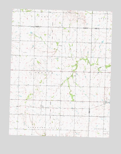
Vilas, KS USGS Topographic Map
Click on map above to begin viewing in our Map Viewer.

This topographic map contains these locations and features:
Feature Name Type Latitude Longitude GNIS ID View Map
Bunker Hill School (historical)SchoolN37.6781°W95.5072°483898View Map
Burdgeville (historical)LocaleN37.6750°W95.6128°482687View Map
Center Ridge ChurchChurchN37.7325°W95.5969°474936View Map
Colfax Baptist ChurchChurchN37.7182°W95.5259°474935View Map
Colfax CemeteryCemeteryN37.7176°W95.5258°2673388View Map
Golden Ridge School (historical)SchoolN37.6667°W95.6150°484173View Map
Grandview School (historical)SchoolN37.6281°W95.5803°484175View Map
KINZ - FM (Chanute)BuildingN37.7479°W95.5610°2625239View Map
Maple Grove School (historical)SchoolN37.6384°W95.5441°484188View Map
Mound Springs School (historical)SchoolN37.6314°W95.6203°484190View Map
North Ridge (historical)Populated PlaceN37.7362°W95.5964°484253View Map
Peach Grove School (historical)SchoolN37.6695°W95.5797°484196View Map
RidgeLocaleN37.7334°W95.5966°481845View Map
Shirley School (historical)SchoolN37.7114°W95.5966°484202View Map
Sorghum Valley School (historical)SchoolN37.6823°W95.5441°484204View Map
South Ridge (historical)Populated PlaceN37.7184°W95.5964°484205View Map
Swede Center CemeteryCemeteryN37.7187°W95.5076°474937View Map
Swede Center School (historical)SchoolN37.7181°W95.5091°483963View Map
Township of ColfaxCivilN37.6894°W95.5978°474929View Map
Union Valley SchoolSchoolN37.6453°W95.5078°474931View Map
VilasPopulated PlaceN37.6542°W95.5864°474932View Map
Vilas Bethel CemeteryCemeteryN37.6606°W95.5614°474938View Map
Village Creek CemeteryCemeteryN37.7141°W95.5623°474934View Map
Village Creek School (historical)SchoolN37.7150°W95.5622°484210View Map
Wilson County Rural Fire District Station 15BuildingN37.6316°W95.6204°2112006View Map
Zion CemeteryCemeteryN37.6896°W95.5253°2673338View Map
Zion ChurchChurchN37.6887°W95.5261°474933View Map

Note: Coordinates in the location and feature list above are referenced to NAD83 datum.


Copyright (C) 2008-2024 Ryan Niemi / Sunset Dynamics ... All Rights Reserved