TopoQuest Logo
Do you find TopoQuest useful?
Help keep TopoQuest running and adding new maps/features by donating!
Bitcoin:  19c7KJd3qBynnjoSw5npx9KScwjBe4ifkT
Litecoin:  LXs6TkuXGGXo1vDsWCkWVdjQX94eUKd6ui
Home View Maps Find Maps Find Places Resources & Links


Vinegar Hill, Idaho Topographic Map

USGS Map Title: Vinegar Hill, ID
USGS Map MRC: 45114B8
DRG (GeoTIFF) Download: o45114b8.tif


Neighboring USGS Topographic Map Quads:


  Wapiti Creek, ID  
45115C1
 

  Cold Meadows, ID  
45114C8
 

  Cottonwood Butte, ID  
45114C7
 

  Acorn Butte, ID  
45115B1
 

  Vinegar Hill, ID  
45114B8
 

  Papoose Peak, ID  
45114B7
 

  Monument, ID  
45115A1
 

  Mormon Mountain, ID  
45114A8
 

  Dave Lewis Peak, ID  
45114A7


Map MRC Location:

N46°
W115°
N46°
W114°
H8 H7 H6 H5 H4 H3 H2 H1
G8 G7 G6 G5 G4 G3 G2 G1
F8 F7 F6 F5 F4 F3 F2 F1
E8 E7 E6 E5 E4 E3 E2 E1
D8 D7 D6 D5 D4 D3 D2 D1
C8 C7 C6 C5 C4 C3 C2 C1
B8 B7 B6 B5 B4 B3 B2 B1
A8 A7 A6 A5 A4 A3 A2 A1
N45°
W115°
N45°
W114°

Vinegar Hill, ID USGS 1:24K Topographic Map Preview:
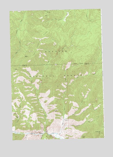
Vinegar Hill, ID USGS Topographic Map
Click on map above to begin viewing in our Map Viewer.

This topographic map contains these locations and features:
Feature Name Type Latitude Longitude GNIS ID View Map
Blackburn SaddleGapN45.2055°W114.9809°377799View Map
Cabin CreekStreamN45.1266°W114.9359°378651View Map
Cabin Creek USFS AirportAirportN45.1435°W114.9290°400760View Map
Calf CreekStreamN45.1480°W114.9148°378713View Map
Cave CreekStreamN45.1324°W114.9554°379059View Map
Clover (historical)Populated PlaceN45.1338°W114.9957°399450View Map
Cold MountainSummitN45.2491°W114.9490°379519View Map
Cold Mountain LookoutLocaleN45.2485°W114.9504°394604View Map
Cold Mountain RidgeRidgeN45.2227°W114.9582°379520View Map
Conyer CreekStreamN45.1299°W114.9593°379640View Map
Cow CreekStreamN45.1435°W114.9301°379947View Map
Doe CreekStreamN45.1302°W114.9787°380676View Map
Garden CreekStreamN45.1330°W114.9965°382171View Map
Horse MountainSummitN45.1294°W114.8795°383396View Map
Mile Hi Landing Strip (historical)AirportN45.1510°W114.9993°397339View Map
North Fork Cabin CreekStreamN45.1766°W114.9232°387663View Map
Spring CreekStreamN45.1338°W114.9337°391174View Map
Towhead BasinBasinN45.1457°W114.9912°392252View Map
Vinegar HillSummitN45.1524°W114.9418°398307View Map
Vines Landing Strip (historical)AirportN45.1324°W114.9993°399748View Map
West Fork Cave CreekStreamN45.1324°W114.9548°393070View Map

Note: Coordinates in the location and feature list above are referenced to NAD83 datum.


Copyright (C) 2008-2025 Ryan Niemi / Sunset Dynamics ... All Rights Reserved