TopoQuest Logo
Do you find TopoQuest useful?
Help keep TopoQuest running and adding new maps/features by donating!
Bitcoin:  19c7KJd3qBynnjoSw5npx9KScwjBe4ifkT
Litecoin:  LXs6TkuXGGXo1vDsWCkWVdjQX94eUKd6ui
Home View Maps Find Maps Find Places Resources & Links


Cottonwood Butte, Idaho Topographic Map

USGS Map Title: Cottonwood Butte, ID
USGS Map MRC: 45114C7
DRG (GeoTIFF) Download: o45114c7.tif


Neighboring USGS Topographic Map Quads:


  Devils Teeth Rapids, ID  
45114D8
 

  Waugh Mountain, ID  
45114D7
 

  Square Top, ID  
45114D6
 

  Cold Meadows, ID  
45114C8
 

  Cottonwood Butte, ID  
45114C7
 

  Butts Creek Point, ID  
45114C6
 

  Vinegar Hill, ID  
45114B8
 

  Papoose Peak, ID  
45114B7
 

  Aggipah Mountain, ID  
45114B6


Map MRC Location:

N46°
W115°
N46°
W114°
H8 H7 H6 H5 H4 H3 H2 H1
G8 G7 G6 G5 G4 G3 G2 G1
F8 F7 F6 F5 F4 F3 F2 F1
E8 E7 E6 E5 E4 E3 E2 E1
D8 D7 D6 D5 D4 D3 D2 D1
C8 C7 C6 C5 C4 C3 C2 C1
B8 B7 B6 B5 B4 B3 B2 B1
A8 A7 A6 A5 A4 A3 A2 A1
N45°
W115°
N45°
W114°

Cottonwood Butte, ID USGS 1:24K Topographic Map Preview:
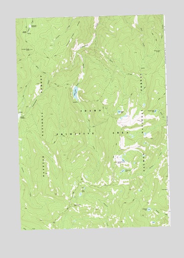
Cottonwood Butte, ID USGS Topographic Map
Click on map above to begin viewing in our Map Viewer.

This topographic map contains these locations and features:
Feature Name Type Latitude Longitude GNIS ID View Map
Basin CreekStreamN45.3624°W114.8084°377000View Map
Basin LakeLakeN45.3184°W114.7905°377011View Map
Black LakeLakeN45.3304°W114.8264°377757View Map
Canyon Creek RidgeRidgeN45.3619°W114.8290°378881View Map
Cottonwood ButteSummitN45.2885°W114.7934°379823View Map
Cottonwood LakeLakeN45.2836°W114.7883°379861View Map
Farrow MountainSummitN45.2635°W114.8307°381610View Map
Farrow Mountain TrailTrailN45.2544°W114.8401°381611View Map
Grandad CampsiteLocaleN45.3671°W114.8657°382504View Map
Hungry Creek PointSummitN45.3563°W114.8634°383549View Map
Mirage CreekStreamN45.3385°W114.8490°387031View Map
Peak CreekStreamN45.3544°W114.8240°388297View Map
Phantom MeadowFlatN45.3702°W114.8626°388393View Map
Stoddard LakeLakeN45.2604°W114.7675°391482View Map
Stub Creek SpringSpringN45.3535°W114.7547°391555View Map
Swamp Angel LakeLakeN45.3183°W114.7599°391701View Map
Twin LakesLakeN45.2739°W114.8210°392525View Map
Twin PeakSummitN45.2719°W114.7507°397282View Map

Note: Coordinates in the location and feature list above are referenced to NAD83 datum.


Copyright (C) 2008-2024 Ryan Niemi / Sunset Dynamics ... All Rights Reserved