TopoQuest Logo
Do you find TopoQuest useful?
Help keep TopoQuest running and adding new maps/features by donating!
Bitcoin:  19c7KJd3qBynnjoSw5npx9KScwjBe4ifkT
Litecoin:  LXs6TkuXGGXo1vDsWCkWVdjQX94eUKd6ui
Home View Maps Find Maps Find Places Resources & Links


Viroqua, Wisconsin Topographic Map

USGS Map Title: Viroqua, WI
USGS Map MRC: 43090E8
DRG (GeoTIFF) Download: o43090e8.tif


Neighboring USGS Topographic Map Quads:


  Coon Valley, WI  
43091F1
 

  Esofea, WI  
43090F8
 

  Westby, WI  
43090F7
 

  Newton, WI  
43091E1
 

  Viroqua, WI  
43090E8
 

  Avalanche, WI  
43090E7
 

  Retreat, WI  
43091D1
 

  Rising Sun, WI  
43090D8
 

  Readstown, WI  
43090D7


Map MRC Location:

N44°
W91°
N44°
W90°
H8 H7 H6 H5 H4 H3 H2 H1
G8 G7 G6 G5 G4 G3 G2 G1
F8 F7 F6 F5 F4 F3 F2 F1
E8 E7 E6 E5 E4 E3 E2 E1
D8 D7 D6 D5 D4 D3 D2 D1
C8 C7 C6 C5 C4 C3 C2 C1
B8 B7 B6 B5 B4 B3 B2 B1
A8 A7 A6 A5 A4 A3 A2 A1
N43°
W91°
N43°
W90°

Viroqua, WI USGS 1:24K Topographic Map Preview:
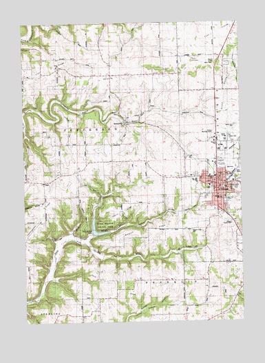
Viroqua, WI USGS Topographic Map
Click on map above to begin viewing in our Map Viewer.

This topographic map contains these locations and features:
Feature Name Type Latitude Longitude GNIS ID View Map
3 ReservoirReservoirN43.5883°W90.8985°1792437View Map
7 ReservoirReservoirN43.5316°W90.9635°1792445View Map
Asbury ChurchChurchN43.6061°W90.9793°1560968View Map
Bad Axe 2 D 2592.1 DamDamN43.5883°W90.8985°1792436View Map
Bad Axe 33 D 2592.1 DamDamN43.5366°W90.9618°1792446View Map
Bad Axe 34 D 2592.1 DamDamN43.5316°W90.9635°1792444View Map
Belgium RidgeRidgeN43.5350°W90.9321°1561518View Map
Belgium Ridge CemeteryCemeteryN43.5382°W90.9038°1561519View Map
Belgium Ridge School (historical)SchoolN43.5350°W90.9332°1840855View Map
Believers Fellowship ChurchChurchN43.5553°W90.8851°1834436View Map
Bethel ChurchChurchN43.6019°W90.9493°1561637View Map
Bethlehem Baptist ChurchChurchN43.5586°W90.8796°1834439View Map
BudPopulated PlaceN43.5583°W90.9879°1577531View Map
Church of the NazareneChurchN43.5611°W90.8865°1834446View Map
City of ViroquaCivilN43.5582°W90.8863°1584335View Map
Coe HollowValleyN43.5379°W90.9601°1563224View Map
Colonel May School (historical)SchoolN43.5639°W90.9676°1840861View Map
Coon PrairieFlatN43.6202°W90.8837°1563372View Map
Cornerstone Christian AcademySchoolN43.5983°W90.8883°2715798View Map
County Farm CemeteryCemeteryN43.5818°W90.8789°1834447View Map
Dach RidgeRidgeN43.5158°W90.9307°1563655View Map
Datch Ridge School (historical)SchoolN43.5139°W90.9460°1840863View Map
Davis SchoolSchoolN43.5597°W90.9185°1563739View Map
English Evangelical Lutheran ChurchChurchN43.5625°W90.8837°1834451View Map
English Lutheran SchoolSchoolN43.5625°W90.8834°2715822View Map
Freedom Worship CenterChurchN43.5603°W90.8910°1834458View Map
Good Shepherd Lutheran ChurchChurchN43.5516°W90.8896°1834459View Map
Hornby CreekStreamN43.5330°W90.9654°1566703View Map
Immanuel Lutheran ChurchChurchN43.5608°W90.9037°1834466View Map
Irish RidgeRidgeN43.6022°W90.9932°1566956View Map
Kingdom Hall of Jehovahs WitnessesChurchN43.5500°W90.8924°1834470View Map
Laurel High SchoolSchoolN43.5545°W90.8901°2715739View Map
Lighthouse Baptist ChurchChurchN43.5586°W90.8904°1834474View Map
Love TabernacleChurchN43.5544°W90.8896°1834477View Map
Mills School (historical)SchoolN43.6033°W90.9887°1840869View Map
North Springville SchoolSchoolN43.6036°W90.9496°1570505View Map
Nottingham RidgeRidgeN43.5344°W90.9993°1570574View Map
Pierce RidgeRidgeN43.5469°W90.9357°1571354View Map
Pioneer CemeteryCemeteryN43.5599°W90.8902°1834486View Map
Pleasant Ridge Waldorf SchoolSchoolN43.5560°W90.8841°1834487View Map
Round PrairieFlatN43.5941°W90.8821°1572680View Map
Round Prairie SchoolSchoolN43.5969°W90.8837°1572683View Map
Saint Marys Catholic ChurchChurchN43.5600°W90.8982°1834491View Map
Sidie HollowValleyN43.5343°W90.9637°1574086View Map
Sidie Hollow County ParkParkN43.5405°W90.9582°1834494View Map
Sidie Hollow LakeReservoirN43.5371°W90.9564°1834495View Map
South Natwick School (historical)SchoolN43.6239°W90.9199°1840875View Map
SpringvillePopulated PlaceN43.5836°W90.9399°1574726View Map
The Church of Jesus Christ of Latter Day SaintsChurchN43.5500°W90.8885°1834445View Map
Three ChimneysPillarN43.6108°W90.9054°1575408View Map
Town of JeffersonCivilN43.5802°W90.9728°1583454View Map
Tri - State Ambulance - ViroquaBuildingN43.5555°W90.8901°2698383View Map
Vernon County Area Better Futures High SchoolSchoolN43.5589°W90.9008°2715826View Map
Vernon County Asylum (historical)HospitalN43.5758°W90.8840°1840877View Map
Vernon County Detention CenterBuildingN43.5770°W90.8853°2759895View Map
Vernon County Sheriff's OfficeBuildingN43.5768°W90.8855°2759645View Map
Vernon Memorial Health CareHospitalN43.5515°W90.8885°1834498View Map
ViroquaPopulated PlaceN43.5569°W90.8887°1576119View Map
Viroqua Christian SchoolSchoolN43.5586°W90.8796°1834499View Map
Viroqua Country ClubLocaleN43.5405°W90.8804°1581360View Map
Viroqua Elementary SchoolSchoolN43.5568°W90.9027°2715740View Map
Viroqua Fire DepartmentBuildingN43.5611°W90.8811°2697930View Map
Viroqua High SchoolSchoolN43.5585°W90.9005°1834500View Map
Viroqua Middle SchoolSchoolN43.5592°W90.9007°2715683View Map
Viroqua Municipal AirportAirportN43.5771°W90.8945°1582247View Map
Viroqua Police DepartmentBuildingN43.5611°W90.8811°2759428View Map
Viroqua Post OfficePost OfficeN43.5552°W90.8883°2768324View Map
White School (historical)SchoolN43.5141°W90.8954°1840878View Map
Youth Initiative High SchoolSchoolN43.5559°W90.8834°2715678View Map

Note: Coordinates in the location and feature list above are referenced to NAD83 datum.


Copyright (C) 2008-2025 Ryan Niemi / Sunset Dynamics ... All Rights Reserved