TopoQuest Logo
Do you find TopoQuest useful?
Help keep TopoQuest running and adding new maps/features by donating!
Bitcoin:  19c7KJd3qBynnjoSw5npx9KScwjBe4ifkT
Litecoin:  LXs6TkuXGGXo1vDsWCkWVdjQX94eUKd6ui
Home View Maps Find Maps Find Places Resources & Links


The Volcanoes, New Mexico Topographic Map

USGS Map Title: The Volcanoes, NM
USGS Map MRC: 35106B7
DRG (GeoTIFF) Download: o35106b7.tif


Neighboring USGS Topographic Map Quads:


  San Felipe Mesa, NM  
35106C8
 

  Arroyo de las Calabacillas, NM  
35106C7
 

  Loma Machete, NM  
35106C6
 

  Benavidez Ranch, NM  
35106B8
 

  The Volcanoes, NM  
35106B7
 

  Los Griegos, NM  
35106B6
 

  La Mesita Negra, NM  
35106A8
 

  La Mesita Negra SE, NM  
35106A7
 

  Albuquerque West, NM  
35106A6


Map MRC Location:

N36°
W107°
N36°
W106°
H8 H7 H6 H5 H4 H3 H2 H1
G8 G7 G6 G5 G4 G3 G2 G1
F8 F7 F6 F5 F4 F3 F2 F1
E8 E7 E6 E5 E4 E3 E2 E1
D8 D7 D6 D5 D4 D3 D2 D1
C8 C7 C6 C5 C4 C3 C2 C1
B8 B7 B6 B5 B4 B3 B2 B1
A8 A7 A6 A5 A4 A3 A2 A1
N35°
W107°
N35°
W106°

The Volcanoes, NM USGS 1:24K Topographic Map Preview:
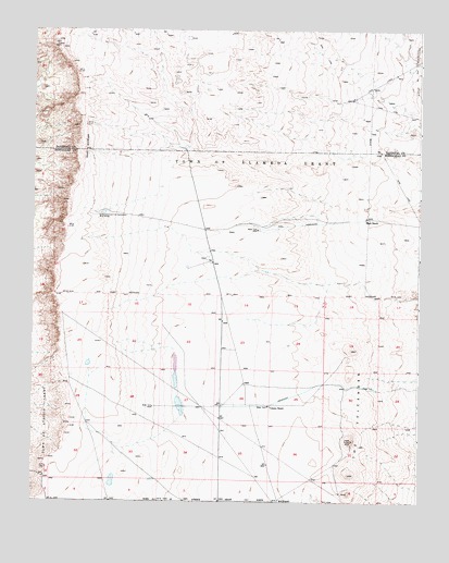
The Volcanoes, NM USGS Topographic Map
Click on map above to begin viewing in our Map Viewer.

This topographic map contains these locations and features:
Feature Name Type Latitude Longitude GNIS ID View Map
1350 FT PZ Water WellWellN35.1795°W106.7803°921611View Map
1500 FT PZ Water WellWellN35.1795°W106.7803°918990View Map
Annulus Water WellWellN35.1795°W106.7803°919095View Map
Black RanchLocaleN35.2003°W106.7673°886448View Map
Black VolcanoSummitN35.1327°W106.7722°2791380View Map
Bond VolcanoSummitN35.1584°W106.7725°932917View Map
Butte VolcanoSummitN35.1655°W106.7720°2791379View Map
CinderSummitN35.1362°W106.7725°932845View Map
Double Eagle II AirportAirportN35.1454°W106.7932°936896View Map
Double Eagle Two Water WellWellN35.1606°W106.7945°919129View Map
J A VolcanoSummitN35.1275°W106.7728°933039View Map
Pre-Piez Water WellWellN35.1795°W106.7803°918891View Map
SAF 1 Water WellWellN35.1462°W106.8245°918641View Map
Shell Oil Water WellWellN35.1478°W106.7845°918642View Map
Shooting Range State ParkParkN35.1525°W106.8514°2026396View Map
The VolcanoesRangeN35.1454°W106.7717°898190View Map
Volcano RanchLocaleN35.1506°W106.7981°896168View Map
Vulcan VolcanoSummitN35.1415°W106.7719°933185View Map

Note: Coordinates in the location and feature list above are referenced to NAD83 datum.


Copyright (C) 2008-2024 Ryan Niemi / Sunset Dynamics ... All Rights Reserved