TopoQuest Logo
Do you find TopoQuest useful?
Help keep TopoQuest running and adding new maps/features by donating!
Bitcoin:  19c7KJd3qBynnjoSw5npx9KScwjBe4ifkT
Litecoin:  LXs6TkuXGGXo1vDsWCkWVdjQX94eUKd6ui
Home View Maps Find Maps Find Places Resources & Links


La Mesita Negra, New Mexico Topographic Map

USGS Map Title: La Mesita Negra, NM
USGS Map MRC: 35106A8
DRG (GeoTIFF) Download: o35106a8.tif


Neighboring USGS Topographic Map Quads:


  Herrera, NM  
35107B1
 

  Benavidez Ranch, NM  
35106B8
 

  The Volcanoes, NM  
35106B7
 

  Canoncito School, NM  
35107A1
 

  La Mesita Negra, NM  
35106A8
 

  La Mesita Negra SE, NM  
35106A7
 

  South Garcia, NM  
34107H1
 

  Dalies NW, NM  
34106H8
 

  Wind Mesa, NM  
34106H7


Map MRC Location:

N36°
W107°
N36°
W106°
H8 H7 H6 H5 H4 H3 H2 H1
G8 G7 G6 G5 G4 G3 G2 G1
F8 F7 F6 F5 F4 F3 F2 F1
E8 E7 E6 E5 E4 E3 E2 E1
D8 D7 D6 D5 D4 D3 D2 D1
C8 C7 C6 C5 C4 C3 C2 C1
B8 B7 B6 B5 B4 B3 B2 B1
A8 A7 A6 A5 A4 A3 A2 A1
N35°
W107°
N35°
W106°

La Mesita Negra, NM USGS 1:24K Topographic Map Preview:
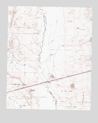
La Mesita Negra, NM USGS Topographic Map
Click on map above to begin viewing in our Map Viewer.

This topographic map contains these locations and features:
Feature Name Type Latitude Longitude GNIS ID View Map
10052 Water WellWellN35.0328°W106.9448°921520View Map
10150 Water WellWellN35.0328°W106.9445°921519View Map
Blackbird HillMineN35.0067°W106.8856°915543View Map
C-T-1 Water WellWellN35.0817°W106.9517°919084View Map
Caņada del OjoStreamN35.0470°W106.9728°897710View Map
Cerro ColoradoSummitN35.0295°W106.9020°897887View Map
Cerro Colorado Land Water WellWellN35.0039°W106.8892°919083View Map
Cerro Colorado-Archuleta ProspectMineN35.0409°W106.8973°915546View Map
ECW2 Water WellWellN35.0620°W106.9973°921457View Map
El RinconAreaN35.0978°W106.8817°888826View Map
El Rincon Water WellWellN35.0903°W106.8864°919140View Map
Fruitvale (historical)Populated PlaceN35.0342°W106.9392°920783View Map
La Mesita NegraSummitN35.0412°W106.9339°890826View Map
MW-1 Water WellWellN35.0059°W106.8870°921429View Map
Rio Puerco Trading PostLocaleN35.0337°W106.9392°923666View Map
Route 66 Casino HotelBuildingN35.0283°W106.9528°2628396View Map
RWPI Water WellWellN35.0837°W106.9539°918682View Map
Texaco Water WellWellN35.0337°W106.9453°919054View Map
West Bernalillo DivisionCivilN35.0960°W106.9511°1937501View Map

Note: Coordinates in the location and feature list above are referenced to NAD83 datum.


Copyright (C) 2008-2025 Ryan Niemi / Sunset Dynamics ... All Rights Reserved