TopoQuest Logo
Do you find TopoQuest useful?
Help keep TopoQuest running and adding new maps/features by donating!
Bitcoin:  19c7KJd3qBynnjoSw5npx9KScwjBe4ifkT
Litecoin:  LXs6TkuXGGXo1vDsWCkWVdjQX94eUKd6ui
Home View Maps Find Maps Find Places Resources & Links


Voluntown, Connecticut Topographic Map

USGS Map Title: Voluntown, CT
USGS Map MRC: 41071E7
DRG (GeoTIFF) Download: o41071e7.tif


Neighboring USGS Topographic Map Quads:


  Plainfield, CT  
41071F8
 

  Oneco, CT  
41071F7
 

  Coventry Center, RI  
41071F6
 

  Jewett City, CT  
41071E8
 

  Voluntown, CT  
41071E7
 

  Hope Valley, RI  
41071E6
 

  Old Mystic, CT  
41071D8
 

  Ashaway, RI  
41071D7
 

  Carolina, RI  
41071D6


Map MRC Location:

N42°
W72°
N42°
W71°
H8 H7 H6 H5 H4 H3 H2 H1
G8 G7 G6 G5 G4 G3 G2 G1
F8 F7 F6 F5 F4 F3 F2 F1
E8 E7 E6 E5 E4 E3 E2 E1
D8 D7 D6 D5 D4 D3 D2 D1
C8 C7 C6 C5 C4 C3 C2 C1
B8 B7 B6 B5 B4 B3 B2 B1
A8 A7 A6 A5 A4 A3 A2 A1
N41°
W72°
N41°
W71°

Voluntown, CT USGS 1:24K Topographic Map Preview:
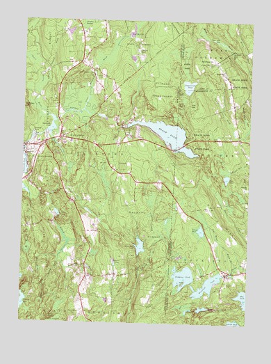
Voluntown, CT USGS Topographic Map
Click on map above to begin viewing in our Map Viewer.

This topographic map contains these locations and features:
Feature Name Type Latitude Longitude GNIS ID View Map
Ashville PondLakeN41.5009°W71.7561°1217861View Map
Ashville Pond DamDamN41.5001°W71.7512°1219054View Map
Baptist CampLocaleN41.5098°W71.8695°1930603View Map
Barber PlotCemeteryN41.5640°W71.7605°1901997View Map
Beach PondLakeN41.5713°W71.7842°1217867View Map
Beach PondReservoirN41.5790°W71.7959°205328View Map
Beach Pond DamDamN41.5816°W71.8175°1771404View Map
BeachdalePopulated PlaceN41.5779°W71.8617°1930614View Map
Beachdale PondReservoirN41.5807°W71.8590°205330View Map
Beachdale Pond DamDamN41.5787°W71.8620°1771471View Map
Bliven BrookStreamN41.5812°W71.8226°205587View Map
Blue PondLakeN41.5106°W71.7505°1217873View Map
Brainard PlotCemeteryN41.5775°W71.7608°1902018View Map
Caswell PlotCemeteryN41.5484°W71.7523°1902052View Map
Crandall PlotCemeteryN41.5706°W71.7570°1902092View Map
Dark Hollow BrookStreamN41.5273°W71.8540°206597View Map
Dawley PondLakeN41.6128°W71.8121°206617View Map
Deep PondLakeN41.5602°W71.7619°1217866View Map
Denison BrookStreamN41.5757°W71.8578°206664View Map
Doaneville PondReservoirN41.5647°W71.8745°206703View Map
Douglas CemeteryCemeteryN41.5692°W71.7936°1930814View Map
Douglas PondReservoirN41.6204°W71.8494°1771599View Map
Douglas Pond DamDamN41.6201°W71.8512°1771598View Map
Dye HillSummitN41.5537°W71.7737°1217865View Map
Ell PondLakeN41.5060°W71.7814°1217858View Map
Erickson Wildlife MarshSwampN41.6104°W71.8264°1930840View Map
EscoheagPopulated PlaceN41.6037°W71.7648°1217869View Map
Escoheag HillSummitN41.6068°W71.7734°1219841View Map
Exeter Fire Department 2 Station 3BuildingN41.5738°W71.7542°2475287View Map
First Baptist ChurchChurchN41.5054°W71.8401°1930853View Map
Gallup CemeteryCemeteryN41.5390°W71.8333°1930906View Map
Gallup Farm AirportAirportN41.5355°W71.8351°213130View Map
Grassy PondLakeN41.5384°W71.7753°1217864View Map
Great Meadow BrookStreamN41.5879°W71.8409°207458View Map
Great Meadow Brook PondReservoirN41.6193°W71.8155°1771536View Map
Great Meadow Brook Pond DamDamN41.6192°W71.8168°1771535View Map
Great Meadow Wildlife MarshSwampN41.6173°W71.8217°1930942View Map
Green Fall PondLakeN41.5320°W71.8089°207478View Map
Green Fall Pond DamDamN41.5315°W71.8084°1771400View Map
Henry Barber PlotCemeteryN41.5929°W71.7656°1902212View Map
Henry Maryott PlotCemeteryN41.5188°W71.7609°1902214View Map
Hodge PondLakeN41.5453°W71.8551°207872View Map
Hope Valley Wyoming Fire District Station 3BuildingN41.5187°W71.7746°2475514View Map
Kelley BrookStreamN41.6040°W71.7509°1217872View Map
Kennedy CemeteryCemeteryN41.6020°W71.8308°208260View Map
Koistenen BrookStreamN41.5226°W71.8503°208332View Map
Locke CemeteryCemeteryN41.5794°W71.7752°1902281View Map
Log House BrookStreamN41.5243°W71.7559°1217863View Map
Long PondLakeN41.5065°W71.7733°1217859View Map
Long Pond DamDamN41.5065°W71.7715°1219060View Map
Lowden BrookStreamN41.6026°W71.8662°208617View Map
Mason-Gray PondLakeN41.6028°W71.8358°208758View Map
Mount MiserySummitN41.5890°W71.8728°208971View Map
Mount Misery BrookStreamN41.6104°W71.8742°209084View Map
Myron Kinney BrookStreamN41.5526°W71.8703°209163View Map
Narragansett TrailTrailN41.5162°W71.8553°209174View Map
Nathaniel Hall PlotCemeteryN41.5136°W71.7633°1902326View Map
New Kinne CemeteryCemeteryN41.5413°W71.8585°208312View Map
Old Kinne CemeteryCemeteryN41.5569°W71.8703°1931336View Map
Palmer - Burdick - Appley PlotCemeteryN41.5463°W71.7685°1902367View Map
Palmer CemeteryCemeteryN41.5149°W71.8405°1931365View Map
Palmer PondLakeN41.5250°W71.8228°209598View Map
Peg Mill BrookStreamN41.5195°W71.8092°209693View Map
Pendleton HillSummitN41.5029°W71.8445°209697View Map
Perkins PlotCemeteryN41.5912°W71.7721°1902383View Map
Phillips IslandIslandN41.5170°W71.7851°1217857View Map
Potter CemeteryCemeteryN41.5789°W71.8177°1931419View Map
Richmond LotCemeteryN41.5866°W71.7675°1902433View Map
Robbins CemeteryCemeteryN41.5766°W71.8522°210235View Map
RockvillePopulated PlaceN41.5198°W71.7612°1217862View Map
Rockville CemeteryCemeteryN41.5169°W71.7610°1902440View Map
Rockville Management and Public Fishing AreaParkN41.5095°W71.7545°1902441View Map
Rockville Post OfficePost OfficeN41.5203°W71.7603°1902442View Map
Rockville Seventh Day Baptist ChurchChurchN41.5209°W71.7548°1902443View Map
Saint Leos SchoolSchoolN41.5307°W71.7578°602167View Map
Saint Thomas-Saint Anns Parish CenterChurchN41.5732°W71.8640°1931502View Map
Sawmill PondReservoirN41.5757°W71.8698°210671View Map
Sawmill Pond DamDamN41.5773°W71.8678°1771402View Map
Stepstone FallsFallsN41.6118°W71.7603°1217870View Map
Tanners BridgeBridgeN41.5843°W71.8556°1931596View Map
Tippecansett PondLakeN41.5983°W71.7838°1217868View Map
Town of VoluntownCivilN41.5799°W71.8324°213521View Map
Upper Deep HoleLakeN41.6175°W71.7704°1217871View Map
VoluntownPopulated PlaceN41.5707°W71.8703°211753View Map
Voluntown Baptist ChurchChurchN41.5729°W71.8681°1931669View Map
Voluntown Elementary SchoolSchoolN41.5748°W71.8662°1931670View Map
Voluntown Fire Department Station 53BuildingN41.5679°W71.8669°2419995View Map
Voluntown Post OfficePost OfficeN41.5725°W71.8662°1931671View Map
Voluntown Public LibraryBuildingN41.5740°W71.8634°1931672View Map
WERI-FM (Westerly)TowerN41.6068°W71.7731°1219785View Map
Wiclcabouet MarshReservoirN41.6095°W71.8148°1771603View Map
Wiclcabouet Marsh DamDamN41.6102°W71.8160°1771602View Map
Wincheck PondReservoirN41.5159°W71.7716°1217860View Map
Wincheck Pond DamDamN41.5201°W71.7628°1219070View Map
Wood River PreschoolSchoolN41.5209°W71.7542°2475867View Map
Wylie School (historical)SchoolN41.6079°W71.8440°1931734View Map
Yawgoog PondLakeN41.5196°W71.7849°1217856View Map
Yawgoog Pond DamDamN41.5168°W71.7812°1219066View Map

Note: Coordinates in the location and feature list above are referenced to NAD83 datum.


Copyright (C) 2008-2024 Ryan Niemi / Sunset Dynamics ... All Rights Reserved