TopoQuest Logo
Do you find TopoQuest useful?
Help keep TopoQuest running and adding new maps/features by donating!
Bitcoin:  19c7KJd3qBynnjoSw5npx9KScwjBe4ifkT
Litecoin:  LXs6TkuXGGXo1vDsWCkWVdjQX94eUKd6ui
Home View Maps Find Maps Find Places Resources & Links


Jewett City, Connecticut Topographic Map

USGS Map Title: Jewett City, CT
USGS Map MRC: 41071E8
DRG (GeoTIFF) Download: o41071e8.tif


Neighboring USGS Topographic Map Quads:


  Scotland, CT  
41072F1
 

  Plainfield, CT  
41071F8
 

  Oneco, CT  
41071F7
 

  Norwich, CT  
41072E1
 

  Jewett City, CT  
41071E8
 

  Voluntown, CT  
41071E7
 

  Uncasville, CT  
41072D1
 

  Old Mystic, CT  
41071D8
 

  Ashaway, RI  
41071D7


Map MRC Location:

N42°
W72°
N42°
W71°
H8 H7 H6 H5 H4 H3 H2 H1
G8 G7 G6 G5 G4 G3 G2 G1
F8 F7 F6 F5 F4 F3 F2 F1
E8 E7 E6 E5 E4 E3 E2 E1
D8 D7 D6 D5 D4 D3 D2 D1
C8 C7 C6 C5 C4 C3 C2 C1
B8 B7 B6 B5 B4 B3 B2 B1
A8 A7 A6 A5 A4 A3 A2 A1
N41°
W72°
N41°
W71°

Jewett City, CT USGS 1:24K Topographic Map Preview:
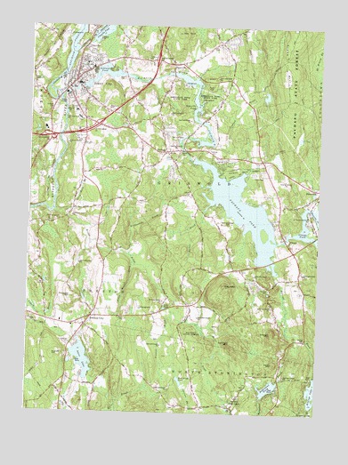
Jewett City, CT USGS Topographic Map
Click on map above to begin viewing in our Map Viewer.

This topographic map contains these locations and features:
Feature Name Type Latitude Longitude GNIS ID View Map
American Legion AmbulanceBuildingN41.6060°W71.9842°2660931View Map
Amos LakeLakeN41.5175°W71.9760°205089View Map
Anderson PondReservoirN41.5086°W71.8957°205092View Map
Ashland PondReservoirN41.6092°W71.9660°205135View Map
Ashland Pond DamDamN41.6054°W71.9772°1771035View Map
Ashwillet BrookStreamN41.5257°W71.8829°205136View Map
Ashwillet School (historical)SchoolN41.5009°W71.8948°1930586View Map
Aspinook Pond DamDamN41.6100°W71.9851°1771233View Map
Ayers BrookStreamN41.5601°W71.9734°205177View Map
Barton IslandIslandN41.5582°W71.8981°1930612View Map
Bay MountainSummitN41.5415°W71.9148°205319View Map
Bee FieldAirportN41.5823°W71.9682°2442485View Map
BethelPopulated PlaceN41.5470°W71.9079°1930626View Map
Bethel ChurchChurchN41.5468°W71.9073°205477View Map
Billings BrookStreamN41.5459°W71.8923°205506View Map
Billings LakeLakeN41.5079°W71.8752°205507View Map
Billings Lake DamDamN41.5076°W71.8751°1771292View Map
Blue LakeReservoirN41.5116°W71.8908°1771299View Map
Blue Lake DamDamN41.5118°W71.8912°1771298View Map
Borough of Jewett CityCivilN41.6069°W71.9807°2378278View Map
Breakneck HillSummitN41.6079°W71.8962°1930650View Map
Broad BrookStreamN41.5657°W71.9890°205730View Map
Brown CemeteryCemeteryN41.5285°W71.9179°1930661View Map
Burton BrookStreamN41.5657°W71.9240°205874View Map
Calvary Bible ChurchChurchN41.5318°W71.9720°1930679View Map
Calvin Wilcox PondReservoirN41.5499°W71.9119°1930684View Map
Campers World CampgroundLocaleN41.6101°W71.9395°1930694View Map
ClayvillePopulated PlaceN41.6173°W71.9776°212435View Map
Clayville PondLakeN41.6230°W71.9697°206318View Map
Cooks Pond (historical)ReservoirN41.5007°W71.9737°1930772View Map
Crary CemeteryCemeteryN41.5333°W71.9459°1930785View Map
Crooked BrookStreamN41.5870°W71.9201°206528View Map
Cutler BrookStreamN41.6176°W71.9795°1930797View Map
Davis CemeteryCemeteryN41.5235°W71.9439°1930800View Map
DoanevillePopulated PlaceN41.5718°W71.8751°212443View Map
Dorrville (historical)Populated PlaceN41.6109°W71.9737°1930813View Map
Edmonds BrookStreamN41.5782°W71.9073°1930830View Map
Edmonds CoveBayN41.5765°W71.9092°1930831View Map
First Congregational ChurchChurchN41.6065°W71.9840°1930863View Map
Fobes - Amos CemeteryCemeteryN41.5267°W71.9854°1930875View Map
Folly Works BrookStreamN41.5490°W71.9545°207895View Map
Geer HillSummitN41.5957°W71.9565°207274View Map
GlasgoPopulated PlaceN41.5559°W71.8881°212465View Map
Glasgo PondReservoirN41.5605°W71.8816°207318View Map
Glasgo Pond DamDamN41.5568°W71.8887°1770353View Map
Glasgo Post OfficePost OfficeN41.5568°W71.8898°1930926View Map
Glasgo SchoolSchoolN41.5504°W71.8834°207319View Map
Glasgo School (historical)SchoolN41.5504°W71.8837°1930927View Map
Grist Mill PondReservoirN41.5278°W71.8769°1930953View Map
Griswald Fire CompanyBuildingN41.5472°W71.9084°2420214View Map
Griswold Fire Marshal's OfficeBuildingN41.6052°W71.9840°2420001View Map
Griswold High SchoolSchoolN41.5976°W71.9804°1930952View Map
Griswold Volunteer Fire Department Station 55BuildingN41.5845°W71.9351°2420182View Map
HopevillePopulated PlaceN41.6126°W71.9384°212481View Map
Hopeville PondReservoirN41.6082°W71.9335°207943View Map
Hopeville Pond DamDamN41.6098°W71.9413°1771037View Map
Hopeville Pond State ParkParkN41.6076°W71.9190°207945View Map
Jewett CityPopulated PlaceN41.6068°W71.9809°208160View Map
Jewett City Baptist ChurchChurchN41.6076°W71.9806°1931064View Map
Jewett City Fire DepartmentBuildingN41.6082°W71.9762°2419989View Map
Jewett City Post OfficePost OfficeN41.6059°W71.9827°1931065View Map
Jewett City Resident State Patrol OfficeBuildingN41.6032°W71.9832°2754767View Map
Jewett City Town HallBuildingN41.6051°W71.9809°1931067View Map
Lakeside Airport (historical)AirportN41.5820°W71.9142°213054View Map
Leonard CemeteryCemeteryN41.5719°W71.9303°208443View Map
Lewis PondLakeN41.5339°W71.9408°208454View Map
Miller BrookStreamN41.5323°W71.9373°208929View Map
Norman BrookStreamN41.6076°W71.9648°209308View Map
Northwest Corner School (historical)SchoolN41.5023°W71.9237°1931304View Map
PachaugPopulated PlaceN41.5843°W71.9406°212536View Map
Pachaug CemeteryCemeteryN41.5845°W71.9203°209578View Map
Pachaug GreenParkN41.5845°W71.9409°1931360View Map
Pachaug PondReservoirN41.5659°W71.9081°209579View Map
Pachaug Pond DamDamN41.5818°W71.9298°1771469View Map
Pachaug RiverStreamN41.6018°W71.9867°209580View Map
Pachaug School (historical)SchoolN41.5815°W71.9440°1931362View Map
Pachaug State ForestForestN41.6015°W71.8859°209581View Map
Partridge BrookStreamN41.6084°W71.9284°1931372View Map
Popple Bridge (historical)BridgeN41.5701°W71.9137°1931410View Map
Prentice BrookStreamN41.5151°W71.9370°209981View Map
Preston CityPopulated PlaceN41.5290°W71.9740°1669631View Map
Preston City Congregational ChurchChurchN41.5287°W71.9751°1931423View Map
Preston City Fire CompanyBuildingN41.5316°W71.9716°2419955View Map
Preston City Historic DistrictParkN41.5282°W71.9748°1931424View Map
Preston City SchoolSchoolN41.5295°W71.9851°1931425View Map
Preston Highway ParkParkN41.5309°W71.9587°1931426View Map
Preston SchoolSchoolN41.5295°W71.9854°209987View Map
Prospect HillSummitN41.5370°W71.9812°210000View Map
Rattlesnake BrookStreamN41.5515°W71.9570°210104View Map
Ross HillSummitN41.6215°W71.9948°210305View Map
Ross Hill CampgroundsLocaleN41.6223°W71.9834°1931460View Map
Round HillSummitN41.5676°W71.9998°210319View Map
Saint Catherine ChurchChurchN41.5226°W71.9815°1931474View Map
Saint Marys ChurchChurchN41.6107°W71.9754°1931486View Map
Sand PlainsFlatN41.5615°W71.8767°1931512View Map
Second Congregational ChurchChurchN41.6095°W71.9767°1931521View Map
Sheep Barn BrookStreamN41.5648°W71.9854°210790View Map
Spruce AirportAirportN41.5942°W71.9304°213065View Map
Spy RockSummitN41.6226°W71.9351°211109View Map
Sterrie BrookStreamN41.5423°W71.8906°1931557View Map
Stickmeadow (historical)LocaleN41.6145°W71.9142°1931558View Map
Stone HillSummitN41.6145°W71.8904°211203View Map
Taylor HillSummitN41.5984°W71.9665°211375View Map
Town of GriswoldCivilN41.5852°W71.9227°213436View Map
Woodmansee PondReservoirN41.5378°W71.8796°1931731View Map
YMCA CampLocaleN41.5143°W71.9267°1931740View Map

Note: Coordinates in the location and feature list above are referenced to NAD83 datum.


Copyright (C) 2008-2024 Ryan Niemi / Sunset Dynamics ... All Rights Reserved