TopoQuest Logo
Do you find TopoQuest useful?
Help keep TopoQuest running and adding new maps/features by donating!
Bitcoin:  19c7KJd3qBynnjoSw5npx9KScwjBe4ifkT
Litecoin:  LXs6TkuXGGXo1vDsWCkWVdjQX94eUKd6ui
Home View Maps Find Maps Find Places Resources & Links


Wadena, Iowa Topographic Map

USGS Map Title: Wadena, IA
USGS Map MRC: 42091G6
DRG (GeoTIFF) Download: o42091g6.tif


Neighboring USGS Topographic Map Quads:


  West Union, IA  
42091H7
 

  Elgin, IA  
42091H6
 

  Gunder, IA  
42091H5
 

  Fayette, IA  
42091G7
 

  Wadena, IA  
42091G6
 

  Volga, IA  
42091G5
 

  Stanley, IA  
42091F7
 

  Arlington, IA  
42091F6
 

  Strawberry Point, IA  
42091F5


Map MRC Location:

N43°
W92°
N43°
W91°
H8 H7 H6 H5 H4 H3 H2 H1
G8 G7 G6 G5 G4 G3 G2 G1
F8 F7 F6 F5 F4 F3 F2 F1
E8 E7 E6 E5 E4 E3 E2 E1
D8 D7 D6 D5 D4 D3 D2 D1
C8 C7 C6 C5 C4 C3 C2 C1
B8 B7 B6 B5 B4 B3 B2 B1
A8 A7 A6 A5 A4 A3 A2 A1
N42°
W92°
N42°
W91°

Wadena, IA USGS 1:24K Topographic Map Preview:
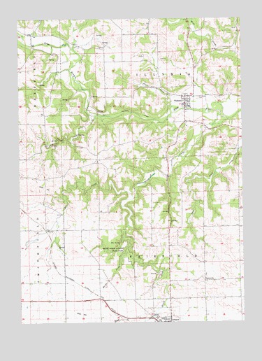
Wadena, IA USGS Topographic Map
Click on map above to begin viewing in our Map Viewer.

This topographic map contains these locations and features:
Feature Name Type Latitude Longitude GNIS ID View Map
Arlington (historical)LocaleN42.7514°W91.6690°1945132View Map
Bear CreekStreamN42.8014°W91.6860°454413View Map
Bear HillSummitN42.7539°W91.7160°454426View Map
Blue SpringSpringN42.7828°W91.6943°454714View Map
Brush CreekStreamN42.8350°W91.6368°454891View Map
Brush Creek Canyon State ParkParkN42.7791°W91.6885°454893View Map
City of WadenaCivilN42.8398°W91.6594°2397161View Map
Corn HillSummitN42.8061°W91.7368°455629View Map
Corn Hill (historical)LocaleN42.7958°W91.7446°1944991View Map
Corn Hill CemeteryCemeteryN42.8068°W91.7368°1945182View Map
Corn Hill Post Office (historical)Post OfficeN42.7958°W91.7446°1944990View Map
Grannis CreekStreamN42.8347°W91.7074°457051View Map
Grannis Creek Wildlife Management AreaParkN42.8228°W91.7085°1944969View Map
LimaPopulated PlaceN42.8683°W91.7429°464619View Map
Lima CemeteryCemeteryN42.8689°W91.7371°1945188View Map
Lima ChurchChurchN42.8666°W91.7418°1945158View Map
Lima Post Office (historical)Post OfficeN42.8683°W91.7429°1944983View Map
Mill Grove Post Office (historical)Post OfficeN42.8111°W91.6663°1944982View Map
Moine CreekStreamN42.7805°W91.6902°459165View Map
Plum CreekStreamN42.8383°W91.6640°460326View Map
Saint Josephs CemeteryCemeteryN42.8425°W91.6493°461128View Map
TaylorsvillePopulated PlaceN42.7672°W91.6468°464774View Map
Taylorsville Post Office (historical)Post OfficeN42.7672°W91.6468°1944977View Map
Taylorville CemeteryCemeteryN42.7698°W91.6464°1945187View Map
Township of FairfieldCivilN42.7742°W91.6664°467810View Map
Township of IllyriaCivilN42.8620°W91.6668°468063View Map
Volga River AccessLocaleN42.8680°W91.7418°1944966View Map
WadenaPopulated PlaceN42.8428°W91.6568°462599View Map
Wadena - Illyria Fire DepartmentBuildingN42.8391°W91.6567°2577338View Map
Wadena (historical)LocaleN42.8416°W91.6568°1945092View Map
Wadena CemeteryCemeteryN42.8428°W91.6529°1945189View Map
Wadena Christian AcademySchoolN42.8391°W91.6552°1945093View Map
Wadena City HallBuildingN42.8416°W91.6568°1945090View Map
Wadena Community Presbyterian ChurchChurchN42.8416°W91.6568°1945089View Map
Wadena Post OfficePost OfficeN42.8416°W91.6568°1945091View Map
Wadena Public LibraryBuildingN42.8416°W91.6568°1945088View Map

Note: Coordinates in the location and feature list above are referenced to NAD83 datum.


Copyright (C) 2008-2024 Ryan Niemi / Sunset Dynamics ... All Rights Reserved