TopoQuest Logo
Do you find TopoQuest useful?
Help keep TopoQuest running and adding new maps/features by donating!
Bitcoin:  19c7KJd3qBynnjoSw5npx9KScwjBe4ifkT
Litecoin:  LXs6TkuXGGXo1vDsWCkWVdjQX94eUKd6ui
Home View Maps Find Maps Find Places Resources & Links


Wakonda, South Dakota Topographic Map

USGS Map Title: Wakonda, SD
USGS Map MRC: 43097A1
DRG (GeoTIFF) Download: o43097a1.tif


Neighboring USGS Topographic Map Quads:


  Center Point, SD  
43097B2
 

  Viborg, SD  
43097B1
 

  Beresford NW, SD  
43096B8
 

  Irene, SD  
43097A2
 

  Wakonda, SD  
43097A1
 

  Centerville, SD  
43096A8
 

  Gayville, SD  
42097H2
 

  Gayville NE, SD  
42097H1
 

  Hub City, SD  
42096H8


Map MRC Location:

N44°
W98°
N44°
W97°
H8 H7 H6 H5 H4 H3 H2 H1
G8 G7 G6 G5 G4 G3 G2 G1
F8 F7 F6 F5 F4 F3 F2 F1
E8 E7 E6 E5 E4 E3 E2 E1
D8 D7 D6 D5 D4 D3 D2 D1
C8 C7 C6 C5 C4 C3 C2 C1
B8 B7 B6 B5 B4 B3 B2 B1
A8 A7 A6 A5 A4 A3 A2 A1
N43°
W98°
N43°
W97°

Wakonda, SD USGS 1:24K Topographic Map Preview:
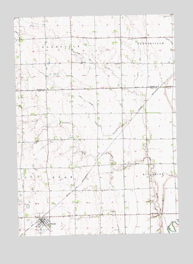
Wakonda, SD USGS Topographic Map
Click on map above to begin viewing in our Map Viewer.

This topographic map contains these locations and features:
Feature Name Type Latitude Longitude GNIS ID View Map
Bellview School (historical)SchoolN43.0208°W97.0600°1264498View Map
Colfax CornerPopulated PlaceN43.0111°W97.0223°1260990View Map
Columkill CemeteryCemeteryN43.0642°W97.0831°1254441View Map
Flynn Dickerson DitchCanalN43.0722°W97.0645°1255093View Map
Frog CreekStreamN43.0022°W97.0075°1255172View Map
Frog Creek School (historical)SchoolN43.0722°W97.0225°1264487View Map
Hagamon Spring (historical)SpringN43.0361°W97.0523°1264485View Map
Holland CemeteryCemeteryN43.1113°W97.0315°1255611View Map
Immanuel ChurchChurchN43.0975°W97.0428°1255738View Map
Ireland School Number 54 (historical)SchoolN43.0805°W97.0823°1264507View Map
Irene-Wakonda Elementary SchoolSchoolN43.0052°W97.1113°2728863View Map
Klepke DitchCanalN43.0955°W97.0284°1255951View Map
Lake MontogomeryLakeN43.0236°W97.1170°1264480View Map
Lake WakondaLakeN43.0125°W97.1170°1264479View Map
Mount Pleasant School Number 32 (historical)SchoolN43.0403°W97.0712°1264506View Map
Riverside (historical)Populated PlaceN43.0194°W97.0059°1264511View Map
Saint Collumbkille Catholic Church (historical)ChurchN43.0722°W97.0837°1264474View Map
Shaw School (historical)SchoolN43.0792°W97.1073°1264470View Map
Spring CreekStreamN43.0433°W97.0248°1258253View Map
Star Corner (historical)Populated PlaceN43.0403°W97.0642°1264512View Map
Star Corner School (historical)SchoolN43.0069°W97.1003°1264468View Map
Town of WakondaCivilN43.0081°W97.1060°1267621View Map
Township of StarCivilN43.0401°W97.1012°1729734View Map
WakondaPopulated PlaceN43.0083°W97.1067°1258793View Map
Wakonda Fire and RescueBuildingN43.0090°W97.1061°2580784View Map
Wakonda Post OfficePost OfficeN43.0089°W97.1072°2712447View Map
Wakonda Public LibraryBuildingN43.0056°W97.1107°2723788View Map

Note: Coordinates in the location and feature list above are referenced to NAD83 datum.


Copyright (C) 2008-2024 Ryan Niemi / Sunset Dynamics ... All Rights Reserved