TopoQuest Logo
Do you find TopoQuest useful?
Help keep TopoQuest running and adding new maps/features by donating!
Bitcoin:  19c7KJd3qBynnjoSw5npx9KScwjBe4ifkT
Litecoin:  LXs6TkuXGGXo1vDsWCkWVdjQX94eUKd6ui
Home View Maps Find Maps Find Places Resources & Links


Walbridge, Ohio Topographic Map

USGS Map Title: Walbridge, OH
USGS Map MRC: 41083E4
DRG (GeoTIFF) Download: o41083e4.tif


Neighboring USGS Topographic Map Quads:


  Toledo, OH  
41083F5
 

  Oregon, OH  
41083F4
 

  Reno Beach, OH  
41083F3
 

  Rossford, OH  
41083E5
 

  Walbridge, OH  
41083E4
 

  Genoa, OH  
41083E3
 

  Dunbridge, OH  
41083D5
 

  Pemberville, OH  
41083D4
 

  Elmore, OH  
41083D3


Map MRC Location:

N42°
W84°
N42°
W83°
H8 H7 H6 H5 H4 H3 H2 H1
G8 G7 G6 G5 G4 G3 G2 G1
F8 F7 F6 F5 F4 F3 F2 F1
E8 E7 E6 E5 E4 E3 E2 E1
D8 D7 D6 D5 D4 D3 D2 D1
C8 C7 C6 C5 C4 C3 C2 C1
B8 B7 B6 B5 B4 B3 B2 B1
A8 A7 A6 A5 A4 A3 A2 A1
N41°
W84°
N41°
W83°

Walbridge, OH USGS 1:24K Topographic Map Preview:
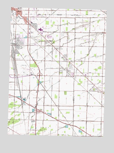
Walbridge, OH USGS Topographic Map
Click on map above to begin viewing in our Map Viewer.

This topographic map contains these locations and features:
Feature Name Type Latitude Longitude GNIS ID View Map
Allen CemeteryCemeteryN41.5807°W83.3970°1037368View Map
Athens Missionary Baptist ChurchChurchN41.5912°W83.4930°1960432View Map
Ayers CreekStreamN41.6014°W83.3860°1037560View Map
Aztec SubdivisionPopulated PlaceN41.6173°W83.4641°1951581View Map
BieberPopulated PlaceN41.6173°W83.4599°1951587View Map
Biltmore GardensPopulated PlaceN41.6070°W83.4666°1062401View Map
Brighton GardensPopulated PlaceN41.6059°W83.4663°1951612View Map
Cedar CreekPopulated PlaceN41.5995°W83.4313°1951620View Map
Cedar Creek PreserveParkN41.5912°W83.4402°1951621View Map
Cedar Creek WoodsPopulated PlaceN41.6048°W83.4288°1951622View Map
Cedar Creeks PreserveParkN41.5912°W83.4438°1960433View Map
Central ParkParkN41.6106°W83.4827°1951623View Map
Central ParkParkN41.6095°W83.4833°1050425View Map
Chippewa Golf CourseLocaleN41.5992°W83.3922°1049674View Map
City of NorthwoodCivilN41.6089°W83.4838°1087191View Map
Crane Creek PlacePopulated PlaceN41.5637°W83.4283°1951629View Map
Cresceus FarmsPopulated PlaceN41.5848°W83.4402°1048642View Map
CrosswoodsPopulated PlaceN41.6000°W83.4402°1951630View Map
Cummings (historical)Populated PlaceN41.5584°W83.4930°1050422View Map
Deluxe Mobile Home ParkPopulated PlaceN41.5984°W83.4883°1951682View Map
DixonPopulated PlaceN41.6070°W83.4547°1951683View Map
Dry CreekStreamN41.6114°W83.3969°1039801View Map
East GardensPopulated PlaceN41.6150°W83.4816°1062461View Map
East LawnPopulated PlaceN41.5764°W83.4272°1064580View Map
Eastpointe on the MallPopulated PlaceN41.5970°W83.4524°1951690View Map
Faith Tabernacle Church of GodChurchN41.5909°W83.4880°1960434View Map
Forest ParkPopulated PlaceN41.5448°W83.3788°1040569View Map
Grace United Methodist ChurchChurchN41.5876°W83.4910°1960435View Map
Great Eastern Shopping CenterLocaleN41.6145°W83.4888°1050424View Map
Gruetter Airport (historical)AirportN41.5923°W83.3753°1082633View Map
Hayes PlacePopulated PlaceN41.6123°W83.4810°1951776View Map
Henry CreekStreamN41.5651°W83.4305°1066746View Map
Hille FarmsPopulated PlaceN41.5684°W83.4213°1951780View Map
Indian Trail EstatesPopulated PlaceN41.5906°W83.4355°1951786View Map
Interchange 2CrossingN41.5589°W83.4602°1061268View Map
Interchange 5CrossingN41.5239°W83.4577°1080266View Map
Interchange 6CrossingN41.6103°W83.4772°1061270View Map
Johnsons SubdivisionPopulated PlaceN41.5242°W83.4908°1951789View Map
Lake CemeteryCemeteryN41.5892°W83.4677°1042374View Map
Lake High SchoolSchoolN41.5596°W83.4706°1042377View Map
Lake Middle SchoolSchoolN41.5604°W83.4706°1050421View Map
Lake Township Fire Department - Station 1BuildingN41.5875°W83.4836°2549076View Map
Lake Township Fire Department Station 2BuildingN41.5729°W83.4311°2549350View Map
Lake Township HouseBuildingN41.5892°W83.4935°1951839View Map
Lake Township Police DepartmentBuildingN41.5578°W83.4840°2733006View Map
LatchaPopulated PlaceN41.5442°W83.4535°1085471View Map
Lindbergh HeightsPopulated PlaceN41.5626°W83.4324°1951844View Map
Little Cedar CreekStreamN41.5917°W83.4424°1048340View Map
Little Crane CreekStreamN41.5778°W83.4019°1042656View Map
Loop ParkParkN41.5898°W83.4872°1042779View Map
Main Street United Brethren ChurchChurchN41.5906°W83.4930°1960436View Map
MillburyPopulated PlaceN41.5662°W83.4247°1065468View Map
Millbury Elementary SchoolSchoolN41.5592°W83.4252°1050430View Map
Millbury Post OfficePost OfficeN41.5662°W83.4245°1082361View Map
Mound ViewPopulated PlaceN41.6164°W83.4860°1065862View Map
Moundview ParkPopulated PlaceN41.6150°W83.4922°1951920View Map
Nature Trails ParkParkN41.6125°W83.4305°1960437View Map
NorthcrestPopulated PlaceN41.6178°W83.4560°1951925View Map
NorthwoodPopulated PlaceN41.6073°W83.4688°1049027View Map
Northwood Elementary SchoolSchoolN41.6082°W83.4749°1050426View Map
Northwood Fire Department - Station 2BuildingN41.6091°W83.4813°2549356View Map
Northwood High SchoolSchoolN41.6049°W83.4748°1050428View Map
Northwood Police DepartmentBuildingN41.6094°W83.4819°2732431View Map
Olney Elementary SchoolSchoolN41.6070°W83.4748°1050427View Map
Orchard ViewPopulated PlaceN41.5959°W83.4241°1951932View Map
Park Du LangladePopulated PlaceN41.6162°W83.4705°1951933View Map
Promedica Bay Park HospitalHospitalN41.6210°W83.4799°2548891View Map
Roselawn Memorial ParkCemeteryN41.5134°W83.4660°1045194View Map
Saint Jerome ChurchChurchN41.5928°W83.4872°1960438View Map
Saint Jerome SchoolSchoolN41.5928°W83.4872°1960439View Map
The MeadowsPopulated PlaceN41.5950°W83.4435°1951992View Map
Toledo Executive AirportAirportN41.5645°W83.4765°1083059View Map
Township of LakeCivilN41.5576°W83.4715°1087186View Map
Troy Villa Mobile Home ParkPopulated PlaceN41.5028°W83.4663°1952001View Map
Turnberry EstatesPopulated PlaceN41.6037°W83.4541°1952002View Map
Updyke AdditionPopulated PlaceN41.5681°W83.4188°1952004View Map
VickersPopulated PlaceN41.6162°W83.4958°1062589View Map
Village of MillburyCivilN41.5647°W83.4255°2399352View Map
Village of WalbridgeCivilN41.5864°W83.4930°2400082View Map
WalbridgePopulated PlaceN41.5878°W83.4933°1047491View Map
Walbridge Branch Wood County District Public LibraryBuildingN41.5884°W83.4930°1952009View Map
Walbridge Church of the NazareneChurchN41.5901°W83.4908°1960440View Map
Walbridge Elementary SchoolSchoolN41.5870°W83.4905°1050423View Map
Walbridge Police DepartmentBuildingN41.5884°W83.4935°2732738View Map
Walbridge Post OfficePost OfficeN41.5918°W83.4938°1082360View Map
Walbridge YardLocaleN41.5737°W83.4935°1047493View Map
Walnut Hills Mobile Home ParkPopulated PlaceN41.5970°W83.4883°1952011View Map
Webb (historical)Populated PlaceN41.5148°W83.4230°1061821View Map
West PointePopulated PlaceN41.6175°W83.4538°1952020View Map
Windemere OrchardsPopulated PlaceN41.5937°W83.4535°1952107View Map
Wolf Creek AdditionPopulated PlaceN41.6064°W83.4555°1952113View Map
Wood LakeReservoirN41.5346°W83.4793°1048066View Map
Wood Lake Mobile Home ParkPopulated PlaceN41.5362°W83.4797°1952115View Map
WoodhurstPopulated PlaceN41.6150°W83.4513°1952116View Map
Woodland ForestPopulated PlaceN41.5423°W83.4260°1952117View Map
Woodville GardensPopulated PlaceN41.5920°W83.4505°1049344View Map
Woodville Mall Shopping CenterLocaleN41.6037°W83.4608°1050429View Map
Zion ChurchChurchN41.5370°W83.4538°1048284View Map

Note: Coordinates in the location and feature list above are referenced to NAD83 datum.


Copyright (C) 2008-2025 Ryan Niemi / Sunset Dynamics ... All Rights Reserved