TopoQuest Logo
Do you find TopoQuest useful?
Help keep TopoQuest running and adding new maps/features by donating!
Bitcoin:  19c7KJd3qBynnjoSw5npx9KScwjBe4ifkT
Litecoin:  LXs6TkuXGGXo1vDsWCkWVdjQX94eUKd6ui
Home View Maps Find Maps Find Places Resources & Links


Wallace, Alabama Topographic Map

USGS Map Title: Wallace, AL
USGS Map MRC: 31087B2
DRG (GeoTIFF) Download: o31087b2.tif


Neighboring USGS Topographic Map Quads:


  Frisco City SE, AL  
31087C3
 

  Range, AL  
31087C2
 

  Castleberry, AL  
31087C1
 

  Barnett Crossroads, AL  
31087B3
 

  Wallace, AL  
31087B2
 

  Brewton North, AL  
31087B1
 

  Flomaton, AL  
31087A3
 

  Pollard, AL  
31087A2
 

  Brewton South, AL  
31087A1


Map MRC Location:

N32°
W88°
N32°
W87°
H8 H7 H6 H5 H4 H3 H2 H1
G8 G7 G6 G5 G4 G3 G2 G1
F8 F7 F6 F5 F4 F3 F2 F1
E8 E7 E6 E5 E4 E3 E2 E1
D8 D7 D6 D5 D4 D3 D2 D1
C8 C7 C6 C5 C4 C3 C2 C1
B8 B7 B6 B5 B4 B3 B2 B1
A8 A7 A6 A5 A4 A3 A2 A1
N31°
W88°
N31°
W87°

Wallace, AL USGS 1:24K Topographic Map Preview:
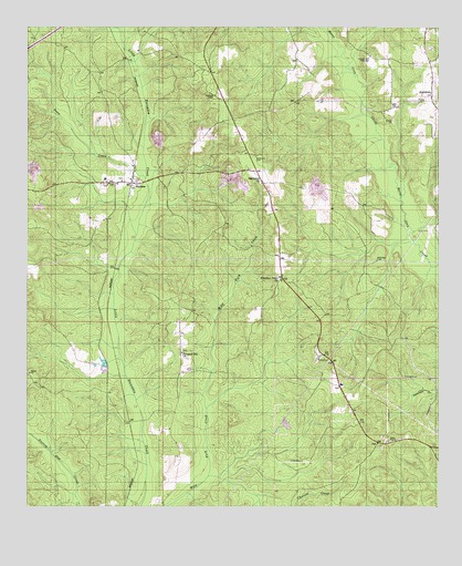
Wallace, AL USGS Topographic Map
Click on map above to begin viewing in our Map Viewer.

This topographic map contains these locations and features:
Feature Name Type Latitude Longitude GNIS ID View Map
Appleton ChurchChurchN31.2302°W87.1386°133740View Map
Appleton Oil FieldOilfieldN31.2468°W87.1264°151174View Map
Brewton DivisionCivilN31.1527°W87.1312°165765View Map
Cooper CemeteryCemeteryN31.2418°W87.1466°116573View Map
Dean CreekStreamN31.2107°W87.2141°117177View Map
Escambia CountyCivilN31.1261°W87.1616°161552View Map
Hammac CemeteryCemeteryN31.1896°W87.1439°119650View Map
Hammac Church (historical)ChurchN31.1991°W87.1741°133805View Map
Hanberry CemeteryCemeteryN31.2166°W87.1808°119665View Map
Hanberry ChurchChurchN31.2093°W87.1786°119666View Map
Hanberry Church Oil FieldOilfieldN31.1877°W87.1472°151182View Map
Huxford Still (historical)LocaleN31.1474°W87.1500°133812View Map
Old Town Post Office (historical)Post OfficeN31.1949°W87.1480°166054View Map
Pleasant Grove ChurchChurchN31.1841°W87.1728°124944View Map
Pleasant Hill CemeteryCemeteryN31.1657°W87.2030°133860View Map
Pleasant Hill ChurchChurchN31.1652°W87.2033°124981View Map
South Burnt Corn Creek Oil FieldOilfieldN31.2038°W87.1458°151189View Map
Turpentine CampLocaleN31.1627°W87.1569°133888View Map
WallacePopulated PlaceN31.2096°W87.2183°128532View Map
Wallace Baptist ChurchChurchN31.2091°W87.2275°155796View Map
Wallace Church CemeteryCemeteryN31.2099°W87.2214°133891View Map
Wallace Oil FieldOilfieldN31.2241°W87.2230°151190View Map
Wallace SchoolSchoolN31.2107°W87.2264°133892View Map
Wallace United Methodist ChurchChurchN31.2096°W87.2214°155951View Map
Wallace Volunteer Fire DepartmentBuildingN31.1994°W87.1747°2331064View Map

Note: Coordinates in the location and feature list above are referenced to NAD83 datum.


Copyright (C) 2008-2024 Ryan Niemi / Sunset Dynamics ... All Rights Reserved