TopoQuest Logo
Do you find TopoQuest useful?
Help keep TopoQuest running and adding new maps/features by donating!
Bitcoin:  19c7KJd3qBynnjoSw5npx9KScwjBe4ifkT
Litecoin:  LXs6TkuXGGXo1vDsWCkWVdjQX94eUKd6ui
Home View Maps Find Maps Find Places Resources & Links


Boles Meadow East, California Topographic Map

USGS Map Title: Boles Meadow East, CA
USGS Map MRC: 41120F7
DRG (GeoTIFF) Download: o41120f7.tif


Neighboring USGS Topographic Map Quads:


  Pothole Valley, CA  
41120G8
 

  Hager Basin, CA  
41120G7
 

  South Mountain, CA  
41120G6
 

  Boles Meadow West, CA  
41120F8
 

  Boles Meadow East, CA  
41120F7
 

  Whittemore Ridge, CA  
41120F6
 

  Ambrose, CA  
41120E8
 

  Jacks Butte, CA  
41120E7
 

  Big Sage Reservoir, CA  
41120E6


Map MRC Location:

N42°
W121°
N42°
W120°
H8 H7 H6 H5 H4 H3 H2 H1
G8 G7 G6 G5 G4 G3 G2 G1
F8 F7 F6 F5 F4 F3 F2 F1
E8 E7 E6 E5 E4 E3 E2 E1
D8 D7 D6 D5 D4 D3 D2 D1
C8 C7 C6 C5 C4 C3 C2 C1
B8 B7 B6 B5 B4 B3 B2 B1
A8 A7 A6 A5 A4 A3 A2 A1
N41°
W121°
N41°
W120°

Boles Meadow East, CA USGS 1:24K Topographic Map Preview:
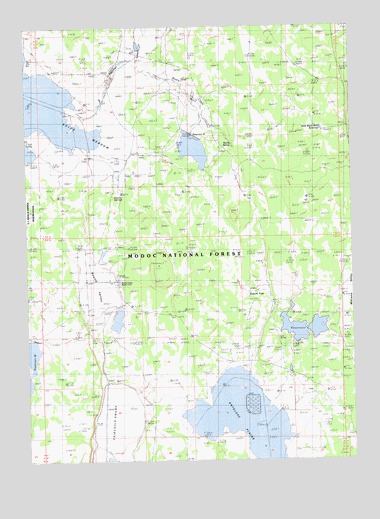
Boles Meadow East, CA USGS Topographic Map
Click on map above to begin viewing in our Map Viewer.

This topographic map contains these locations and features:
Feature Name Type Latitude Longitude GNIS ID View Map
Antelope PlainsLakeN41.6284°W120.7912°256278View Map
Bottle CreekStreamN41.7407°W120.8314°219675View Map
Bottle SpringSpringN41.7157°W120.7961°219676View Map
Coyote SpringsSpringN41.7007°W120.8416°221773View Map
Dutch FlatFlatN41.6707°W120.7841°222763View Map
Fletcher CreekStreamN41.7263°W120.8472°266713View Map
Reservoir CReservoirN41.6629°W120.7703°231499View Map
Reservoir C CampgroundLocaleN41.6602°W120.7758°275950View Map
Reservoir GReservoirN41.7174°W120.8086°231501View Map
Round ValleyStreamN41.6879°W120.8514°231976View Map
Round Valley RanchLocaleN41.6779°W120.8408°231979View Map
Triangle HeadquartersLocaleN41.6488°W120.7736°276004View Map
UlbrightLocaleN41.6546°W120.7866°275951View Map
West Black Rock ReservoirReservoirN41.7199°W120.7622°237423View Map
Williams ValleyValleyN41.6618°W120.7677°252580View Map

Note: Coordinates in the location and feature list above are referenced to NAD83 datum.


Copyright (C) 2008-2025 Ryan Niemi / Sunset Dynamics ... All Rights Reserved