TopoQuest Logo
Do you find TopoQuest useful?
Help keep TopoQuest running and adding new maps/features by donating!
Bitcoin:  19c7KJd3qBynnjoSw5npx9KScwjBe4ifkT
Litecoin:  LXs6TkuXGGXo1vDsWCkWVdjQX94eUKd6ui
Home View Maps Find Maps Find Places Resources & Links


Wardsville, Missouri Topographic Map

USGS Map Title: Wardsville, MO
USGS Map MRC: 38092D2
DRG (GeoTIFF) Download: o38092d2.tif


Neighboring USGS Topographic Map Quads:


  Lohman, MO  
38092E3
 

  Jefferson City, MO  
38092E2
 

  Osage City, MO  
38092E1
 

  Brazito, MO  
38092D3
 

  Wardsville, MO  
38092D2
 

  Westphalia West, MO  
38092D1
 

  Saint Elizabeth, MO  
38092C3
 

  Meta, MO  
38092C2
 

  Argyle, MO  
38092C1


Map MRC Location:

N39°
W93°
N39°
W92°
H8 H7 H6 H5 H4 H3 H2 H1
G8 G7 G6 G5 G4 G3 G2 G1
F8 F7 F6 F5 F4 F3 F2 F1
E8 E7 E6 E5 E4 E3 E2 E1
D8 D7 D6 D5 D4 D3 D2 D1
C8 C7 C6 C5 C4 C3 C2 C1
B8 B7 B6 B5 B4 B3 B2 B1
A8 A7 A6 A5 A4 A3 A2 A1
N38°
W93°
N38°
W92°

Wardsville, MO USGS 1:24K Topographic Map Preview:
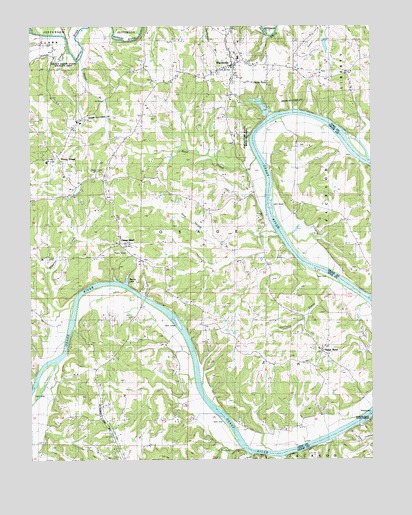
Wardsville, MO USGS Topographic Map
Click on map above to begin viewing in our Map Viewer.

This topographic map contains these locations and features:
Feature Name Type Latitude Longitude GNIS ID View Map
Blair Oaks Elementary SchoolSchoolN38.4922°W92.1749°2571059View Map
Blair Oaks High SchoolSchoolN38.4905°W92.1741°2571061View Map
Blair Oaks Middle SchoolSchoolN38.4928°W92.1737°2571060View Map
Bodie FerryLocaleN38.4742°W92.1596°714472View Map
Buschs LakeLakeN38.4270°W92.2149°737977View Map
Castle RockPillarN38.4817°W92.1677°715478View Map
Castle Rock (historical)Populated PlaceN38.4709°W92.1549°738711View Map
Castle Rock SchoolSchoolN38.4470°W92.1377°715479View Map
Central School (historical)SchoolN38.4870°W92.2121°715686View Map
Graessle-Rockers LakeReservoirN38.4734°W92.1635°764888View Map
Graessle-Rockers Lake DamDamN38.4734°W92.1635°764887View Map
Gum Spring BranchStreamN38.4400°W92.1585°718928View Map
Harrison CreekStreamN38.4295°W92.1452°719158View Map
Hazel BranchStreamN38.4911°W92.2307°719273View Map
Higgins CreekStreamN38.4217°W92.2343°719511View Map
Honey CreekPopulated PlaceN38.4628°W92.2418°737972View Map
Honey CreekStreamN38.4945°W92.2357°719758View Map
Honey Creek State Wildlife AreaParkN38.4900°W92.2371°741825View Map
Immanuel Lutheran SchoolSchoolN38.4609°W92.2438°719765View Map
KLUM-FM (Jefferson City)TowerN38.4581°W92.2257°759013View Map
KTXY-FM (Jefferson City)TowerN38.4581°W92.2257°759164View Map
Little Profits CreekStreamN38.3775°W92.1777°721304View Map
Old Saint Thomas School (historical)SchoolN38.4014°W92.2257°723782View Map
Osage BendPopulated PlaceN38.4061°W92.1432°738648View Map
Osage Bend School (historical)SchoolN38.4064°W92.1437°723853View Map
Osage BluffPopulated PlaceN38.4375°W92.2174°741128View Map
Osage Bluff Ferry (historical)CrossingN38.4217°W92.2085°723854View Map
Osage Bluff School (historical)SchoolN38.4448°W92.2199°723855View Map
Osage Fire Protection District Station 1 HeadquartersBuildingN38.4839°W92.1769°2620759View Map
Osage Fire Protection District Station 3BuildingN38.4082°W92.1748°2621318View Map
Pikes Camp State Wildlife AreaParkN38.4670°W92.1718°741846View Map
Profits CreekStreamN38.3781°W92.1730°724949View Map
Rock CreekStreamN38.4617°W92.1671°725438View Map
Saint Margaret ChurchChurchN38.4069°W92.1435°725821View Map
Saint Stanislaus CemeteryCemeteryN38.4864°W92.1760°2547270View Map
Township of OsageCivilN38.4307°W92.2024°766525View Map
Vanloo Lake DamDamN38.4967°W92.1418°765500View Map
Village of WardsvilleCivilN38.4900°W92.1791°2400093View Map
WardsvillePopulated PlaceN38.4889°W92.1743°728346View Map

Note: Coordinates in the location and feature list above are referenced to NAD83 datum.


Copyright (C) 2008-2025 Ryan Niemi / Sunset Dynamics ... All Rights Reserved