TopoQuest Logo
Do you find TopoQuest useful?
Help keep TopoQuest running and adding new maps/features by donating!
Bitcoin:  19c7KJd3qBynnjoSw5npx9KScwjBe4ifkT
Litecoin:  LXs6TkuXGGXo1vDsWCkWVdjQX94eUKd6ui
Home View Maps Find Maps Find Places Resources & Links


Warm Springs Dam, California Topographic Map

USGS Map Title: Warm Springs Dam, CA
USGS Map MRC: 38123F1
DRG (GeoTIFF) Download: o38123f1.tif


Neighboring USGS Topographic Map Quads:


  Big Foot Mountain, CA  
38123G2
 

  Cloverdale, CA  
38123G1
 

  Asti, CA  
38122G8
 

  Tombs Creek, CA  
38123F2
 

  Warm Springs Dam, CA  
38123F1
 

  Geyserville, CA  
38122F8
 

  Fort Ross, CA  
38123E2
 

  Cazadero, CA  
38123E1
 

  Guerneville, CA  
38122E8


Map MRC Location:

N39°
W124°
N39°
W123°
H8 H7 H6 H5 H4 H3 H2 H1
G8 G7 G6 G5 G4 G3 G2 G1
F8 F7 F6 F5 F4 F3 F2 F1
E8 E7 E6 E5 E4 E3 E2 E1
D8 D7 D6 D5 D4 D3 D2 D1
C8 C7 C6 C5 C4 C3 C2 C1
B8 B7 B6 B5 B4 B3 B2 B1
A8 A7 A6 A5 A4 A3 A2 A1
N38°
W124°
N38°
W123°

Warm Springs Dam, CA USGS 1:24K Topographic Map Preview:
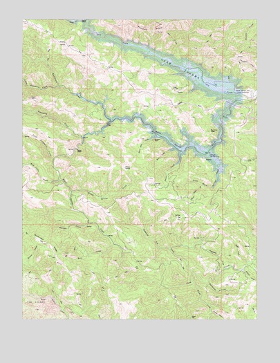
Warm Springs Dam, CA USGS Topographic Map
Click on map above to begin viewing in our Map Viewer.

This topographic map contains these locations and features:
Feature Name Type Latitude Longitude GNIS ID View Map
Bear CreekStreamN38.6966°W123.0450°218806View Map
Bearpen CreekStreamN38.6655°W123.0914°218918View Map
Black Sulfur CreekStreamN38.6807°W123.0303°219409View Map
Boyer CreekStreamN38.6485°W123.0061°219744View Map
Bummer PeakSummitN38.7032°W123.0264°220145View Map
Buzzard RockPillarN38.6999°W123.0564°220320View Map
Eagle RockPillarN38.7171°W123.1219°222828View Map
Fall CreekStreamN38.6563°W123.0775°223365View Map
Lake SonomaReservoirN38.6970°W123.0382°234892View Map
Little Rancheria CreekStreamN38.7219°W123.1064°234172View Map
Little Strawberry CreekStreamN38.6919°W123.1092°227381View Map
Little Warm Springs CreekStreamN38.6949°W123.0286°227406View Map
Oak KnollsSummitN38.7207°W123.0472°1659270View Map
Pechaco CreekStreamN38.6460°W123.0081°230457View Map
Picnic CreekStreamN38.6963°W123.0414°230623View Map
Pritchett PeaksSummitN38.7482°W123.0544°1656295View Map
Rancheria CreekStreamN38.7077°W123.0797°231215View Map
Redwood CanyonValleyN38.6410°W123.0278°231414View Map
Redwood Log CreekStreamN38.6441°W123.0344°231443View Map
Reese GapGapN38.6257°W123.0367°231470View Map
Seven Oaks CreekStreamN38.7013°W123.0525°232821View Map
Skaggs Springs (historical)SpringN38.6930°W123.0267°233190View Map
Strawberry CreekStreamN38.7007°W123.0936°235583View Map
Sweetwater CreekStreamN38.6457°W123.0186°235895View Map
Walbridge RidgeRidgeN38.6594°W123.1219°237164View Map
Warm Springs CreekStreamN38.7180°W123.0083°237246View Map
Warm Springs DamDamN38.7183°W123.0086°237247View Map
Wild Cattle CreekStreamN38.6830°W123.1067°237748View Map
Wildcat CanyonValleyN38.6282°W123.0256°237779View Map
Willow SpringSpringN38.6882°W123.0720°237939View Map
Willow Springs CreekStreamN38.6780°W123.1000°237952View Map
Woods CreekStreamN38.6402°W123.0361°238157View Map

Note: Coordinates in the location and feature list above are referenced to NAD83 datum.


Copyright (C) 2008-2024 Ryan Niemi / Sunset Dynamics ... All Rights Reserved