TopoQuest Logo
Do you find TopoQuest useful?
Help keep TopoQuest running and adding new maps/features by donating!
Bitcoin:  19c7KJd3qBynnjoSw5npx9KScwjBe4ifkT
Litecoin:  LXs6TkuXGGXo1vDsWCkWVdjQX94eUKd6ui
Home View Maps Find Maps Find Places Resources & Links


Warm Springs Reservoir, Oregon Topographic Map

USGS Map Title: Warm Springs Reservoir, OR
USGS Map MRC: 43118E2
DRG (GeoTIFF) Download: o43118e2.tif


Neighboring USGS Topographic Map Quads:


  Upton Mountain, OR  
43118F3
 

  Selle Gap, OR  
43118F2
 

  Juntura, OR  
43118F1
 

  Warm Springs Creek, OR  
43118E3
 

  Warm Springs Reservoir, OR  
43118E2
 

  Mosquito Mountain, OR  
43118E1
 

  Dunnean, OR  
43118D3
 

  McEwen Butte, OR  
43118D2
 

  Hickey Basin, OR  
43118D1


Map MRC Location:

N44°
W119°
N44°
W118°
H8 H7 H6 H5 H4 H3 H2 H1
G8 G7 G6 G5 G4 G3 G2 G1
F8 F7 F6 F5 F4 F3 F2 F1
E8 E7 E6 E5 E4 E3 E2 E1
D8 D7 D6 D5 D4 D3 D2 D1
C8 C7 C6 C5 C4 C3 C2 C1
B8 B7 B6 B5 B4 B3 B2 B1
A8 A7 A6 A5 A4 A3 A2 A1
N43°
W119°
N43°
W118°

Warm Springs Reservoir, OR USGS 1:24K Topographic Map Preview:
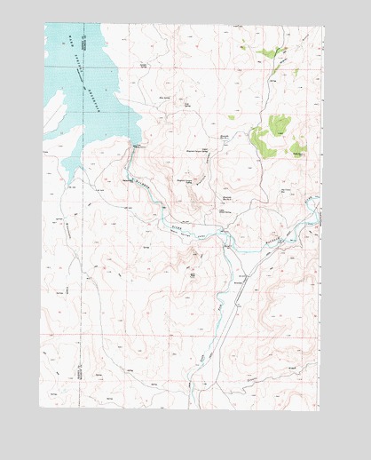
Warm Springs Reservoir, OR USGS Topographic Map
Click on map above to begin viewing in our Map Viewer.

This topographic map contains these locations and features:
Feature Name Type Latitude Longitude GNIS ID View Map
Big Curve ReservoirReservoirN43.5714°W118.1436°1117611View Map
Blaylock CanyonValleyN43.5627°W118.1777°1117806View Map
Blaylock Canyon SpringSpringN43.5733°W118.1832°1117807View Map
Granite CreekStreamN43.5171°W118.1757°1121292View Map
Juniper CanyonValleyN43.5624°W118.1260°1122568View Map
Juniper SpringSpringN43.6118°W118.2038°1122612View Map
Kool SpringSpringN43.6005°W118.1936°1122833View Map
Little Alkali SpringSpringN43.5677°W118.1688°1123120View Map
Lost SpringSpringN43.5987°W118.1870°1123517View Map
Middle Warm Springs Reservoir Boat RampLocaleN43.6035°W118.2417°2698988View Map
RiversidePopulated PlaceN43.5415°W118.1591°1136689View Map
Riverside Post OfficePost OfficeN43.5415°W118.1591°1165862View Map
Riverside Reservoir Number OneReservoirN43.5878°W118.1670°1126067View Map
Riverside Reservoir Number TwoReservoirN43.5677°W118.1691°1126068View Map
Sheep RockSummitN43.5835°W118.1330°1126836View Map
South Fork Malheur RiverStreamN43.5563°W118.1666°1127302View Map
Upper Blaylock Canyon SpringSpringN43.5840°W118.1760°1128435View Map
Warm Springs DamDamN43.5854°W118.2088°1131312View Map
Warm Springs ReservoirReservoirN43.6147°W118.2378°1128656View Map
Warm Springs Reservoir Boat Landing SouthLocaleN43.5872°W118.2097°2698987View Map
Warm Springs ValleyValleyN43.5571°W118.1699°1128657View Map
Winnemucca CreekStreamN43.5721°W118.2388°1129236View Map

Note: Coordinates in the location and feature list above are referenced to NAD83 datum.


Copyright (C) 2008-2025 Ryan Niemi / Sunset Dynamics ... All Rights Reserved