TopoQuest Logo
Do you find TopoQuest useful?
Help keep TopoQuest running and adding new maps/features by donating!
Bitcoin:  19c7KJd3qBynnjoSw5npx9KScwjBe4ifkT
Litecoin:  LXs6TkuXGGXo1vDsWCkWVdjQX94eUKd6ui
Home View Maps Find Maps Find Places Resources & Links


Selle Gap, Oregon Topographic Map

USGS Map Title: Selle Gap, OR
USGS Map MRC: 43118F2
DRG (GeoTIFF) Download: o43118f2.tif


Neighboring USGS Topographic Map Quads:


  Drinkwater Pass, OR  
43118G3
 

  Petes Mountain, OR  
43118G2
 

  Stemler Ridge, OR  
43118G1
 

  Upton Mountain, OR  
43118F3
 

  Selle Gap, OR  
43118F2
 

  Juntura, OR  
43118F1
 

  Warm Springs Creek, OR  
43118E3
 

  Warm Springs Reservoir, OR  
43118E2
 

  Mosquito Mountain, OR  
43118E1


Map MRC Location:

N44°
W119°
N44°
W118°
H8 H7 H6 H5 H4 H3 H2 H1
G8 G7 G6 G5 G4 G3 G2 G1
F8 F7 F6 F5 F4 F3 F2 F1
E8 E7 E6 E5 E4 E3 E2 E1
D8 D7 D6 D5 D4 D3 D2 D1
C8 C7 C6 C5 C4 C3 C2 C1
B8 B7 B6 B5 B4 B3 B2 B1
A8 A7 A6 A5 A4 A3 A2 A1
N43°
W119°
N43°
W118°

Selle Gap, OR USGS 1:24K Topographic Map Preview:
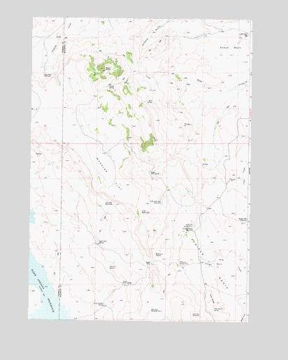
Selle Gap, OR USGS Topographic Map
Click on map above to begin viewing in our Map Viewer.

This topographic map contains these locations and features:
Feature Name Type Latitude Longitude GNIS ID View Map
Bay Stud ReservoirReservoirN43.7257°W118.2433°1117330View Map
Black ButteSummitN43.7288°W118.2091°1117741View Map
Juniper BasinBasinN43.6446°W118.1446°1122563View Map
Juniper Basin ReservoirReservoirN43.6630°W118.1570°1122565View Map
Lake Bed WaterholeLakeN43.6731°W118.2074°1122888View Map
Little Selle GapGapN43.6696°W118.1869°1123277View Map
Little Selle Gap ReservoirReservoirN43.6742°W118.1752°1123278View Map
Little Selle SpringSpringN43.6573°W118.2105°1123279View Map
Lone Juniper SpringSpringN43.6309°W118.2073°1123375View Map
Lower Selle SpringSpringN43.6400°W118.1966°1123588View Map
Meeker Mountain ReservoirReservoirN43.6670°W118.1260°1124043View Map
Mud SpringSpringN43.7155°W118.1813°1124470View Map
Poison BasinBasinN43.7379°W118.1366°1125502View Map
Poison Basin WellWellN43.7433°W118.1274°1125503View Map
Poison CreekStreamN43.7235°W118.1274°1161956View Map
Selle GapGapN43.6490°W118.1802°1126732View Map
Selle Gap ReservoirReservoirN43.6277°W118.1569°1126733View Map
Selle Gap Reservoir Number TwoReservoirN43.6295°W118.1806°1126734View Map
Shovel SpringSpringN43.7212°W118.2062°1126933View Map
Trail SpringSpringN43.6472°W118.2043°1128200View Map
Twin KnollsSummitN43.6368°W118.1477°1136851View Map
Twin Knolls SpringSpringN43.6301°W118.1450°1128344View Map
Upper Mud SpringSpringN43.6860°W118.1818°1128464View Map
Wheeler FlatFlatN43.6840°W118.2041°1128932View Map
Williams CharcoLakeN43.6523°W118.1782°1129110View Map
Williams Spring Number FourSpringN43.6312°W118.1485°1639144View Map
Williams Spring Number ThreeSpringN43.6484°W118.1650°1129122View Map
Williams Spring Number TwoSpringN43.6640°W118.1571°1129121View Map

Note: Coordinates in the location and feature list above are referenced to NAD83 datum.


Copyright (C) 2008-2025 Ryan Niemi / Sunset Dynamics ... All Rights Reserved