TopoQuest Logo
Do you find TopoQuest useful?
Help keep TopoQuest running and adding new maps/features by donating!
Bitcoin:  19c7KJd3qBynnjoSw5npx9KScwjBe4ifkT
Litecoin:  LXs6TkuXGGXo1vDsWCkWVdjQX94eUKd6ui
Home View Maps Find Maps Find Places Resources & Links


Warren Bridge, Wyoming Topographic Map

USGS Map Title: Warren Bridge, WY
USGS Map MRC: 43110A1
DRG (GeoTIFF) Download: o43110a1.tif


Neighboring USGS Topographic Map Quads:


  Pass Peak, WY  
43110B2
 

  Dodge Butte, WY  
43110B1
 

  Kendall Mountain, WY  
43109B8
 

  Signal Hill, WY  
43110A2
 

  Warren Bridge, WY  
43110A1
 

  New Fork Lakes, WY  
43109A8
 

  Webb Draw, WY  
42110H2
 

  Daniel Junction, WY  
42110H1
 

  Cora, WY  
42109H8


Map MRC Location:

N44°
W111°
N44°
W110°
H8 H7 H6 H5 H4 H3 H2 H1
G8 G7 G6 G5 G4 G3 G2 G1
F8 F7 F6 F5 F4 F3 F2 F1
E8 E7 E6 E5 E4 E3 E2 E1
D8 D7 D6 D5 D4 D3 D2 D1
C8 C7 C6 C5 C4 C3 C2 C1
B8 B7 B6 B5 B4 B3 B2 B1
A8 A7 A6 A5 A4 A3 A2 A1
N43°
W111°
N43°
W110°

Warren Bridge, WY USGS 1:24K Topographic Map Preview:
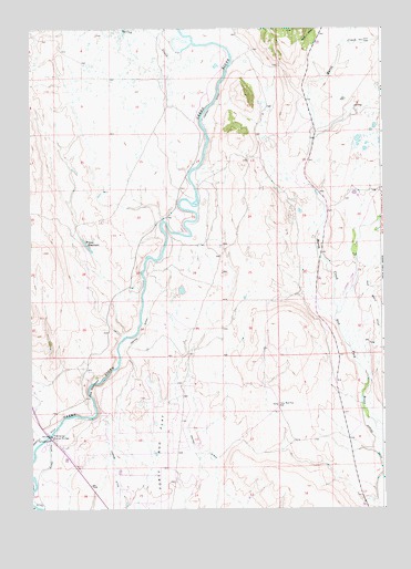
Warren Bridge, WY USGS Topographic Map
Click on map above to begin viewing in our Map Viewer.

This topographic map contains these locations and features:
Feature Name Type Latitude Longitude GNIS ID View Map
Alexander Family CemeteryCemeteryN43.0664°W110.0115°2774433View Map
Bickel DitchCanalN43.0138°W110.1182°1585419View Map
Buds Pit MineMineN43.0274°W110.0115°1704184View Map
Canyon DitchCanalN43.0458°W110.0860°1586355View Map
Daylite Pit MineMineN43.0216°W110.1235°1704185View Map
Five Eighty-two Pit Number Two MineMineN43.0311°W110.0163°1704187View Map
Five Thirty-two Pit Number One MineMineN43.0166°W110.0115°1704186View Map
Forty Rod Flat WellWellN43.0269°W110.0382°1588654View Map
Franz ReservoirReservoirN43.0669°W110.1032°1588722View Map
Horsefly DitchCanalN43.0163°W110.1204°1589722View Map
L L Pit MineMineN43.0563°W110.0210°1704188View Map
Marsh CreekStreamN43.0511°W110.0168°1601260View Map
Marsh Creek Pit MineMineN43.0633°W110.0221°1704189View Map
Pine Grove DitchCanalN43.0627°W110.0038°1602158View Map
Pinedale DivisionCivilN43.0562°W110.0413°1939728View Map
Pocket Pit MineMineN43.0852°W110.0254°1704190View Map
Que Pit MineMineN43.0286°W110.1210°1704191View Map
Rexs Pit MineMineN43.0527°W110.0257°1704192View Map
Spring CreekStreamN43.1211°W110.0668°1594875View Map
The NarrowsGapN43.0311°W110.1046°1595448View Map
Wardell Pit MineMineN43.0633°W110.0221°1704193View Map
Warren BridgeBridgeN43.0191°W110.1182°1596048View Map

Note: Coordinates in the location and feature list above are referenced to NAD83 datum.


Copyright (C) 2008-2025 Ryan Niemi / Sunset Dynamics ... All Rights Reserved