TopoQuest Logo
Do you find TopoQuest useful?
Help keep TopoQuest running and adding new maps/features by donating!
Bitcoin:  19c7KJd3qBynnjoSw5npx9KScwjBe4ifkT
Litecoin:  LXs6TkuXGGXo1vDsWCkWVdjQX94eUKd6ui
Home View Maps Find Maps Find Places Resources & Links


Waterloo, South Carolina Topographic Map

USGS Map Title: Waterloo, SC
USGS Map MRC: 34082C1
DRG (GeoTIFF) Download: o34082c1.tif


Neighboring USGS Topographic Map Quads:


  Ware Shoals East, SC  
34082D2
 

  Laurens South, SC  
34082D1
 

  Clinton, SC  
34081D8
 

  Cokesbury, SC  
34082C2
 

  Waterloo, SC  
34082C1
 

  Cross Hill, SC  
34081C8
 

  Greenwood, SC  
34082B2
 

  Ninety Six, SC  
34082B1
 

  Dyson, SC  
34081B8


Map MRC Location:

N35°
W83°
N35°
W82°
H8 H7 H6 H5 H4 H3 H2 H1
G8 G7 G6 G5 G4 G3 G2 G1
F8 F7 F6 F5 F4 F3 F2 F1
E8 E7 E6 E5 E4 E3 E2 E1
D8 D7 D6 D5 D4 D3 D2 D1
C8 C7 C6 C5 C4 C3 C2 C1
B8 B7 B6 B5 B4 B3 B2 B1
A8 A7 A6 A5 A4 A3 A2 A1
N34°
W83°
N34°
W82°

Waterloo, SC USGS 1:24K Topographic Map Preview:
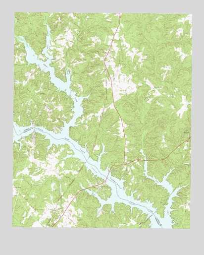
Waterloo, SC USGS Topographic Map
Click on map above to begin viewing in our Map Viewer.

This topographic map contains these locations and features:
Feature Name Type Latitude Longitude GNIS ID View Map
Andersons Mill (historical)LocaleN34.3485°W82.1007°1234732View Map
Balls Mill (historical)LocaleN34.2507°W82.0187°1234740View Map
Bethlehem CemeteryCemeteryN34.2540°W82.0796°1220595View Map
Bethlehem ChurchChurchN34.2590°W82.0898°1246831View Map
Bethlehem ChurchChurchN34.3271°W82.1068°1220616View Map
Bethlehem ChurchChurchN34.3348°W82.1201°1234754View Map
Boyds BridgeBridgeN34.3079°W82.1101°1251761View Map
Boyds MillLocaleN34.3015°W82.1104°1234053View Map
Camp BranchStreamN34.3032°W82.1221°1247118View Map
Cane CreekStreamN34.2562°W82.0157°1221311View Map
Collins Lakeside VillagePopulated PlaceN34.3140°W82.1154°1234787View Map
CoronacaPopulated PlaceN34.2598°W82.0943°1247396View Map
Coronaca Baptist ChurchChurchN34.2607°W82.0954°1234079View Map
Coronaca Census Designated PlaceCensusN34.2596°W82.0969°2402797View Map
Coronaca Volunteer Fire Department Station 1BuildingN34.2628°W82.0966°2578791View Map
Franklin CemeteryCemeteryN34.3276°W82.0123°1222540View Map
Good Hope ChurchChurchN34.2882°W82.0440°1245768View Map
Harris SpringsPopulated PlaceN34.3318°W82.0265°1227914View Map
Isle of PinesPopulated PlaceN34.3335°W82.1023°1234856View Map
Lake GreenwoodReservoirN34.2553°W82.0176°1237668View Map
Lake GreenwoodReservoirN34.2553°W82.0176°1251823View Map
Lake ShoresPopulated PlaceN34.2760°W82.0615°1231459View Map
Lakeside ChurchChurchN34.2743°W82.0668°1223789View Map
Lakeview ChurchChurchN34.3023°W82.1112°1223791View Map
Laurel Hill ChurchChurchN34.3415°W82.0604°1246308View Map
Laurens County Fire Department Cross Hill Station 4BuildingN34.2965°W82.0466°2578815View Map
Laurens County Fire Department WaterlooBuildingN34.3575°W82.0558°2578646View Map
Laurens County Fire Department Waterloo Station 2BuildingN34.3230°W82.1046°2578398View Map
Long Lick BranchStreamN34.3332°W82.0873°1224174View Map
LotaPopulated PlaceN34.2526°W82.0451°1246471View Map
Mount Zion ChurchChurchN34.2596°W82.1085°1249718View Map
Mount Zion School (historical)SchoolN34.2598°W82.1090°1234179View Map
Neilus Ferry (historical)CrossingN34.3015°W82.0893°1234914View Map
Niswongers Mill (historical)LocaleN34.3604°W82.1243°1234923View Map
Old Puckett Ferry (historical)CrossingN34.2679°W82.0498°1251762View Map
Pine Land ShoresPopulated PlaceN34.2640°W82.0068°1234934View Map
Quarter CreekStreamN34.2676°W82.0537°1225713View Map
Rabon CreekStreamN34.3460°W82.1015°1250281View Map
Reedy RiverStreamN34.3040°W82.0893°1225823View Map
Ridgewood AirAirportN34.2937°W82.0475°2650812View Map
Rosemont School (historical)SchoolN34.3051°W82.0468°1234956View Map
Smyrna CemeteryCemeteryN34.3468°W82.0748°1234974View Map
Smyrna ChurchChurchN34.3473°W82.0743°1250942View Map
South Carolina Noname 24008 D-1264 DamDamN34.2568°W82.1165°1239039View Map
The ForksCapeN34.3337°W82.1207°1227076View Map
Town of WaterlooCivilN34.3555°W82.0579°2406838View Map
WaterlooPopulated PlaceN34.3515°W82.0593°1231896View Map
Waterloo United Methodist ChurchChurchN34.3518°W82.0601°1234993View Map
Youngs Ferry (historical)CrossingN34.3082°W82.1101°1234999View Map

Note: Coordinates in the location and feature list above are referenced to NAD83 datum.


Copyright (C) 2008-2024 Ryan Niemi / Sunset Dynamics ... All Rights Reserved