TopoQuest Logo
Do you find TopoQuest useful?
Help keep TopoQuest running and adding new maps/features by donating!
Bitcoin:  19c7KJd3qBynnjoSw5npx9KScwjBe4ifkT
Litecoin:  LXs6TkuXGGXo1vDsWCkWVdjQX94eUKd6ui
Home View Maps Find Maps Find Places Resources & Links


Watertown East, South Dakota Topographic Map

USGS Map Title: Watertown East, SD
USGS Map MRC: 44097H1
DRG (GeoTIFF) Download: o44097h1.tif


Neighboring USGS Topographic Map Quads:


  Still Lake, SD  
45097A2
 

  Still Lake SE, SD  
45097A1
 

  South Shore, SD  
45096A8
 

  Watertown West, SD  
44097H2
 

  Watertown East, SD  
44097H1
 

  Kranzburg, SD  
44096H8
 

  Pelican Lake, SD  
44097G2
 

  Watertown SE, SD  
44097G1
 

  Kranzburg SW, SD  
44096G8


Map MRC Location:

N45°
W98°
N45°
W97°
H8 H7 H6 H5 H4 H3 H2 H1
G8 G7 G6 G5 G4 G3 G2 G1
F8 F7 F6 F5 F4 F3 F2 F1
E8 E7 E6 E5 E4 E3 E2 E1
D8 D7 D6 D5 D4 D3 D2 D1
C8 C7 C6 C5 C4 C3 C2 C1
B8 B7 B6 B5 B4 B3 B2 B1
A8 A7 A6 A5 A4 A3 A2 A1
N44°
W98°
N44°
W97°

Watertown East, SD USGS 1:24K Topographic Map Preview:
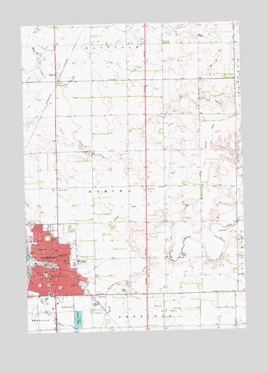
Watertown East, SD USGS Topographic Map
Click on map above to begin viewing in our Map Viewer.

This topographic map contains these locations and features:
Feature Name Type Latitude Longitude GNIS ID View Map
Agriculture and Custom Paint and Fab BuildingSchoolN44.9027°W97.0947°2726270View Map
Automotive Technology BuildingSchoolN44.9043°W97.0945°2726269View Map
Belmont ParkParkN44.9036°W97.0995°1253840View Map
Building Trades Technology BuildingSchoolN44.9041°W97.0948°2726268View Map
Children's Educare CenterBuildingN44.9009°W97.0945°2726273View Map
Codington County CourthouseBuildingN44.8986°W97.1144°2712627View Map
Codington County Heritage MuseumBuildingN44.8993°W97.1136°2729317View Map
Codington County JailBuildingN44.8986°W97.1144°2755654View Map
Codington County Sheriff's OfficeBuildingN44.8984°W97.1141°2755641View Map
Garfield Elementary SchoolSchoolN44.8941°W97.0995°1255208View Map
Grant SchoolSchoolN44.9083°W97.1076°1255336View Map
Great Plains Lutheran High SchoolSchoolN44.9144°W97.1060°2728744View Map
Highland ParkParkN44.9133°W97.1123°1255547View Map
Holy Name SchoolSchoolN44.9122°W97.1206°1255633View Map
Immaculate Conception SchoolSchoolN44.8980°W97.1106°1255735View Map
Interchange 177CrossingN44.8901°W97.0568°2725727View Map
Interchange 180CrossingN44.9338°W97.0559°2725729View Map
Jefferson Elementary SchoolSchoolN44.9219°W97.1123°2729784View Map
KLSC-AM (Watertown)TowerN44.9327°W97.1056°1259348View Map
Lake Area Technical InstituteSchoolN44.9030°W97.0957°2726093View Map
Lincoln Elementary SchoolSchoolN44.9126°W97.0933°1256131View Map
Main BuildingSchoolN44.9028°W97.0957°2726267View Map
Manufacturing Energy and Transportation CenterSchoolN44.9000°W97.0948°2726274View Map
Mellette Elementary SchoolSchoolN44.9091°W97.1176°1256432View Map
Miracle MallLocaleN44.8902°W97.1173°1259542View Map
Mount Hope CemeteryCemeteryN44.9163°W97.0990°1256563View Map
National American University - WatertownSchoolN44.8890°W97.0696°2726099View Map
Prairie Lakes Healthcare SystemHospitalN44.9110°W97.1212°2610950View Map
RauvillePopulated PlaceN44.9797°W97.1059°1261132View Map
Rockys ParkParkN44.8977°W97.1237°1257447View Map
Roosevelt Elementary SchoolSchoolN44.8947°W97.1126°1257459View Map
Saint Ann HospitalHospitalN44.9111°W97.1212°1257562View Map
Saint Martins Elementary SchoolSchoolN44.9150°W97.1101°1257666View Map
Saint Marys CemeteryCemeteryN44.8908°W97.0840°1257681View Map
Student Services CenterBuildingN44.9018°W97.0952°2726272View Map
Technical Education CenterSchoolN44.9018°W97.0947°2726271View Map
Township of ElmiraCivilN44.9393°W97.0584°1729730View Map
WatertownPopulated PlaceN44.8994°W97.1151°1258841View Map
Watertown City AuditoriumBuildingN44.8985°W97.1159°2728288View Map
Watertown City HallBuildingN44.9008°W97.1111°2725390View Map
Watertown Civic ArenaLocaleN44.9033°W97.0978°2728673View Map
Watertown Family Aquatic CenterBuildingN44.8907°W97.1228°2728669View Map
Watertown Fire and RescueBuildingN44.9026°W97.1171°2580718View Map
Watertown High SchoolSchoolN44.9023°W97.0978°2729785View Map
Watertown Junior High SchoolSchoolN44.9081°W97.0980°2729786View Map
Watertown MallLocaleN44.8902°W97.0920°1259541View Map
Watertown Police DepartmentBuildingN44.9020°W97.1101°2755552View Map
Watertown Post OfficePost OfficeN44.8996°W97.1075°2712462View Map
Watertown Regional LibraryBuildingN44.9026°W97.1035°2723790View Map

Note: Coordinates in the location and feature list above are referenced to NAD83 datum.


Copyright (C) 2008-2025 Ryan Niemi / Sunset Dynamics ... All Rights Reserved