TopoQuest Logo
Do you find TopoQuest useful?
Help keep TopoQuest running and adding new maps/features by donating!
Bitcoin:  19c7KJd3qBynnjoSw5npx9KScwjBe4ifkT
Litecoin:  LXs6TkuXGGXo1vDsWCkWVdjQX94eUKd6ui
Home View Maps Find Maps Find Places Resources & Links


Waterville, North Carolina Topographic Map

USGS Map Title: Waterville, NC
USGS Map MRC: 35083G1
DRG (GeoTIFF) Download: o35083g1.tif


Neighboring USGS Topographic Map Quads:


  Newport, TN  
35083H2
 

  Neddy Mountain, TN  
35083H1
 

  Paint Rock, NC  
35082H8
 

  Hartford, TN  
35083G2
 

  Waterville, NC  
35083G1
 

  Lemon Gap, NC  
35082G8
 

  Luftee Knob, NC  
35083F2
 

  Cove Creek Gap, NC  
35083F1
 

  Fines Creek, NC  
35082F8


Map MRC Location:

N36°
W84°
N36°
W83°
H8 H7 H6 H5 H4 H3 H2 H1
G8 G7 G6 G5 G4 G3 G2 G1
F8 F7 F6 F5 F4 F3 F2 F1
E8 E7 E6 E5 E4 E3 E2 E1
D8 D7 D6 D5 D4 D3 D2 D1
C8 C7 C6 C5 C4 C3 C2 C1
B8 B7 B6 B5 B4 B3 B2 B1
A8 A7 A6 A5 A4 A3 A2 A1
N35°
W84°
N35°
W83°

Waterville, NC USGS 1:24K Topographic Map Preview:
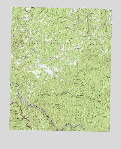
Waterville, NC USGS Topographic Map
Click on map above to begin viewing in our Map Viewer.

This topographic map contains these locations and features:
Feature Name Type Latitude Longitude GNIS ID View Map
Andrews ChapelChurchN35.8248°W83.1035°1304839View Map
Baker BranchStreamN35.8690°W83.0313°1276138View Map
Ball CemeteryCemeteryN35.8515°W83.0957°1276233View Map
Bear BranchStreamN35.8734°W83.1077°1276569View Map
Bear BranchStreamN35.8732°W83.0004°1641251View Map
Bearpen BranchStreamN35.7954°W83.0118°1305026View Map
Bell Hill SchoolSchoolN35.8637°W83.1177°1276928View Map
Bennett BranchStreamN35.8259°W83.1243°1277007View Map
Big BendBendN35.7548°W83.0365°981318View Map
Big BranchStreamN35.7518°W83.1076°1009278View Map
Big Bull MountainSummitN35.8232°W83.0293°1305208View Map
Big CreekStreamN35.7751°W83.0993°1009306View Map
Big Creek CampgroundLocaleN35.7501°W83.1114°2775201View Map
Big Creek Group CampLocaleN35.7524°W83.1091°2775202View Map
Big Creek Horse CampLocaleN35.7543°W83.1073°2775203View Map
Big Flat RidgeRidgeN35.8186°W83.1033°1277294View Map
Big HillSummitN35.8000°W83.0210°1277305View Map
Bills KnobSummitN35.7737°W83.0651°1019175View Map
Birchfield GapGapN35.7990°W83.0454°1277494View Map
Black SchoolSchoolN35.8232°W83.1099°1305268View Map
Black's Chapel Missionary Baptist ChurchChurchN35.8287°W83.1010°1277556View Map
Brown Gap CreekStreamN35.7954°W83.0118°1269381View Map
BrownsPopulated PlaceN35.7848°W83.1138°1314744View Map
Buck RidgeRidgeN35.7611°W83.1195°982115View Map
Buck RidgeRidgeN35.8448°W83.1163°1278834View Map
Bull Mountain GapGapN35.8345°W83.0468°1278952View Map
Calder CemeteryCemeteryN35.8651°W83.0138°1279303View Map
Calder RidgeRidgeN35.8631°W83.0145°1279304View Map
Camp Moss CreekStreamN35.8084°W83.0329°1279403View Map
Cates CreekStreamN35.8168°W83.0918°1279883View Map
Cedar CliffRidgeN35.7736°W83.0689°982801View Map
Cherokee National ForestForestN35.8665°W83.0637°1639804View Map
Chestnut BranchStreamN35.7598°W83.1040°1010228View Map
Chestnut MountainSummitN35.8436°W83.0533°1280400View Map
Chestnut Orchard BranchStreamN35.7693°W83.0260°983120View Map
Chute BranchStreamN35.7934°W83.1143°1280559View Map
Clark CemeteryCemeteryN35.8459°W83.0324°1280593View Map
Cogdill ChapelChurchN35.8709°W83.1032°1280873View Map
Commissioner District 1CivilN35.8622°W83.0547°2464220View Map
Counterfeit BranchStreamN35.7507°W83.0660°983605View Map
CrestmontPopulated PlaceN35.7526°W83.1101°1023422View Map
Cut RidgeRidgeN35.8527°W83.0124°1281908View Map
Dan TopSummitN35.8436°W83.0533°1282010View Map
Davenport GapGapN35.7709°W83.1113°983968View Map
Davenport GapGapN35.7709°W83.1115°1282085View Map
Davenport Gap ShelterLocaleN35.7709°W83.1115°1647977View Map
Davenport Gap ShelterBuildingN35.7690°W83.1238°1652189View Map
Davis CemeteryCemeteryN35.8320°W83.0607°1282148View Map
Deep GapGapN35.7834°W83.0251°1282286View Map
Deep GapGapN35.7837°W83.0251°984080View Map
Deep Gap ChurchChurchN35.8484°W83.0279°1306315View Map
Deep Gap CreekStreamN35.8082°W83.0318°1282287View Map
Deep Gap ShelterLocaleN35.7815°W83.0265°1326404View Map
Dry BranchStreamN35.7590°W83.0354°984356View Map
Dry Gap RidgeRidgeN35.7708°W83.0538°984364View Map
Ephraim BranchStreamN35.7704°W83.0260°984826View Map
Fall BranchStreamN35.8026°W83.0610°1284057View Map
Fern Springs BranchStreamN35.8065°W83.0699°1284217View Map
Flat BranchStreamN35.7707°W83.0860°1011251View Map
Flat RidgeRidgeN35.7751°W83.0020°985172View Map
Fork RidgeRidgeN35.8197°W83.0645°1284627View Map
Grassy ForkStreamN35.8243°W83.0926°1285891View Map
Grassy ForkPopulated PlaceN35.8173°W83.0913°1315147View Map
Grassy Fork Elementary SchoolSchoolN35.8284°W83.0907°1309152View Map
Grassy Fork Volunteer Fire DepartmentBuildingN35.8432°W83.0980°2654649View Map
Green KnobSummitN35.8661°W83.1173°1309150View Map
Green RidgeRidgeN35.8661°W83.1173°1286119View Map
Groundhog CreekStreamN35.7562°W83.0357°986171View Map
Hall CemeteryCemeteryN35.8648°W83.1071°1286568View Map
Harmon Den MountainSummitN35.7725°W83.0022°1020622View Map
Hickory RidgeRidgeN35.7669°W83.0145°986717View Map
Hollow Field GapGapN35.8454°W83.1060°1288080View Map
Holly Bottom BranchStreamN35.7751°W83.0271°986941View Map
Hood BranchStreamN35.8326°W83.0115°1288220View Map
Hootowl BranchStreamN35.8126°W83.0393°1288262View Map
Hopkins CemeteryCemeteryN35.7628°W83.1060°2775251View Map
Hunter CreekStreamN35.8420°W83.0210°1288742View Map
Hurricane RidgeRidgeN35.8377°W83.0298°1288837View Map
Interchange 451CrossingN35.7834°W83.1101°1309110View Map
Jake RidgeRidgeN35.8501°W83.0464°1289260View Map
John MountainSummitN35.8326°W83.0744°1289488View Map
Johnson CemeteryCemeteryN35.8206°W83.1163°1289556View Map
Jonas Phillips CemeteryCemeteryN35.7776°W83.1180°2775260View Map
JunctionLocaleN35.8032°W83.0138°1315310View Map
Lamb GulfValleyN35.8143°W83.0413°1290546View Map
Laurel BranchStreamN35.8723°W83.0026°1290710View Map
Laurel CreekStreamN35.8032°W83.0143°1290731View Map
Laurel CreekStreamN35.7648°W83.1021°1012731View Map
LawsLocaleN35.8693°W83.0804°1290794View Map
Laws School (historical)SchoolN35.8695°W83.0804°1309149View Map
Leatherwood BranchStreamN35.7562°W83.1043°988259View Map
Little Bull MountainSummitN35.8307°W83.0392°1291408View Map
Little Pine GapGapN35.8287°W83.0365°1291607View Map
Little Toper RidgeRidgeN35.8350°W83.1068°1291691View Map
Locust Thorn RidgeRidgeN35.7845°W83.0143°1291801View Map
LondonPopulated PlaceN35.8698°W83.0021°1315428View Map
Long BranchStreamN35.8498°W83.0963°1291878View Map
Mack CemeteryCemeteryN35.8143°W83.1224°1292444View Map
Maple Spring GapGapN35.8043°W83.0482°1292633View Map
Middle Prong Gulf CreekStreamN35.8009°W83.0132°1293687View Map
MidwayPopulated PlaceN35.8698°W83.0304°1293725View Map
Midway School (historical)SchoolN35.8587°W83.0315°1309146View Map
Mine RidgeRidgeN35.7803°W83.0432°990042View Map
Moore HollowValleyN35.8040°W83.1246°1294293View Map
Mount SterlingPopulated PlaceN35.7620°W83.1038°1006303View Map
Mount Sterling CreekStreamN35.7548°W83.0701°1013767View Map
Naillon (historical)Populated PlaceN35.8240°W83.0921°1309151View Map
New Prospect Baptist ChurchChurchN35.8304°W83.0571°1320045View Map
New Prospect SchoolSchoolN35.8304°W83.0582°1295622View Map
Oak Grove School (historical)SchoolN35.8473°W83.0124°1309148View Map
Over Mountain School (historical)SchoolN35.8420°W83.0357°1309147View Map
Painter BranchStreamN35.7729°W83.0901°991792View Map
Peaked KnobSummitN35.7871°W83.0828°1021848View Map
Pheasant GapGapN35.8407°W83.0132°1297296View Map
Phillips CemeteryCemeteryN35.7790°W83.1179°1297341View Map
Piney Grove ChurchChurchN35.8723°W83.0354°1309145View Map
Piney Grove RidgeRidgeN35.8604°W83.0536°1297640View Map
Puncheon Camp BranchStreamN35.7548°W83.0543°1014672View Map
Rag MountainSummitN35.8082°W83.0503°1298811View Map
Raven BranchPopulated PlaceN35.8515°W83.1007°1315785View Map
Raven BranchStreamN35.8518°W83.1021°1298964View Map
Raven GapGapN35.8551°W83.0604°1298970View Map
Raven MountainSummitN35.8577°W83.0692°1298972View Map
Reece HollowValleyN35.8459°W83.0388°1647141View Map
Rich MountainSummitN35.8056°W83.1097°1299320View Map
Ridge HollowValleyN35.8461°W83.0388°1647140View Map
Rube Rock BranchStreamN35.7551°W83.0340°993794View Map
Runyon CreekStreamN35.7537°W83.0685°993807View Map
Runyon GapGapN35.7768°W83.0624°993808View Map
Runyon RidgeRidgeN35.7797°W83.0514°993809View Map
Sandy GapGapN35.8479°W83.0282°1300756View Map
Sandy John RidgeRidgeN35.7651°W83.0891°994285View Map
Simmons BranchStreamN35.8129°W83.0913°1303627View Map
Skiffley CreekStreamN35.7562°W83.0379°994880View Map
Snakeden RidgeRidgeN35.7973°W83.0370°1270758View Map
Snowbird CreekStreamN35.7712°W83.0868°995072View Map
Snowbird MountainSummitN35.7897°W83.0527°1022692View Map
Sol Messer MountainSummitN35.8711°W83.0887°1327062View Map
Sowbed BranchStreamN35.7998°W83.0282°1270928View Map
Spicewood BranchStreamN35.8695°W83.0029°1270998View Map
Stanley CliffCliffN35.8709°W83.1065°1271242View Map
Strange HollowValleyN35.8660°W83.0304°1647139View Map
Talton GapGapN35.8159°W83.0579°1272068View Map
Teague BranchStreamN35.8409°W83.0932°1272258View Map
Tobes CreekStreamN35.7848°W83.1129°1641161View Map
Tobes CreekStreamN35.7845°W83.1129°1272697View Map
Tom Hall BranchStreamN35.7529°W83.0338°996134View Map
Tom TownPopulated PlaceN35.8454°W83.0165°1314413View Map
Toper RidgeRidgeN35.8353°W83.1048°1272777View Map
Turkey GapGapN35.7865°W83.0329°996334View Map
Turkey GapGapN35.7870°W83.0385°1273018View Map
Varner CemeteryCemeteryN35.8701°W83.0274°1273394View Map
WatervillePopulated PlaceN35.7712°W83.1007°1023126View Map
Waterville School (historical)SchoolN35.7882°W83.1015°1309109View Map
Whaley BranchStreamN35.7729°W83.1013°997097View Map
Wildcat SpringSpringN35.7840°W83.0432°997317View Map
Wildcat TopSummitN35.7854°W83.0430°1000718View Map
William Ford CemeteryCemeteryN35.7740°W83.1126°2775320View Map
Zion ChurchChurchN35.7501°W83.0932°997789View Map

Note: Coordinates in the location and feature list above are referenced to NAD83 datum.


Copyright (C) 2008-2025 Ryan Niemi / Sunset Dynamics ... All Rights Reserved