TopoQuest Logo
Do you find TopoQuest useful?
Help keep TopoQuest running and adding new maps/features by donating!
Bitcoin:  19c7KJd3qBynnjoSw5npx9KScwjBe4ifkT
Litecoin:  LXs6TkuXGGXo1vDsWCkWVdjQX94eUKd6ui
Home View Maps Find Maps Find Places Resources & Links


Weedsport, New York Topographic Map

USGS Map Title: Weedsport, NY
USGS Map MRC: 43076A5
DRG (GeoTIFF) Download: o43076a5.tif


Neighboring USGS Topographic Map Quads:


  Victory, NY  
43076B6
 

  Cato, NY  
43076B5
 

  Lysander, NY  
43076B4
 

  Montezuma, NY  
43076A6
 

  Weedsport, NY  
43076A5
 

  Jordan, NY  
43076A4
 

  Cayuga, NY  
42076H6
 

  Auburn, NY  
42076H5
 

  Skaneateles, NY  
42076H4


Map MRC Location:

N44°
W77°
N44°
W76°
H8 H7 H6 H5 H4 H3 H2 H1
G8 G7 G6 G5 G4 G3 G2 G1
F8 F7 F6 F5 F4 F3 F2 F1
E8 E7 E6 E5 E4 E3 E2 E1
D8 D7 D6 D5 D4 D3 D2 D1
C8 C7 C6 C5 C4 C3 C2 C1
B8 B7 B6 B5 B4 B3 B2 B1
A8 A7 A6 A5 A4 A3 A2 A1
N43°
W77°
N43°
W76°

Weedsport, NY USGS 1:24K Topographic Map Preview:
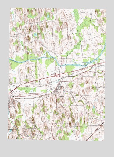
Weedsport, NY USGS Topographic Map
Click on map above to begin viewing in our Map Viewer.

This topographic map contains these locations and features:
Feature Name Type Latitude Longitude GNIS ID View Map
Arthur A Gates Elementary SchoolSchoolN43.0407°W76.6177°942593View Map
Berry HumpSummitN43.0490°W76.5097°943750View Map
Bibbens FarmsLocaleN43.0375°W76.5236°2515534View Map
Bonta BridgeBridgeN43.0767°W76.5138°944435View Map
Bowen CemeteryCemeteryN43.0174°W76.5198°2517302View Map
Brick ChurchChurchN43.1145°W76.5502°944713View Map
Brick Church Station (historical)LocaleN43.1067°W76.5481°2123364View Map
Cayuga CountyCivilN43.0103°W76.5744°974104View Map
CenterportPopulated PlaceN43.0409°W76.5927°946209View Map
Cold Spring BrookStreamN43.0703°W76.5597°969284View Map
Community CemeteryCemeteryN43.0060°W76.5700°2517300View Map
Crim CemeteryCemeteryN43.0435°W76.5256°2517304View Map
Crosman CemeteryCemeteryN43.1005°W76.5201°947799View Map
DIRT AmbulanceBuildingN43.0586°W76.5460°2719237View Map
EmersonPopulated PlaceN43.1001°W76.6141°972448View Map
Emerson CemeteryCemeteryN43.0982°W76.6144°2517295View Map
Evergreen HeightsBuildingN43.0506°W76.5727°2598492View Map
First Baptist ChurchChurchN43.0478°W76.5619°2417088View Map
First Presbyterian ChurchChurchN43.0467°W76.5639°2417089View Map
First United Methodist ChurchChurchN43.0481°W76.5594°2417092View Map
Flag IslandIslandN43.0728°W76.5322°2123361View Map
Frost IslandIslandN43.0767°W76.5930°973945View Map
God's Acre CemeteryCemeteryN43.0435°W76.5631°2517297View Map
Graham ParkParkN43.0564°W76.5600°2417087View Map
Guidone FarmsLocaleN43.0417°W76.6158°2515536View Map
Helmer Family CemeteryCemeteryN43.0431°W76.5201°2517303View Map
Hickory IslandIslandN43.0803°W76.5758°973948View Map
Hidden Acres Mobile Home ParkPopulated PlaceN43.0205°W76.6225°2598484View Map
Interchange Number 40CrossingN43.0615°W76.5633°974659View Map
Kenyon Landing Mobile Home ParkPopulated PlaceN43.0254°W76.5028°2598487View Map
La Due CemeteryCemeteryN43.1042°W76.5453°2123360View Map
Lamphere CemeteryCemeteryN43.0323°W76.5543°2517298View Map
Leslie B Lehn Middle SchoolSchoolN43.0419°W76.6172°2597458View Map
Meadowbrook Golf CourseLocaleN43.0388°W76.5832°2598511View Map
Meech CemeteryCemeteryN43.0510°W76.5044°956910View Map
Mount Pleasant CemeteryCemeteryN43.0324°W76.6211°957885View Map
Muskrat CreekStreamN43.0720°W76.5524°970393View Map
Nicholson IslandIslandN43.0734°W76.5416°973949View Map
North BrookStreamN43.0417°W76.5799°958734View Map
North WeedsportPopulated PlaceN43.0590°W76.5591°972878View Map
Oakland FarmsLocaleN43.0525°W76.5711°2515535View Map
Our Lady of the Snow Parish ChurchChurchN43.0447°W76.5639°2667615View Map
Owen OrchardsLocaleN43.0114°W76.5033°2519406View Map
Port ByronPopulated PlaceN43.0345°W76.6238°960960View Map
Port Byron Fire DepartmentBuildingN43.0359°W76.6216°2735030View Map
Port Byron LibraryBuildingN43.0360°W76.6246°2598517View Map
Port Byron Post OfficePost OfficeN43.0360°W76.6230°2599622View Map
Port Byron Senior High SchoolSchoolN43.0419°W76.6172°2597461View Map
Pump CornersPopulated PlaceN43.0667°W76.5017°2123365View Map
Putnam BrookStreamN43.0584°W76.5699°962002View Map
River Forest ParkParkN43.0723°W76.5788°973947View Map
Riverforest Park CampgroundLocaleN43.0755°W76.5676°2598506View Map
Saint John's Catholic ChurchChurchN43.0447°W76.5636°2417091View Map
Saint Josephs CemeteryCemeteryN43.0522°W76.5731°963731View Map
School Number 10 (historical)SchoolN43.0919°W76.5678°2123368View Map
School Number 2 (historical)SchoolN43.0981°W76.5500°2123367View Map
Skaneateles CreekStreamN43.0776°W76.5105°970613View Map
Smith Road CemeteryCemeteryN43.0917°W76.5677°2517296View Map
Stark PondLakeN43.0997°W76.5911°966254View Map
The Patch (historical)Populated PlaceN43.0578°W76.5539°2123366View Map
Town of BrutusCivilN43.0456°W76.5454°978763View Map
Village of WeedsportCivilN43.0481°W76.5636°2391204View Map
WeedsportPopulated PlaceN43.0487°W76.5627°969005View Map
Weedsport Canal TerminalLocaleN43.0703°W76.5597°969006View Map
Weedsport Elementary SchoolSchoolN43.0506°W76.5574°946307View Map
Weedsport Fire DepartmentBuildingN43.0479°W76.5613°2701157View Map
Weedsport Free LibraryBuildingN43.0479°W76.5559°2598520View Map
Weedsport Junior-Senior High SchoolSchoolN43.0492°W76.5528°2417093View Map
Weedsport Post OfficePost OfficeN43.0502°W76.5617°2598480View Map
Weedsport Rural CemeteryCemeteryN43.0442°W76.5397°969008View Map
Weedsport TheatreBuildingN43.0475°W76.5639°2417090View Map
Weedsport Toll PlazaLocaleN43.0598°W76.5606°2598505View Map
West Shore Mobile Home ParkPopulated PlaceN43.0428°W76.6185°2598491View Map
Whitfords AirportAirportN43.0794°W76.5385°978357View Map
Wilson - Dixon CemeteryCemeteryN43.0340°W76.5987°2517294View Map
Wilson Family CemeteryCemeteryN43.0558°W76.5112°2517299View Map
Withford MarinaLocaleN43.0720°W76.5469°973946View Map

Note: Coordinates in the location and feature list above are referenced to NAD83 datum.


Copyright (C) 2008-2025 Ryan Niemi / Sunset Dynamics ... All Rights Reserved