TopoQuest Logo
Do you find TopoQuest useful?
Help keep TopoQuest running and adding new maps/features by donating!
Bitcoin:  19c7KJd3qBynnjoSw5npx9KScwjBe4ifkT
Litecoin:  LXs6TkuXGGXo1vDsWCkWVdjQX94eUKd6ui
Home View Maps Find Maps Find Places Resources & Links


Bonito Rock, Arizona Topographic Map

USGS Map Title: Bonito Rock, AZ
USGS Map MRC: 33109G5
DRG (GeoTIFF) Download: o33109g5.tif


Neighboring USGS Topographic Map Quads:


  Hawley Lake East, AZ  
33109H6
 

  Mount Baldy, AZ  
33109H5
 

  Big Lake North, AZ  
33109H4
 

  Marshall Butte, AZ  
33109G6
 

  Bonito Rock, AZ  
33109G5
 

  Big Lake South, AZ  
33109G4
 

  Odart Mountain, AZ  
33109F6
 

  Maverick, AZ  
33109F5
 

  Hoodoo Knoll, AZ  
33109F4


Map MRC Location:

N34°
W110°
N34°
W109°
H8 H7 H6 H5 H4 H3 H2 H1
G8 G7 G6 G5 G4 G3 G2 G1
F8 F7 F6 F5 F4 F3 F2 F1
E8 E7 E6 E5 E4 E3 E2 E1
D8 D7 D6 D5 D4 D3 D2 D1
C8 C7 C6 C5 C4 C3 C2 C1
B8 B7 B6 B5 B4 B3 B2 B1
A8 A7 A6 A5 A4 A3 A2 A1
N33°
W110°
N33°
W109°

Bonito Rock, AZ USGS 1:24K Topographic Map Preview:
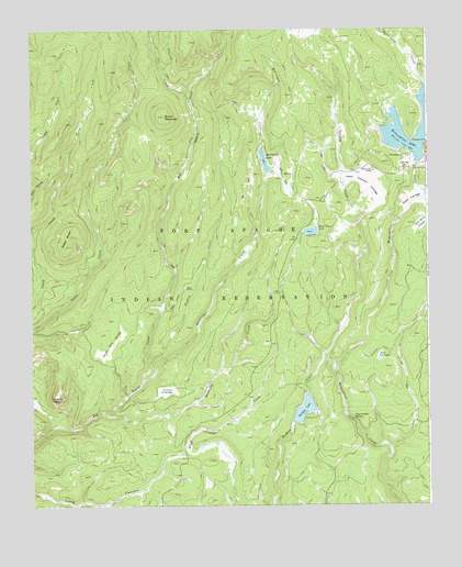
Bonito Rock, AZ USGS Topographic Map
Click on map above to begin viewing in our Map Viewer.

This topographic map contains these locations and features:
Feature Name Type Latitude Longitude GNIS ID View Map
Aspen ButteSummitN33.8181°W109.6143°862View Map
Bear CienegaSwampN33.7889°W109.5154°1120View Map
Bonito RockSummitN33.7803°W109.6165°1827View Map
Bonito Rock CienegaSwampN33.7914°W109.6001°1828View Map
Burnt MountainSummitN33.8523°W109.5826°2232View Map
Butterfly CienegaSwampN33.7806°W109.5831°2313View Map
Butterfly CreekStreamN33.7745°W109.6023°2314View Map
Charvoidles SpringSpringN33.7728°W109.5240°2773View Map
Deep CienegaFlatN33.8314°W109.5012°28362View Map
Drift Fence DamDamN33.8217°W109.5390°21607View Map
Drift Fence LakeReservoirN33.8220°W109.5368°4099View Map
Drift Fence Lake CampgroundLocaleN33.8212°W109.5390°21608View Map
Duke CreekStreamN33.8006°W109.5843°4185View Map
Duke RanchLocaleN33.8073°W109.5762°4187View Map
Hughey CreekStreamN33.7876°W109.5881°6102View Map
Hurricane CreekStreamN33.7831°W109.5893°6148View Map
Hurricane DamDamN33.8384°W109.5506°21664View Map
Hurricane LakeReservoirN33.8405°W109.5514°6149View Map
Hurricane Lake CampgroundLocaleN33.8420°W109.5531°21665View Map
Pacheta DamDamN33.7767°W109.5423°21735View Map
Pacheta LakeReservoirN33.7751°W109.5395°9085View Map
Pacheta Lake CampgroundLocaleN33.7734°W109.5354°21736View Map
Peasoup CreekStreamN33.8573°W109.5748°32762View Map
Race Horse CienegaSwampN33.8242°W109.5017°9897View Map
Reservation DamDamN33.8400°W109.5006°21770View Map
Reservation LakeReservoirN33.8448°W109.5064°33581View Map
Reservation Lake CampgroundsParkN33.8389°W109.5043°21771View Map
Reservation RanchLocaleN33.8378°W109.5170°10224View Map
Upper Pacheta CienegaSwampN33.8350°W109.5187°13111View Map

Note: Coordinates in the location and feature list above are referenced to NAD83 datum.


Copyright (C) 2008-2025 Ryan Niemi / Sunset Dynamics ... All Rights Reserved