TopoQuest Logo
Do you find TopoQuest useful?
Help keep TopoQuest running and adding new maps/features by donating!
Bitcoin:  19c7KJd3qBynnjoSw5npx9KScwjBe4ifkT
Litecoin:  LXs6TkuXGGXo1vDsWCkWVdjQX94eUKd6ui
Home View Maps Find Maps Find Places Resources & Links


Wendell, Idaho Topographic Map

USGS Map Title: Wendell, ID
USGS Map MRC: 42114G6
DRG (GeoTIFF) Download: o42114g6.tif


Neighboring USGS Topographic Map Quads:


  Gooding Butte, ID  
42114H7
 

  Gooding, ID  
42114H6
 

  Tunupa, ID  
42114H5
 

  Tuttle, ID  
42114G7
 

  Wendell, ID  
42114G6
 

  Gooding SE, ID  
42114G5
 

  Thousand Springs, ID  
42114F7
 

  Niagara Springs, ID  
42114F6
 

  Jerome, ID  
42114F5


Map MRC Location:

N43°
W115°
N43°
W114°
H8 H7 H6 H5 H4 H3 H2 H1
G8 G7 G6 G5 G4 G3 G2 G1
F8 F7 F6 F5 F4 F3 F2 F1
E8 E7 E6 E5 E4 E3 E2 E1
D8 D7 D6 D5 D4 D3 D2 D1
C8 C7 C6 C5 C4 C3 C2 C1
B8 B7 B6 B5 B4 B3 B2 B1
A8 A7 A6 A5 A4 A3 A2 A1
N42°
W115°
N42°
W114°

Wendell, ID USGS 1:24K Topographic Map Preview:
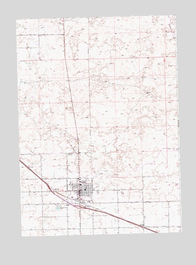
Wendell, ID USGS Topographic Map
Click on map above to begin viewing in our Map Viewer.

This topographic map contains these locations and features:
Feature Name Type Latitude Longitude GNIS ID View Map
City of WendellCivilN42.7745°W114.7026°2412213View Map
Lateral S-12CanalN42.7503°W114.6731°2569122View Map
Lateral S-2CanalN42.7616°W114.6289°373499View Map
Lateral S-33CanalN42.7536°W114.6379°2569136View Map
Lateral W-19CanalN42.7607°W114.7071°2569155View Map
Lateral W-20CanalN42.7616°W114.7048°2569156View Map
Lateral W-3CanalN42.7701°W114.6540°2569160View Map
Lateral W-33CanalN42.7899°W114.7246°2569161View Map
Lateral W-53CanalN42.7794°W114.7445°2569170View Map
Lateral W-7CanalN42.7838°W114.7316°2569175View Map
Lateral W-9CanalN42.7693°W114.6859°373505View Map
Lateral X-1CanalN42.8046°W114.6603°373507View Map
Lateral X-3CanalN42.8027°W114.6953°2569184View Map
Lateral X-31CanalN42.7949°W114.7135°2569186View Map
Lateral X-7CanalN42.8617°W114.7345°2569190View Map
McGinnis ParkParkN42.7743°W114.6917°395780View Map
W CanalCanalN42.7930°W114.6462°395886View Map
WendellPopulated PlaceN42.7757°W114.7042°398332View Map
Wendell CemeteryCemeteryN42.7733°W114.7126°2766750View Map
Wendell DivisionCivilN42.7531°W114.7280°1936828View Map
Wendell Elementary SchoolSchoolN42.7788°W114.7028°399698View Map
Wendell High SchoolSchoolN42.7762°W114.6911°395811View Map
Wendell Middle SchoolSchoolN42.7779°W114.6901°399689View Map
Wendell Physical Education BuildingSchoolN42.7757°W114.6909°399703View Map
Wendell Police DepartmentBuildingN42.7761°W114.6993°2722409View Map
Wendell Post OfficePost OfficeN42.7762°W114.7060°2767314View Map
Wendell Rural Fire District / Wendell City Fire DepartmentBuildingN42.7746°W114.7034°2618988View Map
Wendell WellWellN42.8307°W114.6498°375789View Map

Note: Coordinates in the location and feature list above are referenced to NAD83 datum.


Copyright (C) 2008-2024 Ryan Niemi / Sunset Dynamics ... All Rights Reserved