TopoQuest Logo
Do you find TopoQuest useful?
Help keep TopoQuest running and adding new maps/features by donating!
Bitcoin:  19c7KJd3qBynnjoSw5npx9KScwjBe4ifkT
Litecoin:  LXs6TkuXGGXo1vDsWCkWVdjQX94eUKd6ui
Home View Maps Find Maps Find Places Resources & Links


West Charleston, Vermont Topographic Map

USGS Map Title: West Charleston, VT
USGS Map MRC: 44072H1
DRG (GeoTIFF) Download: o44072h1.tif


Neighboring USGS Topographic Map Quads:


  Newport, VT  
44072H2
 

  West Charleston, VT  
44072H1
 

  Morgan Center, VT  
44071H8
 

  Orleans, VT  
44072G2
 

  Westmore, VT  
44072G1
 

  Island Pond, VT  
44071G8


Map MRC Location:

N45°
W73°
N45°
W72°
H8 H7 H6 H5 H4 H3 H2 H1
G8 G7 G6 G5 G4 G3 G2 G1
F8 F7 F6 F5 F4 F3 F2 F1
E8 E7 E6 E5 E4 E3 E2 E1
D8 D7 D6 D5 D4 D3 D2 D1
C8 C7 C6 C5 C4 C3 C2 C1
B8 B7 B6 B5 B4 B3 B2 B1
A8 A7 A6 A5 A4 A3 A2 A1
N44°
W73°
N44°
W72°

West Charleston, VT USGS 1:24K Topographic Map Preview:
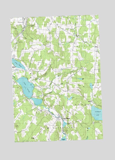
West Charleston, VT USGS Topographic Map
Click on map above to begin viewing in our Map Viewer.

This topographic map contains these locations and features:
Feature Name Type Latitude Longitude GNIS ID View Map
Balm of Gilead BeachBeachN44.9187°W72.1015°1921672View Map
Bates HillSummitN44.9495°W72.0901°1456296View Map
Cargill HillSummitN44.9292°W72.0248°1456767View Map
Castle CemeteryCemeteryN44.9478°W72.0070°1919955View Map
Chargo CampgroundLocaleN44.9192°W72.1001°1919959View Map
Charleston PondLakeN44.8916°W72.0535°1460351View Map
Clark CemeteryCemeteryN44.8919°W72.0135°1456899View Map
Coche BrookStreamN44.9178°W72.0893°1456950View Map
Crawford HillSummitN44.8798°W72.0959°1457053View Map
Crawford Hill CemeteryCemeteryN44.8792°W72.0944°1919974View Map
Crystal BrookStreamN44.9864°W72.1115°1457065View Map
Davis CemeteryCemeteryN44.9533°W72.0069°1919977View Map
Derby Center CemeteryCemeteryN44.9592°W72.1237°1919979View Map
E Taylor Hatton SchoolSchoolN44.9154°W72.0130°2427498View Map
Elm HillSummitN44.8914°W72.1234°1457359View Map
Gore CemeteryCemeteryN44.9216°W72.0557°1457576View Map
Green SchoolSchoolN44.9864°W72.0387°1457639View Map
Greens BrookStreamN44.9353°W72.1020°1457642View Map
HollandPopulated PlaceN44.9670°W72.0023°1457867View Map
Holland Congregational ChurchChurchN44.9695°W72.0370°1920025View Map
Holland Elementary SchoolSchoolN44.9732°W72.0127°1920026View Map
Lake DerbyLakeN44.9531°W72.1165°1457155View Map
Lake SalemLakeN44.9272°W72.1025°1459353View Map
Little Salem Pond (historical)ReservoirN44.9181°W72.1007°1920049View Map
Mead HillSummitN44.9459°W72.0059°1458406View Map
Mead Hill CemeteryCemeteryN44.9441°W72.0090°1458407View Map
Mead Hill CemeteryCemeteryN44.9442°W72.0093°1920058View Map
Meadow Brook Girl Scout CampLocaleN44.9956°W72.0882°1920059View Map
Moon CemeteryCemeteryN44.9964°W72.0507°1920163View Map
MorganPopulated PlaceN44.9137°W72.0143°1458532View Map
Morgan Post OfficePost OfficeN44.9131°W72.0147°1920065View Map
Mount Pisgah East TrailTrailN44.9831°W72.0262°1920068View Map
Mud PondLakeN44.8865°W72.0193°1458628View Map
Mud PondLakeN44.9169°W72.0445°1458629View Map
Mud PondLakeN44.9289°W72.0141°1458630View Map
Mud PondLakeN44.9364°W72.0289°1458631View Map
Nelson HillSummitN44.9803°W72.0704°1458662View Map
Oliver HillSummitN44.8878°W72.0784°1458841View Map
Orcutt BrookStreamN44.9256°W72.0970°1458850View Map
Pensioner PondReservoirN44.8850°W72.0562°1766626View Map
Pensioner Pond DamDamN44.8850°W72.0562°1766625View Map
Pisgah TrailTrailN44.9834°W72.0312°1920103View Map
Salem Lake CemeteryCemeteryN44.9201°W72.0985°1459351View Map
TicePopulated PlaceN44.9798°W72.0351°1459903View Map
Tice - Marston - Moon CemeteryCemeteryN44.9901°W72.0551°1920125View Map
Tice-Marston CemeteryCemeteryN44.9964°W72.0543°1920124View Map
West CharlestonPopulated PlaceN44.8989°W72.0595°1460126View Map
West Charleston CemeteryCemeteryN44.8982°W72.0554°1920139View Map
West Charleston Post OfficePost OfficeN44.8979°W72.0578°1920140View Map
Wilcox CemeteryCemeteryN44.9096°W72.0184°1920153View Map

Note: Coordinates in the location and feature list above are referenced to NAD83 datum.


Copyright (C) 2008-2024 Ryan Niemi / Sunset Dynamics ... All Rights Reserved