TopoQuest Logo
Do you find TopoQuest useful?
Help keep TopoQuest running and adding new maps/features by donating!
Bitcoin:  19c7KJd3qBynnjoSw5npx9KScwjBe4ifkT
Litecoin:  LXs6TkuXGGXo1vDsWCkWVdjQX94eUKd6ui
Home View Maps Find Maps Find Places Resources & Links


Westmore, Vermont Topographic Map

USGS Map Title: Westmore, VT
USGS Map MRC: 44072G1
DRG (GeoTIFF) Download: o44072g1.tif


Neighboring USGS Topographic Map Quads:


  Newport, VT  
44072H2
 

  West Charleston, VT  
44072H1
 

  Morgan Center, VT  
44071H8
 

  Orleans, VT  
44072G2
 

  Westmore, VT  
44072G1
 

  Island Pond, VT  
44071G8
 

  Crystal Lake, VT  
44072F2
 

  Sutton, VT  
44072F1
 

  West Burke, VT  
44071F8


Map MRC Location:

N45°
W73°
N45°
W72°
H8 H7 H6 H5 H4 H3 H2 H1
G8 G7 G6 G5 G4 G3 G2 G1
F8 F7 F6 F5 F4 F3 F2 F1
E8 E7 E6 E5 E4 E3 E2 E1
D8 D7 D6 D5 D4 D3 D2 D1
C8 C7 C6 C5 C4 C3 C2 C1
B8 B7 B6 B5 B4 B3 B2 B1
A8 A7 A6 A5 A4 A3 A2 A1
N44°
W73°
N44°
W72°

Westmore, VT USGS 1:24K Topographic Map Preview:
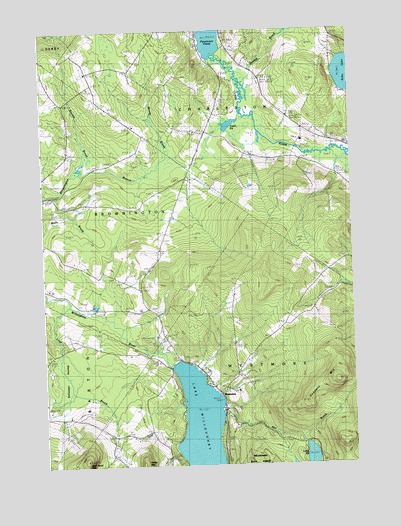
Westmore, VT USGS Topographic Map
Click on map above to begin viewing in our Map Viewer.

This topographic map contains these locations and features:
Feature Name Type Latitude Longitude GNIS ID View Map
Bassett BrookStreamN44.8345°W72.1120°1456294View Map
Blyhill CemeteryCemeteryN44.8435°W72.0124°1456501View Map
Charleston Elementary SchoolSchoolN44.8431°W72.0195°1456851View Map
East BrowningtonPopulated PlaceN44.8009°W72.0857°1919986View Map
East Brownington CemeteryCemeteryN44.8035°W72.0946°1919987View Map
East Brownington SchoolSchoolN44.8012°W72.0862°1457263View Map
East CemeteryCemeteryN44.8042°W72.0943°1457267View Map
Fisk SchoolSchoolN44.7839°W72.1226°1457441View Map
Goodwin MountainSummitN44.7731°W72.0082°1457570View Map
Hinton SchoolSchoolN44.8006°W72.0176°1457843View Map
Lake View SchoolSchoolN44.7531°W72.0765°1458142View Map
Lake WilloughbyLakeN44.7501°W72.0563°1460283View Map
Lakeview CemeteryCemeteryN44.7806°W72.0698°1458152View Map
Lakeview CemeteryCemeteryN44.7812°W72.0704°1920045View Map
Long PondLakeN44.7505°W72.0172°1456097View Map
Lord BrookStreamN44.7975°W72.1145°1458287View Map
Lubber LakeReservoirN44.8334°W72.0829°1766338View Map
May Pond MountainSummitN44.7523°W72.1090°1458384View Map
Mill BrookStreamN44.7659°W72.0545°1458456View Map
Moody BrookStreamN44.8378°W72.0723°1458524View Map
Nutting BrookStreamN44.8514°W72.0437°1458799View Map
Pensioner PondLakeN44.8730°W72.0557°1458936View Map
Pierce HillSummitN44.8164°W72.0018°1458960View Map
Powers SchoolSchoolN44.8262°W72.1093°1459068View Map
Songadeewin CampLocaleN44.7734°W72.0737°1459562View Map
Stillwater SwampSwampN44.7748°W72.1165°1459721View Map
Stumpf BrookStreamN44.8623°W72.0451°1459758View Map
Toad PondLakeN44.8479°W72.0486°1459918View Map
Town of CharlestonCivilN44.8503°W72.0204°1462067View Map
Town of WestmoreCivilN44.7599°W72.0272°1462254View Map
Valley MountainSummitN44.7514°W72.0862°1460010View Map
West Charleston DamDamN44.8334°W72.0829°1766337View Map
WestmorePopulated PlaceN44.7714°W72.0548°1460188View Map
Westmore Fire and RescueBuildingN44.7806°W72.0804°2121496View Map
Will-O-Wood CampgroundLocaleN44.7862°W72.0815°1920155View Map

Note: Coordinates in the location and feature list above are referenced to NAD83 datum.


Copyright (C) 2008-2024 Ryan Niemi / Sunset Dynamics ... All Rights Reserved