TopoQuest Logo
Do you find TopoQuest useful?
Help keep TopoQuest running and adding new maps/features by donating!
Bitcoin:  19c7KJd3qBynnjoSw5npx9KScwjBe4ifkT
Litecoin:  LXs6TkuXGGXo1vDsWCkWVdjQX94eUKd6ui
Home View Maps Find Maps Find Places Resources & Links


West Elk Peak SW, Colorado Topographic Map

USGS Map Title: West Elk Peak SW, CO
USGS Map MRC: 38107E2
DRG (GeoTIFF) Download: o38107e2.tif


Neighboring USGS Topographic Map Quads:


  Big Soap Park, CO  
38107F3
 

  West Elk Peak, CO  
38107F2
 

  Squirrel Creek, CO  
38107F1
 

  Little Soap Park, CO  
38107E3
 

  West Elk Peak SW, CO  
38107E2
 

  McIntosh Mountain, CO  
38107E1
 

  Sapinero, CO  
38107D3
 

  Carpenter Ridge, CO  
38107D2
 

  Big Mesa, CO  
38107D1


Map MRC Location:

N39°
W108°
N39°
W107°
H8 H7 H6 H5 H4 H3 H2 H1
G8 G7 G6 G5 G4 G3 G2 G1
F8 F7 F6 F5 F4 F3 F2 F1
E8 E7 E6 E5 E4 E3 E2 E1
D8 D7 D6 D5 D4 D3 D2 D1
C8 C7 C6 C5 C4 C3 C2 C1
B8 B7 B6 B5 B4 B3 B2 B1
A8 A7 A6 A5 A4 A3 A2 A1
N38°
W108°
N38°
W107°

West Elk Peak SW, CO USGS 1:24K Topographic Map Preview:
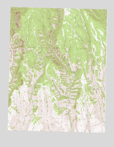
West Elk Peak SW, CO USGS Topographic Map
Click on map above to begin viewing in our Map Viewer.

This topographic map contains these locations and features:
Feature Name Type Latitude Longitude GNIS ID View Map
Bear GulchValleyN38.5240°W107.1720°186948View Map
Bear Wallow GulchValleyN38.5453°W107.1701°186954View Map
Bull GulchValleyN38.5350°W107.1714°186949View Map
Bull ParkFlatN38.5444°W107.1901°186953View Map
Burnt Mill GulchValleyN38.5840°W107.1493°186962View Map
Deadman GulchValleyN38.5523°W107.1293°186959View Map
Deep HollowValleyN38.6030°W107.1915°186771View Map
East Bear Wallow GulchValleyN38.5804°W107.1750°186964View Map
East Bull GulchValleyN38.5362°W107.1773°186951View Map
East Dry GulchValleyN38.5145°W107.2006°186947View Map
East Fork Dry CreekStreamN38.5011°W107.1442°186956View Map
East Red CreekStreamN38.5633°W107.2084°186967View Map
East Steuben CreekStreamN38.6125°W107.1253°186774View Map
Elk ParkFlatN38.5519°W107.2228°186969View Map
Frying Pan CreekStreamN38.5522°W107.1423°186958View Map
Lion GulchValleyN38.5451°W107.2194°186970View Map
Poison GulchValleyN38.5869°W107.1956°186966View Map
Runaway GulchValleyN38.5605°W107.1650°186957View Map
Sapinero State Wildlife AreaParkN38.5217°W107.1917°169400View Map
Sixmile GulchValleyN38.6218°W107.1874°186772View Map
Slab Mill GulchValleyN38.6039°W107.1521°186963View Map
Tenderfoot HillSummitN38.5114°W107.2137°203281View Map
West Bear Wallow GulchValleyN38.5805°W107.1752°186965View Map
West Bull GulchValleyN38.5362°W107.1773°186952View Map
West Dry GulchValleyN38.5144°W107.2005°186950View Map
West Fork Dry CreekStreamN38.5011°W107.1442°186955View Map
West Steuben CreekStreamN38.6125°W107.1253°186775View Map

Note: Coordinates in the location and feature list above are referenced to NAD83 datum.


Copyright (C) 2008-2024 Ryan Niemi / Sunset Dynamics ... All Rights Reserved