TopoQuest Logo
Do you find TopoQuest useful?
Help keep TopoQuest running and adding new maps/features by donating!
Bitcoin:  19c7KJd3qBynnjoSw5npx9KScwjBe4ifkT
Litecoin:  LXs6TkuXGGXo1vDsWCkWVdjQX94eUKd6ui
Home View Maps Find Maps Find Places Resources & Links


Westcott, Texas Topographic Map

USGS Map Title: Westcott, TX
USGS Map MRC: 30095D1
DRG (GeoTIFF) Download: o30095d1.tif


Neighboring USGS Topographic Map Quads:


  Coldspring, TX  
30095E2
 

  Camilla, TX  
30095E1
 

  Goodrich, TX  
30094E8
 

  Bear Creek, TX  
30095D2
 

  Westcott, TX  
30095D1
 

  Rayburn, TX  
30094D8
 

  Fostoria, TX  
30095C2
 

  Cleveland, TX  
30095C1
 

  Tarkington Prairie, TX  
30094C8


Map MRC Location:

N31°
W96°
N31°
W95°
H8 H7 H6 H5 H4 H3 H2 H1
G8 G7 G6 G5 G4 G3 G2 G1
F8 F7 F6 F5 F4 F3 F2 F1
E8 E7 E6 E5 E4 E3 E2 E1
D8 D7 D6 D5 D4 D3 D2 D1
C8 C7 C6 C5 C4 C3 C2 C1
B8 B7 B6 B5 B4 B3 B2 B1
A8 A7 A6 A5 A4 A3 A2 A1
N30°
W96°
N30°
W95°

Westcott, TX USGS 1:24K Topographic Map Preview:
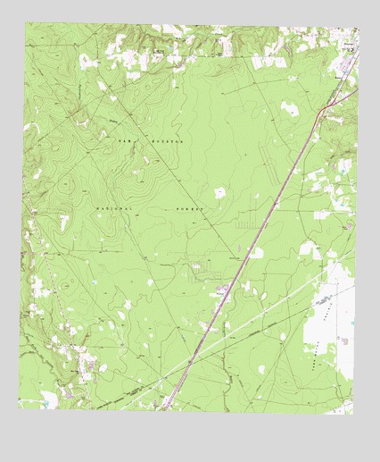
Westcott, TX USGS Topographic Map
Click on map above to begin viewing in our Map Viewer.

This topographic map contains these locations and features:
Feature Name Type Latitude Longitude GNIS ID View Map
Big Creek CemeteryCemeteryN30.4955°W95.0530°1352052View Map
Big Creek Missionary ChurchChurchN30.4905°W95.0722°1352053View Map
City of ShepherdCivilN30.4910°W95.0021°2411884View Map
Dixon High SchoolSchoolN30.4933°W95.0022°1356088View Map
Farley CemeteryCemeteryN30.4905°W95.0535°1844228View Map
Farley ChapelChurchN30.4908°W95.0524°1357234View Map
Gator PondLakeN30.4361°W95.0033°1357929View Map
KenoPopulated PlaceN30.3905°W95.0608°1377114View Map
Little CreekStreamN30.4974°W95.0602°1361320View Map
Lovett CemeteryCemeteryN30.4927°W95.0805°1361895View Map
Mercy TrailTrailN30.4502°W95.0983°2033337View Map
NapierPopulated PlaceN30.4838°W95.0060°1380231View Map
New Hope ChurchChurchN30.3874°W95.1022°1363725View Map
Roark CemeteryCemeteryN30.3827°W95.1088°1366558View Map
Shepherd Intermediate SchoolSchoolN30.4929°W95.0025°2008906View Map
Squier CemeteryCemeteryN30.3791°W95.0997°1369077View Map
Tarkington Hunter CampLocaleN30.4610°W95.1008°1383495View Map
WestcottPopulated PlaceN30.4130°W95.0480°1380761View Map
Winters BayouStreamN30.3933°W95.1183°1371814View Map

Note: Coordinates in the location and feature list above are referenced to NAD83 datum.


Copyright (C) 2008-2024 Ryan Niemi / Sunset Dynamics ... All Rights Reserved