TopoQuest Logo
Do you find TopoQuest useful?
Help keep TopoQuest running and adding new maps/features by donating!
Bitcoin:  19c7KJd3qBynnjoSw5npx9KScwjBe4ifkT
Litecoin:  LXs6TkuXGGXo1vDsWCkWVdjQX94eUKd6ui
Home View Maps Find Maps Find Places Resources & Links


Westerlo, New York Topographic Map

USGS Map Title: Westerlo, NY
USGS Map MRC: 42074E1
DRG (GeoTIFF) Download: o42074e1.tif


Neighboring USGS Topographic Map Quads:


  Gallupville, NY  
42074F2
 

  Altamont, NY  
42074F1
 

  Voorheesville, NY  
42073F8
 

  Rensselaerville, NY  
42074E2
 

  Westerlo, NY  
42074E1
 

  Clarksville, NY  
42073E8
 

  Durham, NY  
42074D2
 

  Greenville, NY  
42074D1
 

  Alcove, NY  
42073D8


Map MRC Location:

N43°
W75°
N43°
W74°
H8 H7 H6 H5 H4 H3 H2 H1
G8 G7 G6 G5 G4 G3 G2 G1
F8 F7 F6 F5 F4 F3 F2 F1
E8 E7 E6 E5 E4 E3 E2 E1
D8 D7 D6 D5 D4 D3 D2 D1
C8 C7 C6 C5 C4 C3 C2 C1
B8 B7 B6 B5 B4 B3 B2 B1
A8 A7 A6 A5 A4 A3 A2 A1
N42°
W75°
N42°
W74°

Westerlo, NY USGS 1:24K Topographic Map Preview:
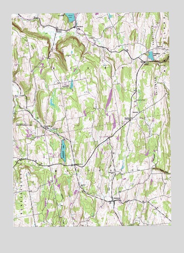
Westerlo, NY USGS Topographic Map
Click on map above to begin viewing in our Map Viewer.

This topographic map contains these locations and features:
Feature Name Type Latitude Longitude GNIS ID View Map
Bensons CornersLocaleN42.6156°W74.0887°943701View Map
Berne Fire District 3 Station 2BuildingN42.6126°W74.0695°2735168View Map
Bramans CornersLocaleN42.5620°W74.0318°944612View Map
Camp OrinsekwaLocaleN42.6237°W74.0821°945638View Map
Camp WoodstockLocaleN42.5820°W74.0787°945690View Map
Cole HillSummitN42.6020°W74.0937°947103View Map
East BernePopulated PlaceN42.6165°W74.0746°948984View Map
Filkin HillSummitN42.6001°W74.0815°950052View Map
Grippy QuarryMineN42.5592°W74.0733°2564205View Map
Heldeberg AirstripAirportN42.6112°W74.0649°977993View Map
HelderbergPopulated PlaceN42.6001°W74.0662°973326View Map
Helderberg Ambulance SquadBuildingN42.6152°W74.0887°2720166View Map
Helderberg LakeLakeN42.5995°W74.0146°952535View Map
Helderberg MountainsRangeN42.5780°W74.0020°970200View Map
Irish HillSummitN42.6084°W74.1137°953765View Map
Mallorys CornersLocaleN42.5959°W74.0201°956314View Map
Morning Fog FarmLocaleN42.5703°W74.1150°2542384View Map
Mountain View FarmLocaleN42.5886°W74.0403°2516865View Map
Onderdonk LakeLakeN42.5441°W74.0850°959359View Map
ReidsvillePopulated PlaceN42.5667°W74.0240°962368View Map
Reidsville CemeteryCemeteryN42.5735°W74.0275°962369View Map
School Number 11 (historical)SchoolN42.5465°W74.0590°974971View Map
School Number 11 (historical)SchoolN42.5859°W74.0710°974977View Map
School Number 7 (historical)SchoolN42.5151°W74.0504°975527View Map
School Number 9 (historical)SchoolN42.5006°W74.0876°975624View Map
Snyder CemeteryCemeteryN42.5232°W74.0714°965592View Map
Snyders CornersLocaleN42.5362°W74.0762°965608View Map
South BernePopulated PlaceN42.5584°W74.1001°965683View Map
South Berne Rural CemeteryCemeteryN42.5581°W74.0918°963085View Map
Still HillSummitN42.5262°W74.1121°966426View Map
Town of BerneCivilN42.5927°W74.1161°978728View Map
Van Leuvans School (historical)SchoolN42.5281°W74.0735°968421View Map
Waxwing AirportAirportN42.5127°W74.1142°978258View Map
WCDA-FM (Voorheesville)TowerN42.6170°W74.0124°977832View Map
WesterloPopulated PlaceN42.5151°W74.0454°970911View Map
Westerlo AirportAirportN42.5242°W74.0267°978362View Map
Westerlo CemeteryCemeteryN42.5299°W74.0446°970912View Map
Westerlo Volunteer Fire Company Station 1BuildingN42.5152°W74.0446°2718272View Map
Wolf HillPopulated PlaceN42.6042°W74.0104°973282View Map
WXXA-TV (Albany)TowerN42.6170°W74.0124°977846View Map

Note: Coordinates in the location and feature list above are referenced to NAD83 datum.


Copyright (C) 2008-2024 Ryan Niemi / Sunset Dynamics ... All Rights Reserved