TopoQuest Logo
Do you find TopoQuest useful?
Help keep TopoQuest running and adding new maps/features by donating!
Bitcoin:  19c7KJd3qBynnjoSw5npx9KScwjBe4ifkT
Litecoin:  LXs6TkuXGGXo1vDsWCkWVdjQX94eUKd6ui
Home View Maps Find Maps Find Places Resources & Links


Westfield West, Wisconsin Topographic Map

USGS Map Title: Westfield West, WI
USGS Map MRC: 43089H5
DRG (GeoTIFF) Download: o43089h5.tif


Neighboring USGS Topographic Map Quads:


  Coloma SW, WI  
44089A6
 

  Coloma, WI  
44089A5
 

  Richford, WI  
44089A4
 

  Grand Marsh, WI  
43089H6
 

  Westfield West, WI  
43089H5
 

  Westfield East, WI  
43089H4
 

  Brooks, WI  
43089G6
 

  Oxford, WI  
43089G5
 

  Packwaukee, WI  
43089G4


Map MRC Location:

N44°
W90°
N44°
W89°
H8 H7 H6 H5 H4 H3 H2 H1
G8 G7 G6 G5 G4 G3 G2 G1
F8 F7 F6 F5 F4 F3 F2 F1
E8 E7 E6 E5 E4 E3 E2 E1
D8 D7 D6 D5 D4 D3 D2 D1
C8 C7 C6 C5 C4 C3 C2 C1
B8 B7 B6 B5 B4 B3 B2 B1
A8 A7 A6 A5 A4 A3 A2 A1
N43°
W90°
N43°
W89°

Westfield West, WI USGS 1:24K Topographic Map Preview:
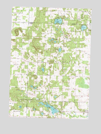
Westfield West, WI USGS Topographic Map
Click on map above to begin viewing in our Map Viewer.

This topographic map contains these locations and features:
Feature Name Type Latitude Longitude GNIS ID View Map
Camp FirewoodLocaleN43.9791°W89.5535°1562607View Map
Chaffee Creek State Fishery AreaLocaleN43.9878°W89.5168°1562918View Map
Echo LakeLakeN43.8845°W89.5856°1564423View Map
Hillview Christmas Tree FarmLocaleN43.9067°W89.5375°2662938View Map
Horseshoe BluffCliffN43.9750°W89.6148°1566722View Map
Lake BurnitaLakeN43.9641°W89.5604°1562437View Map
LawrencePopulated PlaceN43.8836°W89.5446°1567886View Map
Lawrence CreekStreamN43.8933°W89.5690°1567889View Map
Lawrence Creek State Natural AreaParkN43.8953°W89.5915°2054857View Map
Lawrence Creek State Wildlife AreaParkN43.8947°W89.5907°1567890View Map
Lawrence DamDamN43.8825°W89.5462°1791698View Map
Lawrence LakeReservoirN43.8889°W89.5627°1567893View Map
Lawrence Lake 29ReservoirN43.8833°W89.5468°1791699View Map
Pilot Knob (historical)Populated PlaceN43.9875°W89.6182°1837597View Map
Pine LakeLakeN43.9297°W89.5738°1571485View Map
Pine Lake CampLocaleN43.9339°W89.5740°1571509View Map
Pleasant LakeLakeN43.9850°W89.5520°1571610View Map
Pleasant View CemeteryCemeteryN43.9236°W89.5629°1571664View Map
Pockrandt QuarryMineN43.9689°W89.5378°2634031View Map
Riverside CemeteryCemeteryN43.8850°W89.5496°1572358View Map
Rollers LakeLakeN43.8869°W89.6073°1572546View Map
Sandow LakeLakeN43.8800°W89.5728°1573710View Map
School Section LakeLakeN43.9525°W89.5480°1573811View Map
South Burr Oak CemeteryCemeteryN43.9855°W89.6176°1574424View Map
South Burr Oak ChurchChurchN43.9889°W89.6171°1837603View Map
Springfield Township Fire DepartmentBuildingN43.9234°W89.5619°2697673View Map
Sunset PointCapeN43.9836°W89.5546°1575117View Map
Town of SpringfieldCivilN43.9384°W89.5402°1584194View Map
Twin LakesLakeN43.9104°W89.5906°1575793View Map
Wood LakeLakeN43.9784°W89.5120°1576967View Map

Note: Coordinates in the location and feature list above are referenced to NAD83 datum.


Copyright (C) 2008-2025 Ryan Niemi / Sunset Dynamics ... All Rights Reserved