TopoQuest Logo
Do you find TopoQuest useful?
Help keep TopoQuest running and adding new maps/features by donating!
Bitcoin:  19c7KJd3qBynnjoSw5npx9KScwjBe4ifkT
Litecoin:  LXs6TkuXGGXo1vDsWCkWVdjQX94eUKd6ui
Home View Maps Find Maps Find Places Resources & Links


Brooks, Wisconsin Topographic Map

USGS Map Title: Brooks, WI
USGS Map MRC: 43089G6
DRG (GeoTIFF) Download: o43089g6.tif


Neighboring USGS Topographic Map Quads:


  Adams, WI  
43089H7
 

  Grand Marsh, WI  
43089H6
 

  Westfield West, WI  
43089H5
 

  Easton, WI  
43089G7
 

  Brooks, WI  
43089G6
 

  Oxford, WI  
43089G5
 

  Wisconsin Dells North, WI  
43089F7
 

  Big Spring, WI  
43089F6
 

  Briggsville, WI  
43089F5


Map MRC Location:

N44°
W90°
N44°
W89°
H8 H7 H6 H5 H4 H3 H2 H1
G8 G7 G6 G5 G4 G3 G2 G1
F8 F7 F6 F5 F4 F3 F2 F1
E8 E7 E6 E5 E4 E3 E2 E1
D8 D7 D6 D5 D4 D3 D2 D1
C8 C7 C6 C5 C4 C3 C2 C1
B8 B7 B6 B5 B4 B3 B2 B1
A8 A7 A6 A5 A4 A3 A2 A1
N43°
W90°
N43°
W89°

Brooks, WI USGS 1:24K Topographic Map Preview:
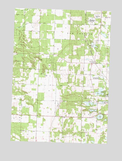
Brooks, WI USGS Topographic Map
Click on map above to begin viewing in our Map Viewer.

This topographic map contains these locations and features:
Feature Name Type Latitude Longitude GNIS ID View Map
Adams County Waterfowl Production AreaParkN43.8540°W89.6331°2765179View Map
Beaver Pond 1ReservoirN43.7883°W89.6401°1792532View Map
BrooksPopulated PlaceN43.8253°W89.6446°1562240View Map
Brooks Bluff State Natural AreaParkN43.8278°W89.7148°2054275View Map
Bulldog Ranch AirportAirportN43.7617°W89.6341°2444172View Map
Camp Oak HillLocaleN43.8144°W89.7110°1562644View Map
Clearwater Aero Estates AirportAirportN43.7562°W89.6528°1582275View Map
Coddington Dam 2WP2383DamN43.7883°W89.6401°1792531View Map
Deep LakeLakeN43.7812°W89.6454°1563808View Map
Federal Correctional Institution OxfordBuildingN43.8660°W89.6493°1581213View Map
Goose LakeLakeN43.7978°W89.6367°1565652View Map
Little LakeLakeN43.8123°W89.7083°1568297View Map
McDougall LakeLakeN43.7890°W89.6313°1569209View Map
McGinnis LakeReservoirN43.8424°W89.6457°1569224View Map
McGinnis Lake 2WP2255 DamDamN43.8405°W89.6451°1792112View Map
New Chester (historical)Populated PlaceN43.8616°W89.6376°1837592View Map
New Chester ChurchChurchN43.8725°W89.6368°1570207View Map
Parker LakeLakeN43.7753°W89.6350°1571050View Map
Peppermill LakeReservoirN43.7882°W89.6483°1571197View Map
Town of JacksonCivilN43.7744°W89.6579°1583441View Map
Town of New ChesterCivilN43.8562°W89.6572°1583802View Map
Upper Neenah Creek State Fishery AreaParkN43.8119°W89.6360°1575980View Map

Note: Coordinates in the location and feature list above are referenced to NAD83 datum.


Copyright (C) 2008-2024 Ryan Niemi / Sunset Dynamics ... All Rights Reserved