TopoQuest Logo
Do you find TopoQuest useful?
Help keep TopoQuest running and adding new maps/features by donating!
Bitcoin:  19c7KJd3qBynnjoSw5npx9KScwjBe4ifkT
Litecoin:  LXs6TkuXGGXo1vDsWCkWVdjQX94eUKd6ui
Home View Maps Find Maps Find Places Resources & Links


Boone East, Iowa Topographic Map

USGS Map Title: Boone East, IA
USGS Map MRC: 42093A7
DRG (GeoTIFF) Download: o42093a7.tif


Neighboring USGS Topographic Map Quads:


  Fraser, IA  
42093B8
 

  Mackey, IA  
42093B7
 

  Ames NW, IA  
42093B6
 

  Boone West, IA  
42093A8
 

  Boone East, IA  
42093A7
 

  Ames West, IA  
42093A6
 

  Madrid NW, IA  
41093H8
 

  Luther, IA  
41093H7
 

  Slater, IA  
41093H6


Map MRC Location:

N43°
W94°
N43°
W93°
H8 H7 H6 H5 H4 H3 H2 H1
G8 G7 G6 G5 G4 G3 G2 G1
F8 F7 F6 F5 F4 F3 F2 F1
E8 E7 E6 E5 E4 E3 E2 E1
D8 D7 D6 D5 D4 D3 D2 D1
C8 C7 C6 C5 C4 C3 C2 C1
B8 B7 B6 B5 B4 B3 B2 B1
A8 A7 A6 A5 A4 A3 A2 A1
N42°
W94°
N42°
W93°

Boone East, IA USGS 1:24K Topographic Map Preview:
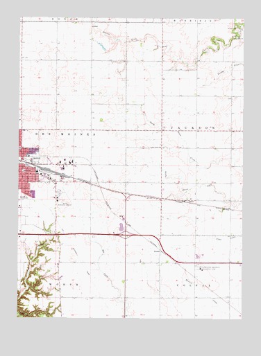
Boone East, IA USGS Topographic Map
Click on map above to begin viewing in our Map Viewer.

This topographic map contains these locations and features:
Feature Name Type Latitude Longitude GNIS ID View Map
Boone Country ClubLocaleN42.0503°W93.8716°465654View Map
Boone County FairgroundsLocaleN42.0653°W93.8697°1996430View Map
Boone Middle SchoolSchoolN42.0550°W93.8666°2719783View Map
Boone Municipal AirportAirportN42.0515°W93.8518°466717View Map
Bryant SchoolSchoolN42.0614°W93.8719°454905View Map
Dickcissel Recreation AreaParkN42.0375°W93.8183°1996586View Map
EricsonPopulated PlaceN42.0286°W93.7963°464538View Map
Iowa State University Agronomy FarmLocaleN42.0211°W93.7733°465848View Map
JordanPopulated PlaceN42.0492°W93.7841°457993View Map
JordanLocaleN42.0492°W93.7841°1996436View Map
Jordan Post Office (historical)Post OfficeN42.0492°W93.7841°1996437View Map
Lowell SchoolSchoolN42.0705°W93.8741°458656View Map
Mitchell CemeteryCemeteryN42.1208°W93.7547°459152View Map
Oak Grove CemeteryCemeteryN42.0569°W93.8252°1996573View Map
Prairie Center ChurchChurchN42.0714°W93.7963°460386View Map
Sarah Dinwoodie CemeteryCemeteryN42.0278°W93.8697°1996558View Map
Seventh Day Adventist ChurchChurchN42.0628°W93.8730°1996481View Map
Squire Boone CemeteryCemeteryN42.0033°W93.8533°461941View Map
The Church of Jesus Christ of Latter Day SaintsChurchN42.0780°W93.8705°1996491View Map
Township of JacksonCivilN42.0789°W93.7571°468092View Map
United Community Elementary SchoolSchoolN42.0265°W93.7754°2719845View Map

Note: Coordinates in the location and feature list above are referenced to NAD83 datum.


Copyright (C) 2008-2024 Ryan Niemi / Sunset Dynamics ... All Rights Reserved