TopoQuest Logo
Do you find TopoQuest useful?
Help keep TopoQuest running and adding new maps/features by donating!
Bitcoin:  19c7KJd3qBynnjoSw5npx9KScwjBe4ifkT
Litecoin:  LXs6TkuXGGXo1vDsWCkWVdjQX94eUKd6ui
Home View Maps Find Maps Find Places Resources & Links


Whigham, Georgia Topographic Map

USGS Map Title: Whigham, GA
USGS Map MRC: 30084H3
DRG (GeoTIFF) Download: o30084h3.tif


Neighboring USGS Topographic Map Quads:


  Vada, GA  
31084A4
 

  Gee Pond, GA  
31084A3
 

  Pelham, GA  
31084A2
 

  Climax North, GA  
30084H4
 

  Whigham, GA  
30084H3
 

  Cairo North, GA  
30084H2
 

  Climax South, GA  
30084G4
 

  Reno, GA  
30084G3
 

  Cairo South, GA  
30084G2


Map MRC Location:

N31°
W85°
N31°
W84°
H8 H7 H6 H5 H4 H3 H2 H1
G8 G7 G6 G5 G4 G3 G2 G1
F8 F7 F6 F5 F4 F3 F2 F1
E8 E7 E6 E5 E4 E3 E2 E1
D8 D7 D6 D5 D4 D3 D2 D1
C8 C7 C6 C5 C4 C3 C2 C1
B8 B7 B6 B5 B4 B3 B2 B1
A8 A7 A6 A5 A4 A3 A2 A1
N30°
W85°
N30°
W84°

Whigham, GA USGS 1:24K Topographic Map Preview:
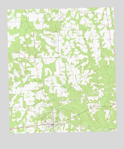
Whigham, GA USGS Topographic Map
Click on map above to begin viewing in our Map Viewer.

This topographic map contains these locations and features:
Feature Name Type Latitude Longitude GNIS ID View Map
Bearden LakeReservoirN30.9869°W84.2632°342034View Map
Bearden Lake DamDamN30.9869°W84.2632°342033View Map
Black CreekStreamN30.9305°W84.2643°311467View Map
BoydvillePopulated PlaceN30.8816°W84.3552°331220View Map
Buss CreekStreamN30.9305°W84.2643°312087View Map
Cedar Spring ChurchChurchN30.9207°W84.3018°312494View Map
City of WhighamCivilN30.8845°W84.3247°2405728View Map
Connells School (historical)SchoolN30.9252°W84.2982°342465View Map
Curry HillSummitN30.9310°W84.3563°331498View Map
Ezell LakeReservoirN30.8771°W84.2904°338517View Map
Ezell Lake DamDamN30.8769°W84.2899°338516View Map
Grady County Volunteer Fire Department Pine Level StationBuildingN30.9842°W84.2566°2604188View Map
Grady County Volunteer Fire Department Whigham StationBuildingN30.8841°W84.3238°2604185View Map
Griffin Memorial GardensCemeteryN30.9013°W84.2741°314913View Map
Live Oak CemeteryCemeteryN30.9674°W84.2560°317248View Map
Live Oak School (historical)SchoolN30.9702°W84.2555°342492View Map
Manbone BranchStreamN30.9774°W84.3549°317651View Map
McElvey BranchStreamN30.9016°W84.3160°317904View Map
Mill BranchStreamN30.9091°W84.3241°318162View Map
Mount Pilgrim ChurchChurchN30.9555°W84.3163°318804View Map
New Hope CemeteryCemeteryN30.9960°W84.3388°319351View Map
New Hope ChurchChurchN30.8863°W84.3341°334162View Map
Paulk CemeteryCemeteryN30.9030°W84.2502°320284View Map
Peoples StillLocaleN30.9916°W84.3110°320374View Map
Poplar Springs CemeteryCemeteryN30.9149°W84.3743°342526View Map
Poplar Springs ChurchChurchN30.9146°W84.3741°321037View Map
Popple BranchStreamN30.9244°W84.3341°321056View Map
RoddenberryPopulated PlaceN30.8771°W84.2599°332908View Map
Sapp CreekStreamN30.9252°W84.2632°322517View Map
Spring Hill ChurchChurchN30.9769°W84.3166°323411View Map
Springhill CemeteryCemeteryN30.9771°W84.3160°342539View Map
Sweetwater BranchStreamN30.9016°W84.3168°323821View Map
Sweetwater CemeteryCemeteryN30.8938°W84.3355°323824View Map
Terrell LakeReservoirN30.9982°W84.3168°342032View Map
Terrell Lake DamDamN30.9985°W84.3182°342031View Map
Thomas CemeteryCemeteryN30.8974°W84.3460°324072View Map
Trinity CemeteryCemeteryN30.9202°W84.3110°342542View Map
Trinity ChurchChurchN30.9205°W84.3107°324299View Map
Union Spring ChurchChurchN30.9327°W84.3510°342545View Map
Union Springs CemeteryCemeteryN30.9324°W84.3507°342546View Map
Wayside School (historical)SchoolN30.9499°W84.3121°334165View Map
WhighamPopulated PlaceN30.8830°W84.3238°333406View Map
Whigham CemeteryCemeteryN30.8852°W84.3263°342550View Map
Whigham DivisionCivilN30.8884°W84.3174°1936644View Map
Whigham Police DepartmentBuildingN30.8832°W84.3244°2733755View Map
Whigham SchoolSchoolN30.8771°W84.3349°342551View Map
Woodlawn CemeteryCemeteryN30.8821°W84.3157°325535View Map

Note: Coordinates in the location and feature list above are referenced to NAD83 datum.


Copyright (C) 2008-2024 Ryan Niemi / Sunset Dynamics ... All Rights Reserved