TopoQuest Logo
Do you find TopoQuest useful?
Help keep TopoQuest running and adding new maps/features by donating!
Bitcoin:  19c7KJd3qBynnjoSw5npx9KScwjBe4ifkT
Litecoin:  LXs6TkuXGGXo1vDsWCkWVdjQX94eUKd6ui
Home View Maps Find Maps Find Places Resources & Links


Cairo South, Georgia Topographic Map

USGS Map Title: Cairo South, GA
USGS Map MRC: 30084G2
DRG (GeoTIFF) Download: o30084g2.tif


Neighboring USGS Topographic Map Quads:


  Whigham, GA  
30084H3
 

  Cairo North, GA  
30084H2
 

  Ochlocknee, GA  
30084H1
 

  Reno, GA  
30084G3
 

  Cairo South, GA  
30084G2
 

  Pine Park, GA  
30084G1
 

  Calvary, GA  
30084F3
 

  Beachton, GA  
30084F2
 

  Miccosukee NE, GA  
30084F1


Map MRC Location:

N31°
W85°
N31°
W84°
H8 H7 H6 H5 H4 H3 H2 H1
G8 G7 G6 G5 G4 G3 G2 G1
F8 F7 F6 F5 F4 F3 F2 F1
E8 E7 E6 E5 E4 E3 E2 E1
D8 D7 D6 D5 D4 D3 D2 D1
C8 C7 C6 C5 C4 C3 C2 C1
B8 B7 B6 B5 B4 B3 B2 B1
A8 A7 A6 A5 A4 A3 A2 A1
N30°
W85°
N30°
W84°

Cairo South, GA USGS 1:24K Topographic Map Preview:
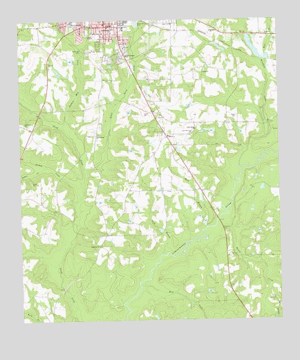
Cairo South, GA USGS Topographic Map
Click on map above to begin viewing in our Map Viewer.

This topographic map contains these locations and features:
Feature Name Type Latitude Longitude GNIS ID View Map
Bethlehem African Methodist Episcopal ChurchChurchN30.8724°W84.2121°342448View Map
BrownleePopulated PlaceN30.8707°W84.1727°342450View Map
Brumbley CreekStreamN30.8141°W84.1438°311909View Map
Cairo City CemeteryCemeteryN30.8738°W84.2024°342451View Map
Cairo High SchoolSchoolN30.8719°W84.1999°342454View Map
Centennial CemeteryCemeteryN30.7807°W84.2127°342458View Map
Centennial ChurchChurchN30.7813°W84.2121°355071View Map
Centennial School (historical)SchoolN30.7816°W84.2124°342459View Map
First Born ChurchChurchN30.8732°W84.2149°342473View Map
First United Methodist ChurchChurchN30.8735°W84.2088°342474View Map
Godwin CemeteryCemeteryN30.8571°W84.2355°314665View Map
Gordon Heights ChurchChurchN30.8605°W84.1974°356054View Map
Grady CountyCivilN30.8747°W84.2344°351261View Map
Grady County Hospital (historical)HospitalN30.8749°W84.2077°342480View Map
Grady County Volunteer Fire Department Midway StationBuildingN30.8255°W84.1785°2604045View Map
Grady General HospitalHospitalN30.8637°W84.1992°342482View Map
Greater New Corinth Missionary Baptist ChurchChurchN30.8732°W84.2141°342483View Map
Grey BranchStreamN30.7780°W84.1818°314893View Map
Hall CemeteryCemeteryN30.7771°W84.1488°315031View Map
Hawthorne CemeteryCemeteryN30.8319°W84.2482°315251View Map
Hawthorne Store (historical)LocaleN30.8302°W84.2435°342486View Map
Hinson CemeteryCemeteryN30.8363°W84.1893°315452View Map
Jack Hall BranchStreamN30.8310°W84.1293°315980View Map
Lake Wight NorthReservoirN30.8516°W84.2298°338515View Map
Lake Wight North DamDamN30.8519°W84.2299°338514View Map
Lewis Memorial CemeteryCemeteryN30.8285°W84.1657°316786View Map
Little Tired CreekStreamN30.8124°W84.2174°317223View Map
MidwayPopulated PlaceN30.8266°W84.1785°342499View Map
Midway ChurchChurchN30.8269°W84.1780°318103View Map
Midway School (historical)SchoolN30.8260°W84.1780°334681View Map
Mock BranchStreamN30.7888°W84.1610°318374View Map
Mount Calvary Missionary Baptist ChurchChurchN30.8730°W84.2138°342502View Map
Myrtle Hill CemeteryCemeteryN30.8627°W84.2193°319182View Map
Parkers Mill CreekStreamN30.8324°W84.2282°320231View Map
Pilgrim Rest Missionary Baptist ChurchChurchN30.8735°W84.2291°342511View Map
Poplar Spring ChurchChurchN30.8299°W84.1643°321031View Map
Rawls CemeteryCemeteryN30.8349°W84.1446°321329View Map
Rice BranchStreamN30.8602°W84.1302°321556View Map
Sasser CemeteryCemeteryN30.8077°W84.2443°322565View Map
Shiloh ChurchChurchN30.8530°W84.1605°322856View Map
Sofkee CreekStreamN30.8130°W84.2399°356544View Map
Southern Terrace ParkParkN30.8635°W84.2096°342538View Map
Southside SchoolSchoolN30.8716°W84.2041°323303View Map
Tabernacle ChurchChurchN30.8705°W84.1566°323873View Map
Turkey CreekStreamN30.8030°W84.2218°324387View Map
Victory Baptist ChurchChurchN30.8582°W84.2091°342547View Map
Walton CreekStreamN30.7902°W84.1502°324825View Map
Washington SchoolSchoolN30.8749°W84.2241°324878View Map
White Springs CemeteryCemeteryN30.8274°W84.2118°342552View Map
White Springs ChurchChurchN30.8274°W84.2124°325195View Map
Wight Lake SouthReservoirN30.8494°W84.2267°342022View Map
Wight Lake South DamDamN30.8469°W84.2249°342021View Map
Wolf CreekStreamN30.7641°W84.1905°325487View Map

Note: Coordinates in the location and feature list above are referenced to NAD83 datum.


Copyright (C) 2008-2024 Ryan Niemi / Sunset Dynamics ... All Rights Reserved