TopoQuest Logo
Do you find TopoQuest useful?
Help keep TopoQuest running and adding new maps/features by donating!
Bitcoin:  19c7KJd3qBynnjoSw5npx9KScwjBe4ifkT
Litecoin:  LXs6TkuXGGXo1vDsWCkWVdjQX94eUKd6ui
Home View Maps Find Maps Find Places Resources & Links


Aldridge Creek, Michigan Topographic Map

USGS Map Title: Aldridge Creek, MI
USGS Map MRC: 46089F6
DRG (GeoTIFF) Download: o46089f6.tif


Neighboring USGS Topographic Map Quads:


  Government Peak, MI  
46089G6
 

  White Pine, MI  
46089G5


  Aldridge Creek, MI  
46089F6
 

  Bergland NE, MI  
46089F5


Map MRC Location:

N47°
W90°
N47°
W89°
H8 H7 H6 H5 H4 H3 H2 H1
G8 G7 G6 G5 G4 G3 G2 G1
F8 F7 F6 F5 F4 F3 F2 F1
E8 E7 E6 E5 E4 E3 E2 E1
D8 D7 D6 D5 D4 D3 D2 D1
C8 C7 C6 C5 C4 C3 C2 C1
B8 B7 B6 B5 B4 B3 B2 B1
A8 A7 A6 A5 A4 A3 A2 A1
N46°
W90°
N46°
W89°

Aldridge Creek, MI USGS 1:24K Topographic Map Preview:
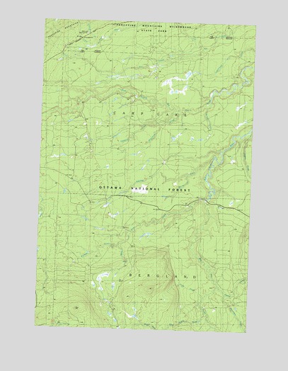
Aldridge Creek, MI USGS Topographic Map
Click on map above to begin viewing in our Map Viewer.

This topographic map contains these locations and features:
Feature Name Type Latitude Longitude GNIS ID View Map
Aldridge CreekStreamN46.6952°W89.6488°619930View Map
Amundsan CreekStreamN46.6433°W89.6438°1619023View Map
Buckless CreekStreamN46.6594°W89.7038°1619354View Map
Chipping CreekStreamN46.7133°W89.6710°623231View Map
Crazy CreekStreamN46.6386°W89.6513°1619615View Map
Deer Creek FallsFallsN46.6524°W89.6972°1622343View Map
Elm CreekStreamN46.7386°W89.6560°1619846View Map
Extension CreekStreamN46.7408°W89.7179°1622760View Map
McFarland CreekStreamN46.7136°W89.6674°631892View Map
Nugget CreekStreamN46.7055°W89.6274°1621073View Map
Rapid RiverStreamN46.6322°W89.6507°1621343View Map
Rapid River FallsFallsN46.6272°W89.6687°635651View Map
Redpoll CreekStreamN46.7169°W89.6515°1621362View Map
Shiras CreekStreamN46.6849°W89.6513°637818View Map
Sleepy CreekStreamN46.6394°W89.6390°1621642View Map
Township of Carp LakeCivilN46.7370°W89.6799°1626034View Map
White Deer CreekStreamN46.6786°W89.6524°1622140View Map
White Pine Camp and Picnic AreaLocaleN46.7416°W89.7488°1622341View Map
White Pine Extension MineMineN46.7438°W89.7246°1616323View Map

Note: Coordinates in the location and feature list above are referenced to NAD83 datum.


Copyright (C) 2008-2025 Ryan Niemi / Sunset Dynamics ... All Rights Reserved