TopoQuest Logo
Do you find TopoQuest useful?
Help keep TopoQuest running and adding new maps/features by donating!
Bitcoin:  19c7KJd3qBynnjoSw5npx9KScwjBe4ifkT
Litecoin:  LXs6TkuXGGXo1vDsWCkWVdjQX94eUKd6ui
Home View Maps Find Maps Find Places Resources & Links


White Pine, Michigan Topographic Map

USGS Map Title: White Pine, MI
USGS Map MRC: 46089G5
DRG (GeoTIFF) Download: o46089g5.tif


Neighboring USGS Topographic Map Quads:


  Government Peak, MI  
46089G6
 

  White Pine, MI  
46089G5


  Aldridge Creek, MI  
46089F6
 

  Bergland NE, MI  
46089F5
 

  Matchwood NW, MI  
46089F4


Map MRC Location:

N47°
W90°
N47°
W89°
H8 H7 H6 H5 H4 H3 H2 H1
G8 G7 G6 G5 G4 G3 G2 G1
F8 F7 F6 F5 F4 F3 F2 F1
E8 E7 E6 E5 E4 E3 E2 E1
D8 D7 D6 D5 D4 D3 D2 D1
C8 C7 C6 C5 C4 C3 C2 C1
B8 B7 B6 B5 B4 B3 B2 B1
A8 A7 A6 A5 A4 A3 A2 A1
N46°
W90°
N46°
W89°

White Pine, MI USGS 1:24K Topographic Map Preview:
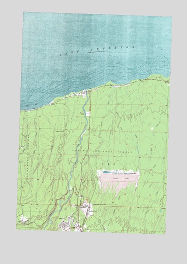
White Pine, MI USGS Topographic Map
Click on map above to begin viewing in our Map Viewer.

This topographic map contains these locations and features:
Feature Name Type Latitude Longitude GNIS ID View Map
Ash CreekStreamN46.8208°W89.6077°620264View Map
Big Iron RiverStreamN46.8313°W89.5704°1620326View Map
Bonanza FallsFallsN46.8180°W89.5693°621700View Map
Carp Lake Township LibraryBuildingN46.7528°W89.5814°2125811View Map
Carp Lake Township Volunteer Fire DepartmentBuildingN46.7515°W89.5801°2125812View Map
Faith Lutheran ChurchChurchN46.7508°W89.6014°2125814View Map
Gull PointCapeN46.8374°W89.5502°627521View Map
Little Iron RiverStreamN46.8277°W89.5885°630645View Map
Little Union Gorge FallsFallsN46.7997°W89.6183°2125799View Map
Little Union RiverStreamN46.7980°W89.6179°630809View Map
Mineral RiverStreamN46.8355°W89.5482°632452View Map
Mud CreekStreamN46.8197°W89.6110°632871View Map
Native CreekStreamN46.8324°W89.5452°633230View Map
NonesuchPopulated PlaceN46.7552°W89.6196°1617744View Map
Nonesuch FallsFallsN46.7536°W89.6203°2125800View Map
Nonesuch Post Office (historical)Post OfficeN46.7553°W89.6197°2125253View Map
Patent CreekStreamN46.8355°W89.5374°634453View Map
Pewabeck FallsFallsN46.8074°W89.5871°634743View Map
Saint Judes Catholic ChurchChurchN46.7528°W89.5808°2125809View Map
Silver CityPopulated PlaceN46.8302°W89.5704°637900View Map
Union BayBayN46.8219°W89.6215°1615329View Map
Union RiverStreamN46.8191°W89.6196°1615355View Map
White PinePopulated PlaceN46.7538°W89.5840°1622143View Map
White Pine Elementary SchoolSchoolN46.7528°W89.5814°2125810View Map
White Pine MineMineN46.7622°W89.5635°1616325View Map
White Pine Post OfficePost OfficeN46.7510°W89.5750°2125808View Map
White Pine StationLocaleN46.7528°W89.5744°2125807View Map
White Pine United Methodist ChuchChurchN46.7558°W89.5733°2125813View Map

Note: Coordinates in the location and feature list above are referenced to NAD83 datum.


Copyright (C) 2008-2025 Ryan Niemi / Sunset Dynamics ... All Rights Reserved