TopoQuest Logo
Do you find TopoQuest useful?
Help keep TopoQuest running and adding new maps/features by donating!
Bitcoin:  19c7KJd3qBynnjoSw5npx9KScwjBe4ifkT
Litecoin:  LXs6TkuXGGXo1vDsWCkWVdjQX94eUKd6ui
Home View Maps Find Maps Find Places Resources & Links


White Hills, Utah Topographic Map

USGS Map Title: White Hills, UT
USGS Map MRC: 37113A6
DRG (GeoTIFF) Download: o37113a6.tif


Neighboring USGS Topographic Map Quads:


  Shivwits, UT  
37113B7
 

  Santa Clara, UT  
37113B6
 

  Washington, UT  
37113B5
 

  Jarvis Peak, UT  
37113A7
 

  White Hills, UT  
37113A6
 

  Saint George, UT  
37113A5
 

  Mountain Sheep Spring, AZ  
36113H7
 

  Purgatory Canyon, AZ  
36113H6
 

  Lizard Point, AZ  
36113H5


Map MRC Location:

N38°
W114°
N38°
W113°
H8 H7 H6 H5 H4 H3 H2 H1
G8 G7 G6 G5 G4 G3 G2 G1
F8 F7 F6 F5 F4 F3 F2 F1
E8 E7 E6 E5 E4 E3 E2 E1
D8 D7 D6 D5 D4 D3 D2 D1
C8 C7 C6 C5 C4 C3 C2 C1
B8 B7 B6 B5 B4 B3 B2 B1
A8 A7 A6 A5 A4 A3 A2 A1
N37°
W114°
N37°
W113°

White Hills, UT USGS 1:24K Topographic Map Preview:
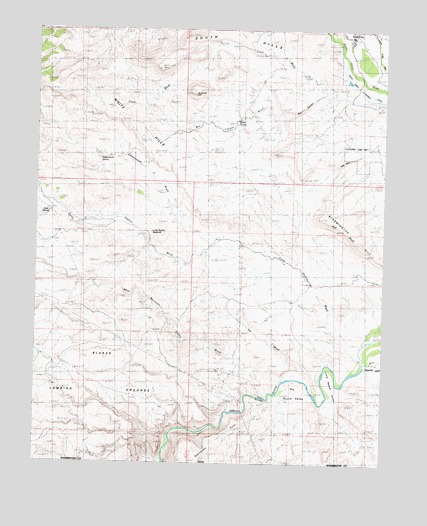
White Hills, UT USGS Topographic Map
Click on map above to begin viewing in our Map Viewer.

This topographic map contains these locations and features:
Feature Name Type Latitude Longitude GNIS ID View Map
AtkinvillePopulated PlaceN37.0300°W113.6277°1437481View Map
Atkinville WashValleyN37.0305°W113.6330°1437230View Map
Big Round ValleyBasinN37.0216°W113.6552°1425541View Map
Blakes Lambing GroundsAreaN37.0328°W113.7372°1425754View Map
Boomer HillSummitN37.1064°W113.6941°1425879View Map
Box CanyonValleyN37.1072°W113.6469°1425924View Map
Box Canyon WashValleyN37.1072°W113.6472°1425928View Map
Cave SpringSpringN37.0718°W113.7464°1435270View Map
Cottonwood SpringSpringN37.0894°W113.7298°1426931View Map
Cottonwood WashValleyN37.0628°W113.6877°1426957View Map
Cove WashValleyN37.1047°W113.6258°1426993View Map
Curley Hollow ReservoirReservoirN37.0662°W113.7096°1435380View Map
Curly Hollow WashValleyN37.0305°W113.6333°1425002View Map
First NarrowsGapN37.0172°W113.6741°1427948View Map
Little Round ValleyBasinN37.0200°W113.6436°1429794View Map
Red BluffCliffN37.0680°W113.6427°1431611View Map
Sand HollowValleyN37.1136°W113.6258°1432191View Map
South HillsSummitN37.1241°W113.6852°1432724View Map
Starvation PointCapeN37.0025°W113.6688°1432926View Map
Stucki SpringSpringN37.0989°W113.6816°1433018View Map
The GapGapN37.0811°W113.6475°1433311View Map
Val WashValleyN37.0275°W113.6563°1436566View Map
West Mountain Valley WashValleyN37.0189°W113.6691°1434102View Map
White HillsSummitN37.0997°W113.7155°1434163View Map

Note: Coordinates in the location and feature list above are referenced to NAD83 datum.


Copyright (C) 2008-2025 Ryan Niemi / Sunset Dynamics ... All Rights Reserved