TopoQuest Logo
Do you find TopoQuest useful?
Help keep TopoQuest running and adding new maps/features by donating!
Bitcoin:  19c7KJd3qBynnjoSw5npx9KScwjBe4ifkT
Litecoin:  LXs6TkuXGGXo1vDsWCkWVdjQX94eUKd6ui
Home View Maps Find Maps Find Places Resources & Links


White Rock, Texas Topographic Map

USGS Map Title: White Rock, TX
USGS Map MRC: 33094F8
DRG (GeoTIFF) Download: o33094f8.tif


Neighboring USGS Topographic Map Quads:


  Negley, TX  
33095G1
 

  Acworth, TX  
33094G8
 

  Idabel SE, OK  
33094G7
 

  Dimple, TX  
33095F1
 

  White Rock, TX  
33094F8
 

  English, TX  
33094F7
 

  Clarksville, TX  
33095E1
 

  Annona, TX  
33094E8
 

  Avery, TX  
33094E7


Map MRC Location:

N34°
W95°
N34°
W94°
H8 H7 H6 H5 H4 H3 H2 H1
G8 G7 G6 G5 G4 G3 G2 G1
F8 F7 F6 F5 F4 F3 F2 F1
E8 E7 E6 E5 E4 E3 E2 E1
D8 D7 D6 D5 D4 D3 D2 D1
C8 C7 C6 C5 C4 C3 C2 C1
B8 B7 B6 B5 B4 B3 B2 B1
A8 A7 A6 A5 A4 A3 A2 A1
N33°
W95°
N33°
W94°

White Rock, TX USGS 1:24K Topographic Map Preview:
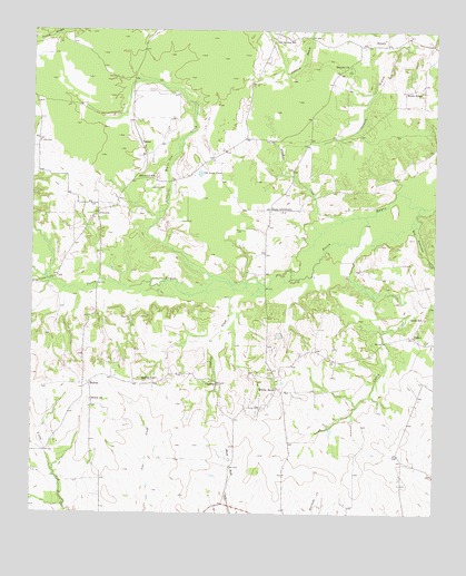
White Rock, TX USGS Topographic Map
Click on map above to begin viewing in our Map Viewer.

This topographic map contains these locations and features:
Feature Name Type Latitude Longitude GNIS ID View Map
BryarlyPopulated PlaceN33.7465°W94.8908°1379465View Map
Bryarly ChurchChurchN33.7407°W94.9022°1353110View Map
Burks RidgeLocaleN33.7351°W94.8822°1353326View Map
CaneyPopulated PlaceN33.6709°W94.8819°1379502View Map
Caney CreekStreamN33.6954°W94.8991°1353731View Map
Caney SchoolSchoolN33.6759°W94.8780°1353747View Map
Cold Spring SchoolSchoolN33.7484°W94.9244°1354752View Map
Concord ChurchChurchN33.6593°W94.9447°1354861View Map
Concord CreekStreamN33.6843°W94.9377°1354863View Map
DilworthPopulated PlaceN33.7026°W94.9802°1379664View Map
Haywood CemeteryCemeteryN33.7101°W94.9613°1358959View Map
Haywood SchoolSchoolN33.7115°W94.9624°1358961View Map
Little White Oak CreekStreamN33.6851°W94.9391°1361500View Map
MadrasPopulated PlaceN33.6584°W94.9822°1380126View Map
Madras SchoolSchoolN33.6598°W94.9611°1362064View Map
Old Goose PondLakeN33.7132°W94.9484°1364427View Map
Reeds SettlementPopulated PlaceN33.7037°W94.9266°1380429View Map
Schaffline CreekStreamN33.7023°W94.8969°1367823View Map
Shiloh ChurchChurchN33.6543°W94.9819°1368174View Map
VesseyPopulated PlaceN33.7209°W94.9669°1380721View Map
West Beaverdam CreekStreamN33.7048°W94.8788°1371067View Map
White Oak BayouStreamN33.6859°W94.9966°1371387View Map
White RockPopulated PlaceN33.6576°W94.9241°1380772View Map

Note: Coordinates in the location and feature list above are referenced to NAD83 datum.


Copyright (C) 2008-2025 Ryan Niemi / Sunset Dynamics ... All Rights Reserved