TopoQuest Logo
Do you find TopoQuest useful?
Help keep TopoQuest running and adding new maps/features by donating!
Bitcoin:  19c7KJd3qBynnjoSw5npx9KScwjBe4ifkT
Litecoin:  LXs6TkuXGGXo1vDsWCkWVdjQX94eUKd6ui
Home View Maps Find Maps Find Places Resources & Links


Whitehorse Mountain, Washington Topographic Map

USGS Map Title: Whitehorse Mountain, WA
USGS Map MRC: 48121B6
DRG (GeoTIFF) Download: o48121b6.tif


Neighboring USGS Topographic Map Quads:


  Mount Higgins, WA  
48121C7
 

  Fortson, WA  
48121C6
 

  Darrington, WA  
48121C5
 

  Meadow Mountain, WA  
48121B7
 

  Whitehorse Mountain, WA  
48121B6
 

  Helena Ridge, WA  
48121B5
 

  Verlot, WA  
48121A7
 

  Mallardy Ridge, WA  
48121A6
 

  Silverton, WA  
48121A5


Map MRC Location:

N49°
W122°
N49°
W121°
H8 H7 H6 H5 H4 H3 H2 H1
G8 G7 G6 G5 G4 G3 G2 G1
F8 F7 F6 F5 F4 F3 F2 F1
E8 E7 E6 E5 E4 E3 E2 E1
D8 D7 D6 D5 D4 D3 D2 D1
C8 C7 C6 C5 C4 C3 C2 C1
B8 B7 B6 B5 B4 B3 B2 B1
A8 A7 A6 A5 A4 A3 A2 A1
N48°
W122°
N48°
W121°

Whitehorse Mountain, WA USGS 1:24K Topographic Map Preview:
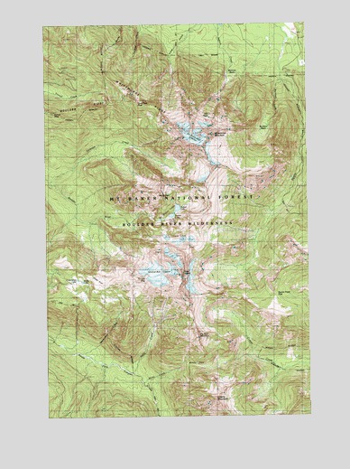
Whitehorse Mountain, WA USGS Topographic Map
Click on map above to begin viewing in our Map Viewer.

This topographic map contains these locations and features:
Feature Name Type Latitude Longitude GNIS ID View Map
Baldy CreekStreamN48.1390°W121.7107°1516094View Map
Big Bear MountainSummitN48.1493°W121.6812°1516463View Map
Boulder River WildernessReserveN48.1717°W121.6941°1529322View Map
Buckeye CreekStreamN48.2323°W121.6393°1517049View Map
Bullen LakeLakeN48.1913°W121.6884°1528528View Map
French PeakSummitN48.2218°W121.7479°1519798View Map
Gerkman CreekStreamN48.2001°W121.7487°1519927View Map
Goat FlatFlatN48.1679°W121.7237°1520030View Map
Liberty MountainSummitN48.1301°W121.6712°1522060View Map
Lone Tree PassGapN48.2254°W121.7074°1522379View Map
Mount BullenSummitN48.1959°W121.6990°1517087View Map
Mount Bullen LakesLakeN48.1890°W121.6911°1533270View Map
Noble LakeLakeN48.1680°W121.7342°1528529View Map
Queest-alb Glacier (not official)GlacierN48.1701°W121.6990°1528533View Map
Sevenmile CreekStreamN48.1451°W121.7332°1525589View Map
Sill BasinBasinN48.2221°W121.6743°1525746View Map
So-Bahli-Alhi GlacierGlacierN48.2134°W121.6823°1528530View Map
Squire Creek PassGapN48.1634°W121.6432°1526468View Map
Three FingersSummitN48.1704°W121.6882°1527144View Map
Tin Can GapGapN48.1684°W121.7040°1528532View Map
Tucker LakeLakeN48.1890°W121.6911°1528527View Map
Wellman BasinBasinN48.2332°W121.6640°1527890View Map
Whitehorse MountainSummitN48.2109°W121.6777°1531183View Map
Whitehorse RidgeRidgeN48.2346°W121.7224°1528096View Map
Windy CreekStreamN48.1354°W121.7032°1528223View Map
Windy PassGapN48.1418°W121.6829°1528232View Map

Note: Coordinates in the location and feature list above are referenced to NAD83 datum.


Copyright (C) 2008-2025 Ryan Niemi / Sunset Dynamics ... All Rights Reserved