TopoQuest Logo
Do you find TopoQuest useful?
Help keep TopoQuest running and adding new maps/features by donating!
Bitcoin:  19c7KJd3qBynnjoSw5npx9KScwjBe4ifkT
Litecoin:  LXs6TkuXGGXo1vDsWCkWVdjQX94eUKd6ui
Home View Maps Find Maps Find Places Resources & Links


Verlot, Washington Topographic Map

USGS Map Title: Verlot, WA
USGS Map MRC: 48121A7
DRG (GeoTIFF) Download: o48121a7.tif


Neighboring USGS Topographic Map Quads:


  Riley Lake, WA  
48121B8
 

  Meadow Mountain, WA  
48121B7
 

  Whitehorse Mountain, WA  
48121B6
 

  Granite Falls, WA  
48121A8
 

  Verlot, WA  
48121A7
 

  Mallardy Ridge, WA  
48121A6
 

  Lake Roesiger, WA  
47121H8
 

  Lake Chaplain, WA  
47121H7
 

  Wallace Lake, WA  
47121H6


Map MRC Location:

N49°
W122°
N49°
W121°
H8 H7 H6 H5 H4 H3 H2 H1
G8 G7 G6 G5 G4 G3 G2 G1
F8 F7 F6 F5 F4 F3 F2 F1
E8 E7 E6 E5 E4 E3 E2 E1
D8 D7 D6 D5 D4 D3 D2 D1
C8 C7 C6 C5 C4 C3 C2 C1
B8 B7 B6 B5 B4 B3 B2 B1
A8 A7 A6 A5 A4 A3 A2 A1
N48°
W122°
N48°
W121°

Verlot, WA USGS 1:24K Topographic Map Preview:
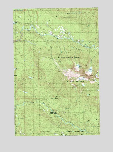
Verlot, WA USGS Topographic Map
Click on map above to begin viewing in our Map Viewer.

This topographic map contains these locations and features:
Feature Name Type Latitude Longitude GNIS ID View Map
Bathtub LakesLakeN48.0556°W121.7800°1528517View Map
Benson CreekStreamN48.0909°W121.7773°1516418View Map
Boulder CreekStreamN48.0248°W121.8215°1516829View Map
Cranberry CreekStreamN48.1040°W121.8421°1518271View Map
Echo Lake Truck TrailTrailN48.0207°W121.8407°1519171View Map
Granite Falls DivisionCivilN48.0362°W121.7814°1939520View Map
Hanson LakeLakeN48.0571°W121.8514°1520520View Map
Hawthorn CreekStreamN48.0973°W121.8257°1520616View Map
Heather CreekStreamN48.0907°W121.7832°1520656View Map
Heather LakeLakeN48.0681°W121.7820°1520658View Map
Hempel LakeLakeN48.0578°W121.7544°1520713View Map
Island LakeLakeN48.0439°W121.7528°1531566View Map
Kelly CreekStreamN48.0332°W121.8387°1521597View Map
Lake JuliaLakeN48.0657°W121.8747°1521494View Map
Lake TwentytwoLakeN48.0640°W121.7637°1527515View Map
Lake Twentytwo Research Natural AreaAreaN48.0701°W121.7598°1533302View Map
Miller CreekStreamN48.0037°W121.7721°1523182View Map
Mount PilchuckSummitN48.0579°W121.7968°1524420View Map
Mount Pilchuck State ForestParkN48.0568°W121.7929°1528518View Map
Mount Pilchuck TrailheadLocaleN48.0676°W121.8137°1529839View Map
Pinnacle LakeLakeN48.0532°W121.7566°1524462View Map
RobePopulated PlaceN48.0973°W121.8135°1525092View Map
Ross CreekStreamN48.0140°W121.8060°1525219View Map
Rotary CreekStreamN48.0987°W121.8279°1525226View Map
Six LakeLakeN48.0392°W121.7681°1528515View Map
Snohomish County Fire District 23BuildingN48.0978°W121.8025°2619807View Map
Summit LakeLakeN48.0489°W121.7745°1526717View Map
Triple CreekStreamN48.0954°W121.8010°1527376View Map
Turlo CampgroundLocaleN48.0923°W121.7851°1529258View Map
Turlo CreekStreamN48.0962°W121.7893°1527475View Map
Twentytwo CreekStreamN48.0798°W121.7510°1527514View Map
VerlotPopulated PlaceN48.0904°W121.7773°1527699View Map
Verlot CampgroundLocaleN48.0898°W121.7779°1530019View Map
Verlot Census Designated PlaceCensusN48.1002°W121.7678°2409509View Map
Verlot Public Service CenterLocaleN48.0970°W121.7890°1530018View Map
Wilson CreekStreamN48.0054°W121.7726°1528204View Map
Worthy CreekStreamN48.0312°W121.8685°1528315View Map

Note: Coordinates in the location and feature list above are referenced to NAD83 datum.


Copyright (C) 2008-2024 Ryan Niemi / Sunset Dynamics ... All Rights Reserved