TopoQuest Logo
Do you find TopoQuest useful?
Help keep TopoQuest running and adding new maps/features by donating!
Bitcoin:  19c7KJd3qBynnjoSw5npx9KScwjBe4ifkT
Litecoin:  LXs6TkuXGGXo1vDsWCkWVdjQX94eUKd6ui
Home View Maps Find Maps Find Places Resources & Links


Whitesburg, Georgia Topographic Map

USGS Map Title: Whitesburg, GA
USGS Map MRC: 33084D8
DRG (GeoTIFF) Download: o33084d8.tif


Neighboring USGS Topographic Map Quads:


  Carrollton, GA  
33085E1
 

  Hulett, GA  
33084E8
 

  Rico, GA  
33084E7
 

  Lowell, GA  
33085D1
 

  Whitesburg, GA  
33084D8
 

  Newnan North, GA  
33084D7
 

  Franklin, GA  
33085C1
 

  Newnan SW, GA  
33084C8
 

  Newnan South, GA  
33084C7


Map MRC Location:

N34°
W85°
N34°
W84°
H8 H7 H6 H5 H4 H3 H2 H1
G8 G7 G6 G5 G4 G3 G2 G1
F8 F7 F6 F5 F4 F3 F2 F1
E8 E7 E6 E5 E4 E3 E2 E1
D8 D7 D6 D5 D4 D3 D2 D1
C8 C7 C6 C5 C4 C3 C2 C1
B8 B7 B6 B5 B4 B3 B2 B1
A8 A7 A6 A5 A4 A3 A2 A1
N33°
W85°
N33°
W84°

Whitesburg, GA USGS 1:24K Topographic Map Preview:
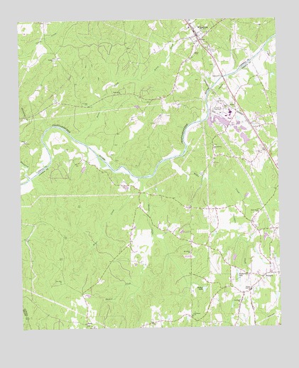
Whitesburg, GA USGS Topographic Map
Click on map above to begin viewing in our Map Viewer.

This topographic map contains these locations and features:
Feature Name Type Latitude Longitude GNIS ID View Map
Acorn CreekStreamN33.4529°W84.9736°310379View Map
Allen CemeteryCemeteryN33.4459°W84.8838°348437View Map
Bridgehaven LakeReservoirN33.3968°W84.8955°311788View Map
Carroll County Fire / Rescue Station 8BuildingN33.4928°W84.9109°2604267View Map
Cavender CreekStreamN33.4318°W84.9035°355044View Map
Cedar CreekStreamN33.4873°W84.8808°312458View Map
City of WhitesburgCivilN33.4928°W84.9137°2405736View Map
Coweta County Fire Department Station 8BuildingN33.3880°W84.8886°2604387View Map
Elim Baptist ChurchChurchN33.3762°W84.9652°355669View Map
Elim CemeteryCemeteryN33.3759°W84.9644°348480View Map
Elim School (historical)SchoolN33.3759°W84.9655°348481View Map
Ephesus CemeteryCemeteryN33.4846°W84.9827°350750View Map
Ephesus ChurchChurchN33.4843°W84.9824°355713View Map
HandyPopulated PlaceN33.3765°W84.9691°331904View Map
Homewood School (historical)SchoolN33.4159°W84.9458°348510View Map
Johnson CemeteryCemeteryN33.4159°W84.8872°348520View Map
Jones Bridge (historical)BridgeN33.4834°W84.8872°348522View Map
Kimbrough LakeReservoirN33.4351°W84.8949°340532View Map
Kimbrough Lake DamDamN33.4351°W84.8949°340531View Map
Lewis Lakes (historical)LakeN33.4543°W84.9855°348527View Map
McIntosh FieldAirportN33.4558°W84.9429°2625395View Map
McKay LakeReservoirN33.3906°W84.9118°317935View Map
Moore CreekStreamN33.4365°W84.9455°318438View Map
Mount Carmel CemeteryCemeteryN33.4062°W84.9177°348543View Map
Mount Carmel Methodist ChurchChurchN33.4057°W84.9180°318606View Map
Mount Carmel School (historical)SchoolN33.4051°W84.9183°348544View Map
New Elim ChurchChurchN33.3934°W84.9811°319307View Map
New Ferry (historical)CrossingN33.4768°W84.9008°348559View Map
New Hope Church (historical)ChurchN33.4709°W84.9258°349663View Map
New Lebanon Baptist ChurchChurchN33.4479°W84.9060°319460View Map
New Lebanon CemeteryCemeteryN33.4490°W84.9060°348560View Map
Providence Baptist ChurchChurchN33.3807°W84.9172°321198View Map
Providence Baptist ChurchChurchN33.3859°W84.8944°321199View Map
Providence CemeteryCemeteryN33.3804°W84.9172°348587View Map
Providence CemeteryCemeteryN33.3862°W84.8952°348588View Map
Providence School (historical)SchoolN33.3809°W84.9172°348589View Map
Rotherwood ChurchChurchN33.4704°W84.9502°321949View Map
Rutherwood School (historical)SchoolN33.4701°W84.9513°349704View Map
Shady Grove Baptist ChurchChurchN33.4218°W84.8844°322761View Map
Shady Grove CemeteryCemeteryN33.4223°W84.8841°348605View Map
Shiloh CemeteryCemeteryN33.4507°W84.9972°349721View Map
Shiloh ChurchChurchN33.4509°W84.9972°322883View Map
Shiloh School (historical)SchoolN33.4507°W84.9969°349722View Map
Snake CreekStreamN33.4932°W84.8752°323184View Map
Springer CemeteryCemeteryN33.4662°W84.9660°323454View Map
Springer School (historical)SchoolN33.4746°W84.9699°349731View Map
Thomas CreekStreamN33.4359°W84.9424°324080View Map
Vine CemeteryCemeteryN33.4037°W84.9799°324715View Map
Wahoo CreekStreamN33.4426°W84.9294°324744View Map
Western Elementary SchoolSchoolN33.3900°W84.8892°325087View Map
WhitesburgPopulated PlaceN33.4940°W84.9138°325222View Map
Whitesburg Baptist ChurchChurchN33.4932°W84.9141°349769View Map
Whitesburg CemeteryCemeteryN33.4998°W84.9177°349770View Map
Whitesburg Elementary SchoolSchoolN33.4976°W84.9173°349771View Map
Whitesburg Police DepartmentBuildingN33.4962°W84.9158°2733686View Map
Whooping CreekStreamN33.4368°W84.9958°325245View Map
YatesPopulated PlaceN33.4634°W84.8949°333476View Map

Note: Coordinates in the location and feature list above are referenced to NAD83 datum.


Copyright (C) 2008-2024 Ryan Niemi / Sunset Dynamics ... All Rights Reserved