TopoQuest Logo
Do you find TopoQuest useful?
Help keep TopoQuest running and adding new maps/features by donating!
Bitcoin:  19c7KJd3qBynnjoSw5npx9KScwjBe4ifkT
Litecoin:  LXs6TkuXGGXo1vDsWCkWVdjQX94eUKd6ui
Home View Maps Find Maps Find Places Resources & Links


Whitewater Creek, New Mexico Topographic Map

USGS Map Title: Whitewater Creek, NM
USGS Map MRC: 31108C6
DRG (GeoTIFF) Download: o31108c6.tif


Neighboring USGS Topographic Map Quads:


  Fitzpatricks, NM  
31108D7
 

  San Luis Pass, NM  
31108D6
 

  Hilo Peak, NM  
31108D5
 

  Lang Canyon, NM  
31108C7
 

  Whitewater Creek, NM  
31108C6
 

  Whitewater Mountains, NM  
31108C5


Map MRC Location:

N32°
W109°
N32°
W108°
H8 H7 H6 H5 H4 H3 H2 H1
G8 G7 G6 G5 G4 G3 G2 G1
F8 F7 F6 F5 F4 F3 F2 F1
E8 E7 E6 E5 E4 E3 E2 E1
D8 D7 D6 D5 D4 D3 D2 D1
C8 C7 C6 C5 C4 C3 C2 C1
B8 B7 B6 B5 B4 B3 B2 B1
A8 A7 A6 A5 A4 A3 A2 A1
N31°
W109°
N31°
W108°

Whitewater Creek, NM USGS 1:24K Topographic Map Preview:
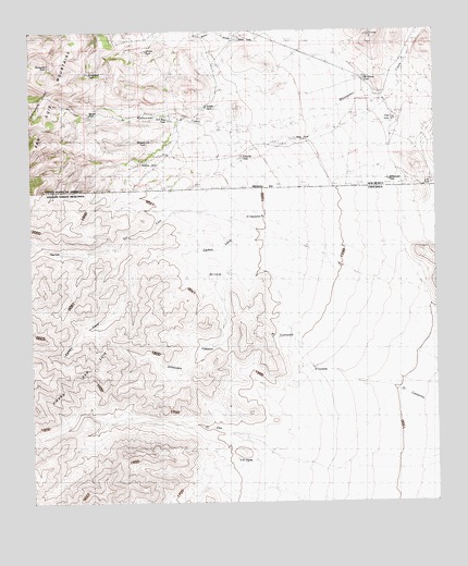
Whitewater Creek, NM USGS Topographic Map
Click on map above to begin viewing in our Map Viewer.

This topographic map contains these locations and features:
Feature Name Type Latitude Longitude GNIS ID View Map
Bass TankReservoirN31.3462°W108.6686°900835View Map
Been TankReservoirN31.3729°W108.6861°900832View Map
Boyles TankReservoirN31.3529°W108.7323°900833View Map
Chavez TankReservoirN31.3698°W108.7148°900852View Map
Dick Bass TankReservoirN31.3514°W108.7073°900834View Map
Edwards TankReservoirN31.3415°W108.6852°900715View Map
Manzanita TankReservoirN31.3663°W108.7446°900708View Map
McKinney TankReservoirN31.3627°W108.6472°900709View Map
Nations HutLocaleN31.3515°W108.7050°892378View Map
Nations TankReservoirN31.3462°W108.6678°892379View Map
Packers TrailTrailN31.3526°W108.7325°893002View Map
Prospector TankReservoirN31.3639°W108.7326°900736View Map
R I Bass RanchLocaleN31.3387°W108.6437°893594View Map
Saddle TankReservoirN31.3552°W108.6962°900775View Map
T Pendleton RanchLocaleN31.3659°W108.6678°895475View Map
Trap TankReservoirN31.3514°W108.6383°900796View Map
W E Bass RanchLocaleN31.3465°W108.6667°896170View Map
Whitetail TankReservoirN31.3459°W108.7140°900795View Map
Whitewater CreekStreamN31.3540°W108.6570°896564View Map
Whitewater TankReservoirN31.3354°W108.6450°900797View Map

Note: Coordinates in the location and feature list above are referenced to NAD83 datum.


Copyright (C) 2008-2025 Ryan Niemi / Sunset Dynamics ... All Rights Reserved