TopoQuest Logo
Do you find TopoQuest useful?
Help keep TopoQuest running and adding new maps/features by donating!
Bitcoin:  19c7KJd3qBynnjoSw5npx9KScwjBe4ifkT
Litecoin:  LXs6TkuXGGXo1vDsWCkWVdjQX94eUKd6ui
Home View Maps Find Maps Find Places Resources & Links


San Luis Pass, New Mexico Topographic Map

USGS Map Title: San Luis Pass, NM
USGS Map MRC: 31108D6
DRG (GeoTIFF) Download: o31108d6.tif


Neighboring USGS Topographic Map Quads:


  Animas Peak, NM  
31108E7
 

  Center Peak, NM  
31108E6
 

  Horse Mountain, NM  
31108E5
 

  Fitzpatricks, NM  
31108D7
 

  San Luis Pass, NM  
31108D6
 

  Hilo Peak, NM  
31108D5
 

  Lang Canyon, NM  
31108C7
 

  Whitewater Creek, NM  
31108C6
 

  Whitewater Mountains, NM  
31108C5


Map MRC Location:

N32°
W109°
N32°
W108°
H8 H7 H6 H5 H4 H3 H2 H1
G8 G7 G6 G5 G4 G3 G2 G1
F8 F7 F6 F5 F4 F3 F2 F1
E8 E7 E6 E5 E4 E3 E2 E1
D8 D7 D6 D5 D4 D3 D2 D1
C8 C7 C6 C5 C4 C3 C2 C1
B8 B7 B6 B5 B4 B3 B2 B1
A8 A7 A6 A5 A4 A3 A2 A1
N31°
W109°
N31°
W108°

San Luis Pass, NM USGS 1:24K Topographic Map Preview:
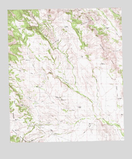
San Luis Pass, NM USGS Topographic Map
Click on map above to begin viewing in our Map Viewer.

This topographic map contains these locations and features:
Feature Name Type Latitude Longitude GNIS ID View Map
Aiken DrawArroyoN31.3937°W108.6950°901107View Map
Asten TankReservoirN31.4555°W108.6707°901108View Map
Austin TankReservoirN31.3915°W108.6616°901106View Map
Been DrawArroyoN31.3951°W108.6595°900840View Map
Big Geronimo TankReservoirN31.4170°W108.6993°900841View Map
Birch CreekStreamN31.4390°W108.7095°900839View Map
C Eckles Ranch (historical)LocaleN31.4251°W108.7145°887012View Map
DeerPopulated PlaceN31.3823°W108.6306°899602View Map
Deer CreekStreamN31.4637°W108.6967°888294View Map
Deer Creek WellsPopulated PlaceN31.4346°W108.6912°899603View Map
Divide TankReservoirN31.4829°W108.6878°901208View Map
East Fork Brushy CreekStreamN31.4965°W108.6473°888654View Map
Eicks DrawArroyoN31.4390°W108.7095°901207View Map
Eicks TankReservoirN31.4491°W108.7492°901168View Map
Little Geronimo TankReservoirN31.4146°W108.6944°901149View Map
Little Lynch DrawArroyoN31.4104°W108.7006°901225View Map
Lower Deer CreekStreamN31.3954°W108.6487°891425View Map
Lynch DrawArroyoN31.3971°W108.6567°901206View Map
Lynch RanchLocaleN31.4401°W108.7112°891501View Map
Lynch TankReservoirN31.4274°W108.7188°901169View Map
Malpais TankReservoirN31.4072°W108.6751°900711View Map
Middle Fork Brushy CreekStreamN31.4740°W108.6292°891946View Map
North TankReservoirN31.3993°W108.6265°900722View Map
Pasco TankReservoirN31.3867°W108.7425°900740View Map
Pendleton TankReservoirN31.4812°W108.6429°900738View Map
Pit TankReservoirN31.4823°W108.7370°900739View Map
Robertson TankReservoirN31.3761°W108.7277°900758View Map
Rough CreekStreamN31.3954°W108.6487°894175View Map
Rough Creek TankReservoirN31.4477°W108.6492°900757View Map
San Luis PassGapN31.3946°W108.7450°894461View Map
Smith TankReservoirN31.4525°W108.7314°900776View Map
Smuggler HillsRangeN31.4570°W108.6425°901128View Map
Smuggler TankReservoirN31.4144°W108.6313°900777View Map
Twin TankReservoirN31.4883°W108.6799°900798View Map
W T Sims RanchLocaleN31.4812°W108.7173°896176View Map

Note: Coordinates in the location and feature list above are referenced to NAD83 datum.


Copyright (C) 2008-2025 Ryan Niemi / Sunset Dynamics ... All Rights Reserved