TopoQuest Logo
Do you find TopoQuest useful?
Help keep TopoQuest running and adding new maps/features by donating!
Bitcoin:  19c7KJd3qBynnjoSw5npx9KScwjBe4ifkT
Litecoin:  LXs6TkuXGGXo1vDsWCkWVdjQX94eUKd6ui
Home View Maps Find Maps Find Places Resources & Links


Wildhorse Ridge, Oregon Topographic Map

USGS Map Title: Wildhorse Ridge, OR
USGS Map MRC: 42121H5
DRG (GeoTIFF) Download: o42121h5.tif


Neighboring USGS Topographic Map Quads:


  Round Butte, OR  
43121A6
 

  Sugarpine Mountain, OR  
43121A5
 

  Bear Butte, OR  
43121A4
 

  Military Crossing, OR  
42121H6
 

  Wildhorse Ridge, OR  
42121H5
 

  Gordon Lake, OR  
42121H4
 

  Wocus Bay, OR  
42121G6
 

  Buckhorn Springs, OR  
42121G5
 

  The Bull Pasture, OR  
42121G4


Map MRC Location:

N43°
W122°
N43°
W121°
H8 H7 H6 H5 H4 H3 H2 H1
G8 G7 G6 G5 G4 G3 G2 G1
F8 F7 F6 F5 F4 F3 F2 F1
E8 E7 E6 E5 E4 E3 E2 E1
D8 D7 D6 D5 D4 D3 D2 D1
C8 C7 C6 C5 C4 C3 C2 C1
B8 B7 B6 B5 B4 B3 B2 B1
A8 A7 A6 A5 A4 A3 A2 A1
N42°
W122°
N42°
W121°

Wildhorse Ridge, OR USGS 1:24K Topographic Map Preview:
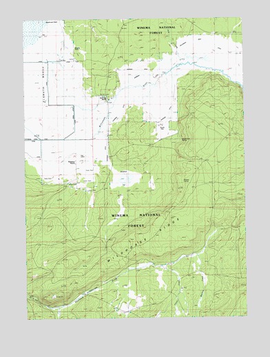
Wildhorse Ridge, OR USGS Topographic Map
Click on map above to begin viewing in our Map Viewer.

This topographic map contains these locations and features:
Feature Name Type Latitude Longitude GNIS ID View Map
Abraham FlatFlatN42.9340°W121.5720°1137003View Map
Bloody PointCapeN42.9868°W121.6025°1138270View Map
Bluejay SpringSpringN42.9320°W121.5361°1138342View Map
Bluejay Spring Research Natural AreaParkN42.9299°W121.5456°1156379View Map
Clover CreekStreamN42.8962°W121.5492°1139848View Map
Copeland SpringSpringN42.9519°W121.5020°1155775View Map
Hog IslandIslandN42.9412°W121.5997°1143643View Map
Jack CreekStreamN42.9804°W121.5417°1144164View Map
Johnson BarnLocaleN42.9546°W121.5967°1144318View Map
Kittredge CanalCanalN42.9499°W121.6164°1155000View Map
Kittredge RanchLocaleN42.9660°W121.5817°1144649View Map
Meadow CreekStreamN42.9007°W121.5320°1146052View Map
South FlatFlatN42.9543°W121.5500°1149917View Map
South Fork SpringSpringN42.9492°W121.5368°1155411View Map
Summers RanchLocaleN42.9410°W121.6028°1150601View Map
Wildhorse RidgeRidgeN42.9082°W121.5542°1152364View Map
Williamson River DitchCanalN42.9901°W121.5247°1155412View Map
Y J CanalCanalN42.9582°W121.5984°1154999View Map

Note: Coordinates in the location and feature list above are referenced to NAD83 datum.


Copyright (C) 2008-2025 Ryan Niemi / Sunset Dynamics ... All Rights Reserved