TopoQuest Logo
Do you find TopoQuest useful?
Help keep TopoQuest running and adding new maps/features by donating!
Bitcoin:  19c7KJd3qBynnjoSw5npx9KScwjBe4ifkT
Litecoin:  LXs6TkuXGGXo1vDsWCkWVdjQX94eUKd6ui
Home View Maps Find Maps Find Places Resources & Links


Sugarpine Mountain, Oregon Topographic Map

USGS Map Title: Sugarpine Mountain, OR
USGS Map MRC: 43121A5
DRG (GeoTIFF) Download: o43121a5.tif


Neighboring USGS Topographic Map Quads:


  Sugarpine Mountain NW, OR  
43121B6
 

  Tea Table Mountain, OR  
43121B5
 

  Location Butte, OR  
43121B4
 

  Round Butte, OR  
43121A6
 

  Sugarpine Mountain, OR  
43121A5
 

  Bear Butte, OR  
43121A4
 

  Military Crossing, OR  
42121H6
 

  Wildhorse Ridge, OR  
42121H5
 

  Gordon Lake, OR  
42121H4


Map MRC Location:

N44°
W122°
N44°
W121°
H8 H7 H6 H5 H4 H3 H2 H1
G8 G7 G6 G5 G4 G3 G2 G1
F8 F7 F6 F5 F4 F3 F2 F1
E8 E7 E6 E5 E4 E3 E2 E1
D8 D7 D6 D5 D4 D3 D2 D1
C8 C7 C6 C5 C4 C3 C2 C1
B8 B7 B6 B5 B4 B3 B2 B1
A8 A7 A6 A5 A4 A3 A2 A1
N43°
W122°
N43°
W121°

Sugarpine Mountain, OR USGS 1:24K Topographic Map Preview:
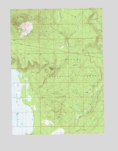
Sugarpine Mountain, OR USGS Topographic Map
Click on map above to begin viewing in our Map Viewer.

This topographic map contains these locations and features:
Feature Name Type Latitude Longitude GNIS ID View Map
Bedpan BurnAreaN43.0121°W121.5784°1137865View Map
Bedpan SpringSpringN43.0164°W121.5637°1137866View Map
Deer Scaffold SpringSpringN43.0470°W121.5130°1140861View Map
God ButteSummitN43.0651°W121.5711°1142793View Map
God CreekStreamN43.0562°W121.6047°1142794View Map
Indian SpringSpringN43.0831°W121.5260°1144076View Map
Jack Creek CorralLocaleN43.1137°W121.5109°1144166View Map
Junction BurnAreaN43.0021°W121.5628°1144429View Map
Kicking Horse SpringSpringN43.0680°W121.5416°1144595View Map
Lane CreekStreamN43.0685°W121.6222°1144811View Map
Lane WellWellN43.0358°W121.6144°1144817View Map
McCarty MeadowSwampN43.0879°W121.5484°1145930View Map
Mosquito CreekStreamN43.0382°W121.6009°1146490View Map
Paddys MeadowFlatN43.0401°W121.5214°1147348View Map
Rakes MeadowSwampN43.0210°W121.5303°1148185View Map
Sagebrush PointCapeN43.0004°W121.6036°1158466View Map
Sheep SpringSpringN43.0794°W121.5841°1149357View Map
Sugarpine BurnAreaN43.1060°W121.6042°1150563View Map
Sugarpine MountainSummitN43.1174°W121.6075°1150565View Map
Sugarpine Mountain LookoutLocaleN43.1174°W121.6067°1156281View Map
Surveyor SpringSpringN43.0950°W121.6199°1150706View Map

Note: Coordinates in the location and feature list above are referenced to NAD83 datum.


Copyright (C) 2008-2025 Ryan Niemi / Sunset Dynamics ... All Rights Reserved