TopoQuest Logo
Do you find TopoQuest useful?
Help keep TopoQuest running and adding new maps/features by donating!
Bitcoin:  19c7KJd3qBynnjoSw5npx9KScwjBe4ifkT
Litecoin:  LXs6TkuXGGXo1vDsWCkWVdjQX94eUKd6ui
Home View Maps Find Maps Find Places Resources & Links


Wildwood, Washington Topographic Map

USGS Map Title: Wildwood, WA
USGS Map MRC: 46123D1
DRG (GeoTIFF) Download: o46123d1.tif


Neighboring USGS Topographic Map Quads:


  Boistfort, WA  
46123E2
 

  Curtis, WA  
46123E1
 

  Napavine, WA  
46122E8
 

  Boistfort Peak, WA  
46123D2
 

  Wildwood, WA  
46123D1
 

  Winlock, WA  
46122D8
 

  Elochoman Lake, WA  
46123C2
 

  Abernathy Mountain, WA  
46123C1
 

  Castle Rock, WA  
46122C8


Map MRC Location:

N47°
W124°
N47°
W123°
H8 H7 H6 H5 H4 H3 H2 H1
G8 G7 G6 G5 G4 G3 G2 G1
F8 F7 F6 F5 F4 F3 F2 F1
E8 E7 E6 E5 E4 E3 E2 E1
D8 D7 D6 D5 D4 D3 D2 D1
C8 C7 C6 C5 C4 C3 C2 C1
B8 B7 B6 B5 B4 B3 B2 B1
A8 A7 A6 A5 A4 A3 A2 A1
N46°
W124°
N46°
W123°

Wildwood, WA USGS 1:24K Topographic Map Preview:
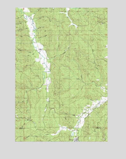
Wildwood, WA USGS Topographic Map
Click on map above to begin viewing in our Map Viewer.

This topographic map contains these locations and features:
Feature Name Type Latitude Longitude GNIS ID View Map
Banks CreekStreamN46.4004°W123.0546°1503158View Map
Becker CreekStreamN46.3846°W123.0493°1503268View Map
Black CreekStreamN46.4404°W123.0804°1503399View Map
Bull Pen CreekStreamN46.4884°W123.1024°1503636View Map
Campbell CreekStreamN46.3868°W123.0446°1503754View Map
Cedar CreekStreamN46.4526°W123.0862°1503873View Map
Cougar FlatFlatN46.4034°W123.0226°1504189View Map
Deer CreekStreamN46.3937°W123.1118°1504407View Map
Foster CreekStreamN46.4926°W123.1140°1504986View Map
Hogan CreekStreamN46.4129°W123.0110°1505543View Map
Laughlin CreekStreamN46.4554°W123.0690°1506103View Map
Lentz CreekStreamN46.4923°W123.1076°1506127View Map
Lewis County Fire District 13 Station 3BuildingN46.4491°W123.0833°2619875View Map
Newland CreekStreamN46.4629°W123.1001°1506970View Map
North Fork Brim CreekStreamN46.4273°W123.0107°1507034View Map
Owens CreekStreamN46.3973°W123.0410°1507231View Map
Point HillSummitN46.4782°W123.0882°1512572View Map
Point Hill CreekStreamN46.4790°W123.0974°1507524View Map
Root House CreekStreamN46.4898°W123.1110°1507909View Map
RyderwoodPopulated PlaceN46.3765°W123.0437°1512630View Map
Sears CreekStreamN46.4707°W123.1010°1508189View Map
Sep CreekStreamN46.4559°W123.0910°1508224View Map
Slide CreekStreamN46.4787°W123.1004°1531514View Map
Snow CemeteryCemeteryN46.4551°W123.0096°1508476View Map
Stony GradeSummitN46.4854°W123.0090°1508758View Map
Trout CreekStreamN46.4148°W123.1098°1509089View Map
Water CreekStreamN46.4720°W123.1012°1509326View Map
WildwoodPopulated PlaceN46.4596°W123.0901°1509518View Map
Wilson CreekStreamN46.4587°W123.0960°1509571View Map

Note: Coordinates in the location and feature list above are referenced to NAD83 datum.


Copyright (C) 2008-2024 Ryan Niemi / Sunset Dynamics ... All Rights Reserved