TopoQuest Logo
Do you find TopoQuest useful?
Help keep TopoQuest running and adding new maps/features by donating!
Bitcoin:  19c7KJd3qBynnjoSw5npx9KScwjBe4ifkT
Litecoin:  LXs6TkuXGGXo1vDsWCkWVdjQX94eUKd6ui
Home View Maps Find Maps Find Places Resources & Links


Williams Peak, Idaho Topographic Map

USGS Map Title: Williams Peak, ID
USGS Map MRC: 45115A6
DRG (GeoTIFF) Download: o45115a6.tif


Neighboring USGS Topographic Map Quads:


  Loon Lake, ID  
45115B7
 

  Pony Meadows, ID  
45115B6
 

  Pilot Peak, ID  
45115B5
 

  Enos Lake, ID  
45115A7
 

  Williams Peak, ID  
45115A6
 

  Parks Peak, ID  
45115A5
 

  Fitsum Peak, ID  
44115H7
 

  Teapot Mountain, ID  
44115H6
 

  Caton Lake, ID  
44115H5


Map MRC Location:

N46°
W116°
N46°
W115°
H8 H7 H6 H5 H4 H3 H2 H1
G8 G7 G6 G5 G4 G3 G2 G1
F8 F7 F6 F5 F4 F3 F2 F1
E8 E7 E6 E5 E4 E3 E2 E1
D8 D7 D6 D5 D4 D3 D2 D1
C8 C7 C6 C5 C4 C3 C2 C1
B8 B7 B6 B5 B4 B3 B2 B1
A8 A7 A6 A5 A4 A3 A2 A1
N45°
W116°
N45°
W115°

Williams Peak, ID USGS 1:24K Topographic Map Preview:
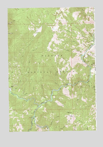
Williams Peak, ID USGS Topographic Map
Click on map above to begin viewing in our Map Viewer.

This topographic map contains these locations and features:
Feature Name Type Latitude Longitude GNIS ID View Map
Browns CampLocaleN45.0443°W115.7476°378281View Map
Circle End CreekStreamN45.0468°W115.6679°379354View Map
Devil CreekStreamN45.0963°W115.6285°380523View Map
Dutch Oven SpringSpringN45.0148°W115.6588°380964View Map
East Fork South Fork Salmon RiverStreamN45.0143°W115.7140°381177View Map
East Fork Zena CreekStreamN45.0568°W115.7329°381202View Map
Fritser CreekStreamN45.0907°W115.6273°382090View Map
Fritser FordPopulated PlaceN45.0866°W115.6287°397727View Map
Grave CreekStreamN45.0832°W115.6337°382583View Map
Hall CreekStreamN45.0974°W115.6268°382828View Map
Hamilton CreekStreamN45.0307°W115.6954°382845View Map
Indian Picnic AreaLocaleN45.0135°W115.7187°394375View Map
Indian PointPillarN45.0132°W115.7171°383705View Map
Moss CreekStreamN45.0493°W115.6448°387270View Map
Oompaul CreekStreamN45.0341°W115.7362°387969View Map
Pidgeon CreekStreamN45.0766°W115.6418°388427View Map
Reservoir CreekStreamN45.0791°W115.6385°389310View Map
Reservoir FlatFlatN45.0741°W115.6401°389311View Map
Secesh RiverStreamN45.0249°W115.7076°390075View Map
Sheep CreekStreamN45.0491°W115.6371°390214View Map
Slide CreekStreamN45.0638°W115.6318°390613View Map
Tailholt CreekStreamN45.0427°W115.6779°391819View Map
Threemile CreekStreamN45.0480°W115.6640°392097View Map
West Fork Zena CreekStreamN45.0568°W115.7329°375823View Map
Willey CreekStreamN45.0430°W115.6282°393454View Map
Williams CreekStreamN45.0043°W115.6948°393459View Map
Williams PeakSummitN45.0185°W115.6629°393476View Map
Williams Peak LookoutLocaleN45.0185°W115.6635°394376View Map
Zena CreekStreamN45.0416°W115.7479°393779View Map

Note: Coordinates in the location and feature list above are referenced to NAD83 datum.


Copyright (C) 2008-2025 Ryan Niemi / Sunset Dynamics ... All Rights Reserved