TopoQuest Logo
Do you find TopoQuest useful?
Help keep TopoQuest running and adding new maps/features by donating!
Bitcoin:  19c7KJd3qBynnjoSw5npx9KScwjBe4ifkT
Litecoin:  LXs6TkuXGGXo1vDsWCkWVdjQX94eUKd6ui
Home View Maps Find Maps Find Places Resources & Links


Teapot Mountain, Idaho Topographic Map

USGS Map Title: Teapot Mountain, ID
USGS Map MRC: 44115H6
DRG (GeoTIFF) Download: o44115h6.tif


Neighboring USGS Topographic Map Quads:


  Enos Lake, ID  
45115A7
 

  Williams Peak, ID  
45115A6
 

  Parks Peak, ID  
45115A5
 

  Fitsum Peak, ID  
44115H7
 

  Teapot Mountain, ID  
44115H6
 

  Caton Lake, ID  
44115H5
 

  Blackmare, ID  
44115G7
 

  White Rock Peak, ID  
44115G6
 

  Log Mountain, ID  
44115G5


Map MRC Location:

N45°
W116°
N45°
W115°
H8 H7 H6 H5 H4 H3 H2 H1
G8 G7 G6 G5 G4 G3 G2 G1
F8 F7 F6 F5 F4 F3 F2 F1
E8 E7 E6 E5 E4 E3 E2 E1
D8 D7 D6 D5 D4 D3 D2 D1
C8 C7 C6 C5 C4 C3 C2 C1
B8 B7 B6 B5 B4 B3 B2 B1
A8 A7 A6 A5 A4 A3 A2 A1
N44°
W116°
N44°
W115°

Teapot Mountain, ID USGS 1:24K Topographic Map Preview:
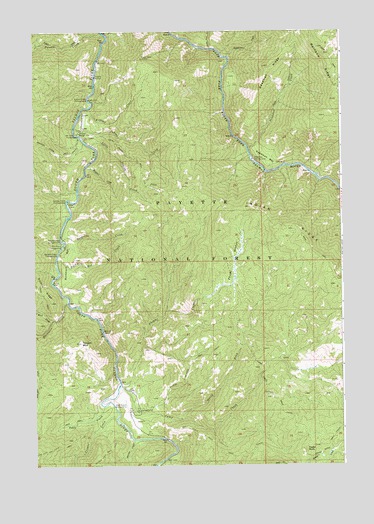
Teapot Mountain, ID USGS Topographic Map
Click on map above to begin viewing in our Map Viewer.

This topographic map contains these locations and features:
Feature Name Type Latitude Longitude GNIS ID View Map
Buckhorn BarBarN44.9346°W115.7373°378401View Map
Buckhorn Bar CampgroundLocaleN44.9360°W115.7398°397492View Map
Buckhorn Bar CreekStreamN44.9346°W115.7415°378402View Map
Buckhorn CampgroundLocaleN44.9385°W115.7382°397493View Map
Buckhorn CreekStreamN44.9227°W115.7368°378408View Map
Camp CreekStreamN44.8977°W115.7168°378785View Map
Camp Creek Cutoff TrailTrailN44.8938°W115.6532°378796View Map
Cougar CreekStreamN44.8885°W115.7179°379891View Map
Deadman BarBarN44.9630°W115.6546°380325View Map
Deadman CampgroundLocaleN44.9630°W115.6615°380326View Map
Deadman CreekStreamN44.9663°W115.6635°380332View Map
Deadman RidgeRidgeN44.9899°W115.6551°380338View Map
Dutch Oven CreekStreamN44.9949°W115.6790°380962View Map
Eagle RockPillarN44.8796°W115.6407°380996View Map
Eagle Rock TrailTrailN44.8799°W115.6765°380999View Map
Fitsum CreekStreamN44.9993°W115.7229°381789View Map
Fourmile CampgroundLocaleN44.9282°W115.7423°401337View Map
Indian CreekStreamN44.9702°W115.7318°383646View Map
Indian RidgeRidgeN44.9435°W115.6493°373241View Map
Indian Ridge TrailTrailN44.9307°W115.6298°383710View Map
Jakie CreekStreamN44.8921°W115.7229°373291View Map
Krassel CreekStreamN44.9782°W115.7273°384306View Map
Krassel Creek CampgroundLocaleN44.9807°W115.7279°384307View Map
Krassel Ranger StationLocaleN44.9710°W115.7318°384308View Map
Krassel USFS AirportAirportN44.9740°W115.7298°400863View Map
Krassel Work CenterLocaleN44.9718°W115.7290°394397View Map
Little Indian CreekStreamN44.9674°W115.7273°384865View Map
Martin CreekStreamN44.8824°W115.7110°386514View Map
Miners Peak TrailTrailN44.8788°W115.7460°387007View Map
North Fork Camp CreekStreamN44.8885°W115.6918°387666View Map
Phoebe CreekStreamN44.8980°W115.7168°388408View Map
Phoebe MeadowFlatN44.9341°W115.6696°388409View Map
Reed Ranch AirportAirportN44.8929°W115.7135°400947View Map
Salmon Point CampgroundLocaleN44.9516°W115.7365°389855View Map
Teapot MountainSummitN44.9105°W115.7318°391880View Map
Teepee CreekStreamN44.9399°W115.7385°391883View Map
Teepee Creek CampgroundLocaleN44.9402°W115.7393°398220View Map
Telephone CreekStreamN44.9927°W115.6721°391896View Map
West Fork Buckhorn CreekStreamN44.9168°W115.7429°393061View Map
Wildcat CreekStreamN44.9613°W115.7293°393433View Map

Note: Coordinates in the location and feature list above are referenced to NAD83 datum.


Copyright (C) 2008-2024 Ryan Niemi / Sunset Dynamics ... All Rights Reserved